Bakshi Ka Talab

Last updated

Bakshi Ka Talab
Bakshi, BKT, Afs
Residential area
Bakshi Ka Talab block map.png
Map of Bakshi Ka Talab CD block
India Uttar Pradesh location map.svg
Red pog.svg
Bakshi Ka Talab
Location in Uttar Pradesh, India
Coordinates: 26°59′0″N80°53′0″E / 26.98333°N 80.88333°E / 26.98333; 80.88333
CountryFlag of India.svg  India
State Uttar Pradesh
District Lucknow
Area
[1]
  Total41.9 km2 (16.2 sq mi)
Elevation
124 m (407 ft)
Population
 (2011) [1]
  Total49,166
  Density1,200/km2 (3,000/sq mi)
Languages
  Official Hindi
Time zone UTC+5:30 (IST)
PIN
226201
Vehicle registration UP-32
Coastline0 kilometres (0 mi)
Nearest cityLucknow
Lok Sabha constituency 1690

Bakshi Ka Talab is a nagar panchayat town in Lucknow district of Uttar Pradesh, India. [1] It is also the headquarters of a corresponding tehsil, as well as a community development block of the same name. [1] As of 2011, its population was 49,166, in 8,728 households. [1] It consists of both residential and business settlements. Bakshi Ka Talab is an organised settlement developed by Lucknow Development Authority (LDA). It is connected to Lucknow via National Highway 24. [2]

Contents

Bakshi Ka Talab features the annual play Ramlila, staged since 1972, wherein lead characters like Rama, Lakshamana and Hanumana are played by Muslim youths. This play has also been adapted into radio play "Us gaon ki ramlila" to promote communal harmony among the masses. [3]

The three main commodities produced here are cement tiles and pipes, soap, and furniture. [1] The famous Chandrika Devi Temple is located in nearby Kathwara.[ citation needed ]

Name and history

Bakshi Ka Talab is named after its large tank built by Bakhshi Tipur Chand, who was paymaster for Nasir-ud-Din Haidar Shah in the first half of the 19th century. [4] This structure was built with flights of stairs descending to the water's surface on all four sides, and four towers marking the corners. [4] A temple to Banke Bihari was built facing the main road, and next to it, Bakhshi Tipur Chand had a mansion built, along with a walled garden. [4] By the turn of the 20th century, the complex had fallen into ruin. [4] Around that time, Bakshi Ka Talab was described as being within the land belonging to Rudahi village, to the west. [4] It had a train station on the Lucknow–Bareilly Railway, a post office, and a village school. [4]

Bakshi Ka Talab was first upgraded to nagar panchayat status for the 2011 Census, with 23 villages being merged into the territory of the city. [1] .Currently Arun Singh Gappu is chairman of Bakshi Ka Talab Nagar Panchayat.

Demographics

As of 2011, the population of Bakshi Ka Talab town was 49,166, in 8,728 households. [1] Children ages 0-6 numbered 6,783, making up 13.8% of the town's population. [1] The town's sex ratio was 910 females for every 1000 males; in the 0-6 age group it was 947. [1] Members of scheduled castes made up 30.2% of town residents (the highest among cities in Lucknow district), and no residents were recorded as belonging to scheduled tribes. [1] The literacy rate of Bakshi Ka Talab town was 73.8% (81.7% of males and 65.3% of females, ages 7 and up). [1]

At the block level, the population of Bakshi Ka Talab's rural areas was 239,938, which was the highest among blocks in Lucknow district. [1]

Education

Bakshi Ka Talab has many schools including SR Institute of management, Institute of Technology and Management (ITM) Lucknow, St. Xavier's Inter College, Lawrence Homan Public School, R.R. Group Of Institutions.

There are government and private higher education institutions such as Chandra Bhanu Gupt Krishi Mahavidyalaya, GCRG Memorial Trust's Group of Institutions, B.N. College of Engineering & Technology, and ITM School of Architecture and Town Planning.

Villages

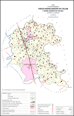
Bakshi Ka Talab block contains the following 161 villages: [1]

Village nameTotal land area (hectares)Population (in 2011)
Sahadat Nagar 118.4243
Garha 127.81,139
Bahargaon 254.82,340
Karaundi 273.21,567
Bagaha 287.42,917
Jamkhanava 283.71,900
Dudhara 1121,757
Makaria Kalan 710.53,441
Aramba 261.32,459
Banauga 2443,876
Bhagautipur 116.1833
Sarai Damu 136.81,081
Shivari 1501,536
Gohana Khurd 180.81,443
Bahadurganj 64.3749
Chaugava 226.22,097
Lodhauli 130.61,075
Manpur Raja 42.4748
Malookpur 253.52,203
Belava 94829
Saray Usrana 38.7493
Madhopur 95.9748
Marapa 56.2599
Gorahi 64.1443
Raipur Raja 236.71,920
Bangaon 77.3730
Kamalpur Kayastha 46.6277
Palpur 62921
Chandpur Khanipur 195.12,781
Derava 42.8622
Ahmedpur Khera 102.8890
Pirthi Nagar 59.5774
Akbarpur 40.3676
Usarana 466.42,770
Karsanda 166.6574
Kishunpur 186.51,210
Dilvasi 163.21,132
Patti 78.9755
Khanpur 57.3771
Bhatesua 106.2777
Atesua 420.23,290
Hanumantpur 139.81,449
Chandanapur 166.61,267
Ashnaha 169.21,443
Bhikharipur 56.4588
Lalpur 80.6695
Shahpur Najol 188.6634
Kunaura 575.61,503
Umariya 257.3732
Muspipari 325.42,149
Himmatpur 64.3545
Godhana 314.21,191
Narayanpur 84.7524
Kuverpur 44.3193
Puhuppur 150.81,002
Subanshipur 75.7730
Haloopur 49.6312
Rampur Babu 78.9727
Bhargahana 151.91,279
Mahgava 378.92,737
Khomau 100.61,316
Narosa 387.12,848
Darauna 34.5375
Indara 484.42,136
Khajuri 88.6517
Karimnagar 173.2706
Tikari 292.61,044
Subhan Nagar Arigawan 83.7926
Palia 116.31,045
Mohammadpur Garhi 185.21,309
Gulalpur 3131,783
Saranva 293.61,089
Parsahia 273.81,582
Aldampur 213.71,500
Kumhrava 481.13,087
Bajpur Gangaura 197.8713
Dariapur 128.3862
Hemi 165.2599
Unai 128.31,018
Jalalpur 277.32,270
Khesravan 127.4992
Prithvipur 42.40
Chak Prithvipur 41.31,222
Arjunpur 71.71,089
Kamalpur Sirsa 181.5817
Bibipur 363.61,996
Chak Bibipur 9.387
Chak Bankat 38.6532
Daulatpur 174.1629
Devari Rokhara 308.53,205
Tikari 951,233
Sultanpur 132.12,874
Shahpur Raja 140.3758
Bhikhampur 59.8506
Singhamau 173.71,548
Bargadikala 132.11,777
Mandauli Khurd 127.21,456
Beharkaraundi 31.4331
Shivpuri 819.83,747
Kathwara 1,295.36,740
Shivkhar 74.3410
Hardhaurpur 283.62,161
Bikamau Khurd 118.9893
Madaripur 264.72,068
Parvatpur 105.8818
Majheria 119.6797
Rampur Bahera 204.81,867
Digoi 172.51,000
Misripur 195.81,619
Sonava 232.61,596
Digurpur 101819
Nagavamau Khurd 88.5564
Naguvamau Kalan 269.62,257
Durjanpur 63.8758
Rajpur 77.7467
Ancharamau 358.33,559
Mohammadpur Saraia 166.9905
Paharpur 259.52,545
Taranpur 77.2783
Bharsar 165.61,253
Ataraura 225.82,052
Parsau 199.91,329
Bhesi 79.2452
Singhpur 49.1496
Malhipur 92.5474
Rajapur Salempur 175.3757
Sarsava 1441,252
Mavaikala 155.2972
Khantari 243.6929
Dahanauri 171.4806
Asti 3152,043
Barakhempur 217.61,600
Fatehpur Khamra 184.61,633
Goravamau 59.2816
Manpur Lala 236.41,924
Siwan 210.31,863
Hajichak 29.1295
Kauriamau 107.31,166
Sadamau 56860
Palaka 1261,735
Bharawamau 191.42,900
Chanda Coder 70.31,566
Dinkarpur Jhalava 103.2919
Gohana Kalan 548.82,814
Adhar Khera 200.41,038
Ajanhar Kalan 202.4713
Rasoolpur Kayastha 167.91,401
Misripur 212.24,583
Barkhudarpur 240.21,178
Guramba 105.22,602
Behta 160.63,693
Para 151.21,437
Rajauli 291.23,892
Paikaramau 3854,276
Dashauli 250.92,921
Kapasi 175.31,710
Rasoolpur Sadat 6314,138
Basaha 546.62,344
Mohammadpur Majara 155.61,607
Goila 760.67,945
Pipri 51.3318

Related Research Articles

<span class="mw-page-title-main">Lucknow district</span> District of Uttar Pradesh in India

Lucknow district is a district located in the state of Uttar Pradesh in northern India. The city of Lucknow is the district headquarters and the district is part of Lucknow Division. It also is the capital of Uttar Pradesh Lucknow is Bounded on the east by Barabanki district, on the west by Unnao and Hardoi districts, on the south by Raebareli district and in the north by Sitapur district.

<span class="mw-page-title-main">Chinahat</span> Block in Uttar Pradesh, India

Chinahat is a block in Lucknow City, Uttar Pradesh, India. According to 2011 Census of India the population of the village is 137,251 out of whom 71,211 are males and 66,040 are females. The village code is 0297. Lucknow serves as the block headquarters. The block is part of two tehsils, with some parts belonging to Lucknow tehsil and other parts belonging to Bakshi Ka Talab tehsil.

Pipri is a village in Bakshi Ka Talab block of Lucknow district, Uttar Pradesh, India. As of 2011, its population is 318, in 69 households. It was first officially upgraded to village status for the 2011 Census.

Aramba is a village in Bakshi Ka Talab block of Lucknow district, Uttar Pradesh, India. As of 2011, its population is 2,459, in 484 households. It is the seat of a gram panchayat.

Gulalpur is a village in Bakshi Ka Talab block of Lucknow district, Uttar Pradesh, India. As of 2011, its population is 1,783, in 319 households.

Bhagautipur is a village in Bakshi Ka Talab block of Lucknow district, Uttar Pradesh, India. As of 2011, its population is 833, in 141 households. It is the seat of a gram panchayat, which also includes the village of Bhatesua.

Raipur Raja is a village in Bakshi Ka Talab block of Lucknow district, Uttar Pradesh, India. As of 2011, its population is 1,920, in 350 households. It is the seat of a gram panchayat.

Bangaon is a village in Bakshi Ka Talab block of Lucknow district, Uttar Pradesh, India. As of 2011, its population is 730, in 151 households.

Singhamau is a village in Bakshi Ka Talab block of Lucknow district, Uttar Pradesh, India. As of 2011, its population is 1,548, in 277 households.

Palpur is a village in Bakshi Ka Talab block of Lucknow district, Uttar Pradesh, India. As of 2011, its population is 921, in 146 households.

Arjunpur is a village in Bakshi Ka Talab block of Lucknow district, Uttar Pradesh, India. As of 2011, its population is 1,089, in 193 households. It is part of the gram panchayat of Chak Prithvipur.

Shivpuri, also spelled Shiupuri, is a village in Bakshi Ka Talab block of Lucknow district, Uttar Pradesh, India. As of 2011, its population is 3,747, in 648 households. It is the seat of a gram panchayat, which also includes the village of Bhikhampur.

Bibipur is a village in Bakshi Ka Talab block of Lucknow district, Uttar Pradesh, India. As of 2011, its population is 1,996, in 335 households. It is the seat of a gram panchayat, which also includes the village of Chak Bibipur.

Digoi is a village in Bakshi Ka Talab block of Lucknow district, Uttar Pradesh, India. As of 2011, its population is 1,000, in 172 households. It is the seat of a gram panchayat.

Sarsava, also spelled Sarsawa, is a village in Bakshi Ka Talab block of Lucknow district, Uttar Pradesh, India. As of 2011, its population is 1,252, in 215 households.

Indara is a village in Bakshi Ka Talab block of Lucknow district, Uttar Pradesh, India. As of 2011, its population is 2,136, in 385 households. It is the seat of a gram panchayat, which also includes the village of Khajuri.

Paharpur is a village in Bakshi Ka Talab block of Lucknow district, Uttar Pradesh, India. As of 2011, its population is 2,545, in 485 households. It is the seat of a gram panchayat, which also includes the village of Mohammadpur Saraia. This is village of social activist Late Shri Jagdev Prasad Tiwari who was principal of many schools,a renowned poet ,whole life member of BKT inter college and director of district cooperative bank. This is the village of present MLA of Bakhshi Ka Talab constituency Shri Yogesh Shukla also.

Unai is a village in Bakshi Ka Talab block of Lucknow district, Uttar Pradesh, India. As of 2011, its population is 1,018, in 194 households.

<span class="mw-page-title-main">Shivgarh</span> Village in Uttar Pradesh, India

Shivgarh is a Nagar Panchayat or Notified Area Council (NAC) in Rae Bareli district, Uttar Pradesh, India. As of 2011, its population is 2,812, in 536 households. It has 6 primary schools and 1 healthcare centre. It hosts a Ramlila festival on Agrahayana Sudi 5-11, which involves a dramatic reenactment of the Ramayana. Vendors bring farm tools, earthenware pots, bamboo baskets, toys, and sweets to sell at the festival. Shivgarh also hosts market weekly twice, on Thursdays and Sundays, which mostly deals in grain and kirana.

Pipri is a town and a nagar panchayat in Sonbhadra district, Uttar Pradesh, India.

References

  1. 1 2 3 4 5 6 7 8 9 10 11 12 13 14 "Census of India 2011: Uttar Pradesh District Census Handbook - Lucknow, Part A (Village and Town Directory)". Census 2011 India. pp. xii, 6, 28–67, 112–37, 278–292. Retrieved 11 March 2021.
  2. Start and end points of National Highways Archived 10 April 2009 at the Library of Congress Web Archives
  3. Indian art and Culture by Nitin Singhania 2nd edition
  4. 1 2 3 4 5 6 Nevill, H.R. (1904). Lucknow - A Gazetteer. Allahabad: Government Press. p. 172. Retrieved 12 March 2021.