
Auras is a town and nagar panchayat in Hasanganj tehsil of Unnao district, Uttar Pradesh, India. First officially classified as a town for the 1981 census, Auras is located just north of the Sai River, on the road from Unnao to Sandila. Other roads branch off to Mohan, Newalganj, and Malihabad.
Kasmandi Kalan is a Village in Malihabad block of Lucknow district, Uttar Pradesh, India. It is located 27 km away from central Lucknow, a short distance to the north of the Behta River. The village lands include two settlements, Kasmandi Kalan proper in the north and the hamlet of Hafiznagar to the south. Historically known as a Muslim centre, Kasmandi Kalan is renowned for its mango orchards and is surrounded by mango trees all around. Some mango groves here are very old, dating back to the time of the Nawabs of Awadh.
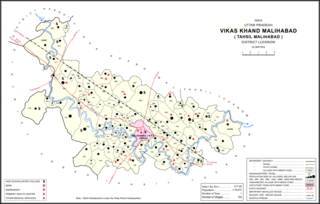
Garhi Sanjar Khan is a village in Malihabad block of Lucknow district, Uttar Pradesh, India. It is located immediately to the west of Malihabad, and it is surrounded by the Behta river on three sides. Markets are held here twice per week. The main staple foods are wheat and rice. As of 2011, Garhi Sanjar Khan has a population of 2,833 people, in 520 households.

Achhai is a village in Shivgarh block of Rae Bareli district, Uttar Pradesh, India. As of 2011, its population is 2,652 people, in 537 households.

Atrehta is a village in Maharajganj block of Rae Bareli district, Uttar Pradesh, India. Located 1 km from Maharajganj, the block headquarters, it is the village whose lands the Maharajganj bazar was originally founded on. As of 2011, Atrehta has a population of 5,628, in 1,056 households. It has two primary schools and no healthcare facilities.
Kumhrawan is a village in Shivgarh block of Rae Bareli district, Uttar Pradesh, India. Formerly a pargana headquarters, it consists of a main village and several scattered hamlets. As of 2011, Kumhrawan has a population of 2,441, in 426 households.
Narayanpur is a village in Shivgarh block of Rae Bareli district, Uttar Pradesh, India. As of 2011, its population is 1,634, in 320 households. It has two primary schools and no healthcare facilities. It is located 15 km from Maharajganj, the block headquarters. The main staple foods are wheat and rice.
Purasi is a village in Maharajganj block of Rae Bareli district, Uttar Pradesh, India. As of 2011, its population is 1,894, in 354 households. It has one primary school and no healthcare facilities. It is located 10 km from Maharajganj, the block headquarters. The main staple foods are wheat and rice.

Chilauli is a village in Singhpur block of Rae Bareli district, Uttar Pradesh, India. As of 2011, its population is 3,429, in 627 households. It has one primary school and no healthcare facilities.

Pahnasa is a village in Bachhrawan block of Rae Bareli district, Uttar Pradesh, India. As of 2011, its population is 2,812, in 558 households. It is located 8 km from Bachhrawan, the block headquarters, and the main staple foods are wheat and rice.
Dundgarh is a village in Bachhrawan block of Rae Bareli district, Uttar Pradesh, India. As of 2011, its population is 1,397, in 270 households. It has one primary school and no healthcare facilities.
Hasanpur is a village in Singhpur block of Rae Bareli district, Uttar Pradesh, India. As of 2011, its population was 1,162, in 203 households. It has one primary school and no healthcare facilities.
Panhauna is a village in Singhpur block of Rae Bareli district, Uttar Pradesh, India. As of 2011, its population is 7,075, in 1,307 households. It has one primary school and no healthcare facilities.

Amawan is a village and corresponding community development block in Rae Bareli district, Uttar Pradesh, India. It historically was the seat of a taluqdari estate held by a Pathan family and eventually split into two shares. As of 2011, its population is 5,245, in 973 households. It has 5 primary schools and a community health centre,a veterinary hospital and 2 Bank 1 Baroda purvi Uttar Pradesh and UCO bank and a post office and a ancient Shiv temple name Shree Jharkhandeshwar.
Pahremau is a village in Amawan block of Rae Bareli district, Uttar Pradesh, India. Located 5 km from Maharajganj on the road to Nigohan, it is an old Muslim centre that historically served as the headquarters of a taluqdari estate. As of 2011, its population is 3,165, in 577 households. It has 3 primary schools and no healthcare facilities.

Semrauta is a village in Tiloi block of Rae Bareli district, Uttar Pradesh, India. It is located at the intersection of the Maharajganj-Inhauna and Mohanganj-Haidargarh roads, about 20 km from Maharajganj, the tehsil headquarters. Although now eclipsed by Maharajganj, Semrauta was historically a relatively important village that served as the headquarters of a pargana and the capital of a branch of the Kanhpuria Rajputs, who later became known as the Rajas of Chandapur. As of 2011, the population of Simrauta is 6,423, in 1,031 households.

Sultanpur Aima is a village in Rahi block of Rae Bareli district, Uttar Pradesh, India. It is located 5 km from Rae Bareli, the district headquarters. As of 2011, it has a population of 448 people, in 78 households. It has one primary school and no healthcare facilities.

Sanhemau is a village in Dalmau block of Rae Bareli district, Uttar Pradesh, India. It is located 13 km from Dalmau, the block headquarters. As of 2011, it has a population of 28 people, in 5 households. It has no schools and no healthcare facilities.

Nuruddinpur is a village in Salon block of Rae Bareli district, Uttar Pradesh, India. It is located 43 km from Raebareli, the district headquarters. As of 2011, Nuruddinpur has a population of 3,882 people, in 667 households. It has 2 primary schools and no healthcare facilities. It is connected to national highways and hosts a periodic haat but not a permanent market.

Marhamau is an abandoned village in Rohaniya block of Rae Bareli district, Uttar Pradesh, India. It is located 44 km from Raebareli, the district headquarters. As of 2011, Marhamau is uninhabited, although the land is used for agricultural purposes. The village lands cover 213.3 hectares, all of which was used as farmland in 2011.
