
Rahim Khera is a village in Sareni block of Rae Bareli district, Uttar Pradesh, India. It is located 19 km from Lalganj, the tehsil headquarters. As of 2011, it has a population of 440 people, in 89 households. It has no schools and no healthcare facilities. It belongs to the nyaya panchayat of Rasulpur.
Birnawan is a village in Sareni block of Rae Bareli district, Uttar Pradesh, India. It is located 19 km from Lalganj, the tehsil headquarters. As of 2011, it has a population of 485 people, in 92 households. It has two primary schools and no healthcare facilities. It belongs to the nyaya panchayat of Rasulpur.
Bithuli is a village in Sareni block of Rae Bareli district, Uttar Pradesh, India. It is located 29 km from Lalganj, the tehsil headquarters. As of 2011, it has a population of 456 people, in 79 households. It has one primary school and no healthcare facilities. It belongs to the nyaya panchayat of Murarmau.
Palti Khera is a village in Sareni block of Rae Bareli district, Uttar Pradesh, India. It is located 18 km from Lalganj, the tehsil headquarters. As of 2011, it has a population of 2,641 people, in 523 households. It has one primary school and no healthcare facilities. It belongs to the nyaya panchayat of Murarmau.

Birpur is a village in Chhatoh block of Rae Bareli district, Uttar Pradesh, India. It is located 9 km from Salon, which is the tehsil headquarters. As of 2011, Birpur has a population of 493 people, in 103 households. It has no schools and no healthcare facilities, and it does not host a permanent market or a weekly haat. It belongs to the nyaya panchayat of Bara.

Golhamau is a village in Lalganj block of Rae Bareli district, Uttar Pradesh, India. It is located 6 km from Lalganj, the block and tehsil headquarters. As of 2011, it has a population of 360 people, in 61 households. It has no schools and no healthcare facilities, and it does not host a permanent market or a weekly haat. It belongs to the nyaya panchayat of Bahuria Khera.
Narsinghpur is a village in Lalganj block of Rae Bareli district, Uttar Pradesh, India. It is located 5 km from Lalganj, the block and tehsil headquarters. As of 2011, it has a population of 655 people, in 108 households. It has 1 primary school and no healthcare facilities, and it does not host a permanent market or a weekly haat. It belongs to the nyaya panchayat of Mubarakpur.
Dhannipur is a village in Lalganj block of Rae Bareli district, Uttar Pradesh, India. It is located 2 km from Lalganj, the block and tehsil headquarters. As of 2011, it has a population of 1,053 people, in 160 households. It has no healthcare facilities and does not host a permanent market or a weekly haat. It belongs to the nyaya panchayat of Mubarakpur.
Haripur is a village in Lalganj block of Rae Bareli district, Uttar Pradesh, India. It is located 3 km from Lalganj, the block and tehsil headquarters. As of 2011, it has a population of 1,527 people, in 270 households. It has 1 primary school and no healthcare facilities, and it does not host a permanent market or a weekly haat. It belongs to the nyaya panchayat of Mubarakpur.
Ugabhad is a village in Lalganj block of Rae Bareli district, Uttar Pradesh, India. It is located 3 km from Lalganj, the block and tehsil headquarters. As of 2011, it has a population of 1,633 people, in 325 households. It has no healthcare facilities and hosts a weekly haat but not a permanent market. It belongs to the nyaya panchayat of Mubarakpur.
Dhanabhad is a village in Lalganj block of Rae Bareli district, Uttar Pradesh, India. It is located 3 km from Lalganj, the block and tehsil headquarters. As of 2011, it has a population of 2,007 people, in 325 households. It has 1 primary school and no healthcare facilities, and it does not host a permanent market or a weekly haat. It belongs to the nyaya panchayat of Mubarakpur.
Maha Khera is a village in Lalganj block of Rae Bareli district, Uttar Pradesh, India. It is located 3 km from Lalganj, the block and tehsil headquarters. As of 2011, it has a population of 1,515 people, in 287 households. It has 1 primary school and no healthcare facilities, and it does not host a permanent market or a weekly haat. It belongs to the nyaya panchayat of Behta Kalan.
Sarai Kurmi is a village in Lalganj block of Rae Bareli district, Uttar Pradesh, India. It is located 4 km from Lalganj, the block and tehsil headquarters. As of 2011, it has a population of 843 people, in 197 households. It has no healthcare facilities and does not host a permanent market or a weekly haat. It belongs to the nyaya panchayat of Behta Kalan.
Shahpur is a village in Lalganj block of Rae Bareli district, Uttar Pradesh, India. It is located 8 km from Lalganj, the block and tehsil headquarters. As of 2011, it has a population of 689 people, in 126 households. It has 1 primary school and no healthcare facilities, and it hosts both a permanent market and a weekly haat. It belongs to the nyaya panchayat of Behta Kalan.
Champatpur is a village in Lalganj block of Rae Bareli district, Uttar Pradesh, India. It is located 8 km from Lalganj, the block and tehsil headquarters. As of 2011, it has a population of 685 people, in 122 households. It has no healthcare facilities and does not host a permanent market or a weekly haat. It belongs to the nyaya panchayat of Behta Kalan.
Gonda is a village in Sareni block of Rae Bareli district, Uttar Pradesh, India. It is located 22 km from Lalganj, the tehsil headquarters. As of 2011, it has a population of 403 people, in 88 households. It has no schools and no healthcare facilities, and does not host a weekly haat or a permanent market. It belongs to the nyaya panchayat of Raipur.
Bahupur is a village in Sareni block of Rae Bareli district, Uttar Pradesh, India. It is located 17 km from Lalganj, the tehsil headquarters. As of 2011, it has a population of 512 people, in 100 households. It has no healthcare facilities and does not host a weekly haat or a permanent market. It belongs to the nyaya panchayat of Raipur.
Jhampur is a village in Sareni block of Rae Bareli district, Uttar Pradesh, India. It is located 15 km from Lalganj, the tehsil headquarters. As of 2011, it has a population of 1,126 people, in 210 households. It has one primary school and no healthcare facilities, and does not host a weekly haat or a permanent market. It belongs to the nyaya panchayat of Sareni.
Singhaur Tara is a village in Sareni block of Rae Bareli district, Uttar Pradesh, India. It is located on the bank of the Ganges, 18 km from the tehsil headquarters at Lalganj. Singhaur Tara is probably identical with the mahal called "Tara Singhaur" Ain-i-Akbari in the late 16th century. This mahal was in the sarkar of Lucknow. It was later merged into the pargana of Sareni under the Nawabs of Awadh in the 1700s.
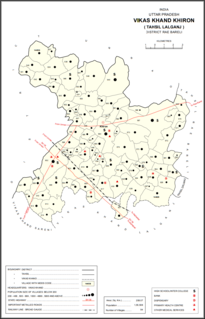
Kamalpur is a village in Khiron block of Rae Bareli district, Uttar Pradesh, India. It is located 17 km from Lalganj, the tehsil headquarters. As of 2011, it has a population of 1,118 people, in 242 households. It has 1 primary school and no healthcare facilities and it does not a weekly haat or a permanent market. It belongs to the nyaya panchayat of Tikwamau.
