
Kandrawan is a village in Unchahar block of Raebareli district, Uttar Pradesh, India. It is located on the road from Salon to Khaga, near the banks of the Ganges. Nearby there is a ferry crossing the Ganges over to Naubasta in Fatehpur district. As of 2011, Kandrawan has a population of 10,283 people, in 1,901 households. It is 3 km from Unchahar.
Jahanabad is a village in Sarojaninagar block of Lucknow district, Uttar Pradesh, India. As of 2011, its population was 454, in 80 households. The village lands cover an area of 43.9 hectares, of which 34.7 (79.0%) were farmland as of 2011, while areas under non-agricultural uses covered 6.6 hectares, or 15.0% of the total village area. It is part of the gram panchayat of Kishunpur Kodia.
Banthra Sikandarpur, also called Banthra or Banthara, is a village in Sarojaninagar block of Lucknow district, Uttar Pradesh, India. As of 2011, its population was 10,989, in 1,885 households. A regular market is held here. The village lands cover an area of 703.8 hectares, of which 341.4 (48.5%) were farmlands as of 2011. Fallow lands covered 182.9 hectares, and areas under non-agricultural uses covered 66.2 hectares, or 9.4% of the total land area.
Mati is a village in Sarojaninagar block of Lucknow district, Uttar Pradesh, India. As of 2011, its population was 5,833, in 1,071 households. A regular market is held here. It is the seat of a gram panchayat.
Bibipur is a village in Sarojaninagar block of Lucknow district, Uttar Pradesh, India. As of 2011, its population was 1,963, in 376 households. The village lands cover an area of 292.9 hectares, of which 191.8 (65.4%) were farmland as of 2011. Total fallow land covered an area of 45.1 hectares as of the same year, making up 15.4% of the total area. Areas under non-agricultural use covered 25.6 hectares, or 8.7% of the total area. It is the seat of a gram panchayat.
Piparsand is a village in Sarojaninagar block of Lucknow district, Uttar Pradesh, India. As of 2011, its population was 4,336, in 769 households. It has three schools providing primary education, a post office, and a public library. It is the seat of a gram panchayat.

Sarojaninagar, also spelled Sarojini Nagar, is a community development block in Lucknow district, Uttar Pradesh, India. It is part of the tehsil of Lucknow and it includes 90 villages. As of 2011, its population was 224,045, in 40,923 households.
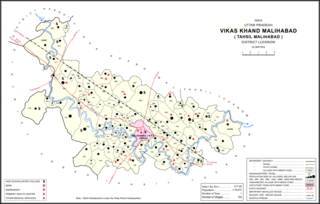
Bakhtiyarnagar is a village in Malihabad block of Lucknow district, Uttar Pradesh, India. It is located immediately to the south of the town of Malihabad. The main staple foods here are wheat and rice. As of 2011, Bakhtiyarnagar's population is 2,480, in 456 households.

Kathwara is a village in Harchandpur block of Rae Bareli district, Uttar Pradesh, India. It is located 13km from Raebareli, the district headquarters, on the road to Lucknow, and on the left bank of the Baita river not far from its confluence with the Sai. The railway passes by Kathwara, and the closest station is at Harchandpur. As of 2011, the population of Kathwara is 5,115, in 921 households. It has two primary schools and no healthcare facilities.

Gokulpur is a village in Amawan block of Rae Bareli district, Uttar Pradesh, India. As of 2011, its population is 228, in 41 households. It has no schools and no healthcare facilities.
Jamalpur Karaundi is a village in Amawan block of Rae Bareli district, Uttar Pradesh, India. It is located 11 km from Raebareli, the district headquarters. As of 2011, its population is 630, in 125 households.

Didaur, also spelled Dedaur, is a village in Sataon block of Rae Bareli district, Uttar Pradesh, India. It is located 8 km from Raebareli on the road to Unnao, just east of the intersection with the road to Lalganj. It is near the right bank of the Sai river. As of 2011, Didaur has a population of 4,781 people, in 900 households. The village hosts two annual festivals: one is the Badhwapur-ka-Mela, which is dedicated to the worship of Nag Devta and is held on Bhadra Sudi 5, and the other is the Jhurhapur-ka-Mela, which is dedicated to worship of Rama and falls on Phalguna Sudi 8.

Lodhwari is a village in Rahi block of Rae Bareli district, Uttar Pradesh, India. It is located 12 km from Rae Bareli, the district headquarters, on the left bank of the Sai river. The road to Parshadepur runs through the northeastern part of the village lands. As of 2011, Lodhwari has a population of 10,592 people, in 2,019 households.

Kahinjar is a village in Sareni block of Rae Bareli district, Uttar Pradesh, India. It is located 20 km from Lalganj, the tehsil headquarters. Kahinjar historically served as the headquarters of a mahal since at least the time of Akbar, before being merged into the pargana of Sareni under the Nawabs of Awadh. As of 2011, Kahinjar has a population of 2,099 people, in 354 households. It has one primary school and no healthcare facilities. It belongs to the nyaya panchayat of Rasulpur.

Gaura Hardo, or just Gaura, is a village in Rae Bareli district, Uttar Pradesh, India. It serves as the headquarters of Deenshah Gaura block, in the tehsil of Dalmau. It is located 33 km from Raebareli, the district headquarters, on the road from Dalmau to Salon. As of 2011, Gaura Hardo has a population of 8,001 people, in 1,446 households. It has five primary schools and one maternity and child welfare centre.
Jalalpur Dhai is a village in Deenshah Gaura block of Rae Bareli district, Uttar Pradesh, India. It is located a short distance north of the Ganges, on the road from Dalmau to Mustafabad. As of 2011, it has a population of 5,520 people, in 966 households. It has one primary school and no healthcare facilities. Jalalpur Dhai hosts markets twice per week, on Wednesdays and Sundays, with cloth and vegetables being the main items traded.
Gaura Khaspari is a village in Deenshah Gaura block of Rae Bareli district, Uttar Pradesh, India. It is located 31 km from Raebareli, the district headquarters. As of 2011, it has a population of 1,963 people, in 366 households. It has one primary school and no healthcare facilities.

Ambara Pachhim is a village in Lalganj block of Rae Bareli district, Uttar Pradesh, India. It is located 5 km from Lalganj, the block and tehsil headquarters. As of 2011, it has a population of 5,223 people, in 941 households. It has three primary schools and one medical clinic. Ambara Pachhim hosts a market twice per week, on Mondays and Thursdays; vegetables and cloth are the main items traded.

Taragarh is an abandoned village in Salon block of Rae Bareli district, Uttar Pradesh, India. It is 24 km (15 mi) from Raebareli, the district headquarters. As of 2011, Taragarh is uninhabited, although the land is used for agricultural purposes. The village lands cover 27.7 hectares, of which 17.6 ha were used as farmland in 2011; another 3.9 ha were under forest cover.

Rokha is a large village in Dih block of Rae Bareli district, Uttar Pradesh, India. Historically the namesake of a pargana, Rokha is a predominantly agricultural village consisting of many hamlets. It is located 28 km from Raebareli, the district headquarters. The large village of Mau also borders Rokha to the north. Rokha is connected by road with Nasirabad and Jais to the northeast and Suchi to the southwest.

