Saraswathipuram

Last updated

Saraswathipuram, Mysore
Kukrahalli
Saraswathipuram
Saraswathipuram Park, Mysore city.jpg
Nickname: 
Saraswathipuram
Coordinates: 12°17′58″N76°37′29″E / 12.29939°N 76.62476°E / 12.29939; 76.62476
CountryFlag of India.svg  India
State Karnataka
District Mysore
Time zone UTC+5:30 (IST)
PIN
570009 [1]
Chandramowleshwara Temple Chandramowleshwara Saraswathipuram.jpg
Chandramowleshwara Temple

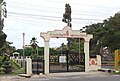
Saraswathipuram is a residential suburb of Mysore city in Karnataka State, India.

Contents

It is located on the western side of Mysore, and is sometimes considered part of downtown Mysore because of its proximity to the city center. [2]

There is a post office at Saraswathipuram.

Academic Community

Saraswathipuram was originally designed as a residential tract for teachers and most of the residents were academics. But recently people from all walks of life have settled there. The academics form a majority even now because the University of Mysore and many other major organizations are located in Saraswathipuram. The area is considered an upmarket place because of its shaded streets and beautiful parks.

Notable landmarks

Kukkarahalli lake

Kukkarahalli Lake is located in Saraswathipuram. This is a property of the University of Mysore and maintained by the university administration. The lake was created in 1864 for irrigation purpose. The lake has a three kilometer long perimeter track which is popular among joggers and trekkers. The biodiversity of the lake area is impressive with many species of birds present in this area. preserve the lake by implementing several remedial measures.

See also

Related Research Articles

<span class="mw-page-title-main">Mysore</span> City in Karnataka, India

Mysore, officially Mysuru, is the second-most populous city in the southern Indian state of Karnataka. It is the headquarters of Mysore district and Mysore division. As the traditional seat of the Wadiyar dynasty, the city functioned as the capital of the Kingdom of Mysore for almost six centuries. Known for its heritage structures, palaces, and its culture, Mysore has been called the "City of Palaces", the "Heritage City", and the "Cultural Capital of Karnataka". It is one of the cleanest cities in India according to the Swachh Survekshan.

<span class="mw-page-title-main">Whitefield, Bangalore</span> Suburb in Bangalore, Karnataka, India

Whitefield is a suburb of Bangalore in the state of Karnataka, India. Established in 1882 as a settlement for the Eurasians and Anglo Indians of Bangalore, Whitefield remained a quaint little settlement at the eastern periphery of Bangalore city till the late 1990s when the local IT boom turned it into a major suburb. It is now a major part of Greater Bangalore. Whitefield is Bengaluru's first tech corridor to be connected by Namma Metro.

<span class="mw-page-title-main">Kukkarahalli Lake</span> Lake in Mysore, India

Kukkarahalli Lake also called Kukkarhalli Kere, located in the heart of the Mysore city, adjoins the Manasgangotri, the Kalamandir (Rangyana) and the Central Food Technological Research Institute (CFTRI) campus. It provides lung-space to the city. Mummadi Krishnaraja Wodeyar (1794–1868) of the Mysore dynasty was responsible for getting the lake created, in the year 1864, to provide water for irrigation to about 4000 ha of land outside the city. The Lake also used to be a source of water supply to the city of Mysore but over the years, sewage and excessive land encroachments and blockage of water flow sources almost led to the eutrophication of the lake. The University of Mysore and the citizen forums of Mysore continue to make efforts to preserve the lake by implementing several remedial measures. There is a 3.5-km walkway on the periphery of the lake with shaded stone benches for visitors to sit, relax and enjoy the scenic serenity of the lake.

<span class="mw-page-title-main">Mysore district</span> District of Karnataka in India

Mysore district, officially Mysuru district, is an administrative district located in the southern part of the state of Karnataka, India. It is the administrative headquarters of Mysore division. Chamarajanagar District was carved out of the original larger Mysore District in the year 1998. The district is bounded by Chamrajanagar district to the southeast, Mandya district to the east and northeast, Kerala state to the south, Kodagu district to the west, and Hassan district to the north.

<span class="mw-page-title-main">Basaveshwaranagara</span> Neighborhood in Bengaluru Urban, Karnataka, India

Basaveshwaranagara, also known as Basaveshwaranagar, Basaveshnagara or Basaveshnagar is a largely residential neighbourhood in the west of Bengaluru, Karnataka, India. It is located to the west of Rajajinagara and is sandwiched between the localities of Mahalakshmi Layout to the north and Vijayanagara to the south, spread across multiple sub-localities, three assembly constituencies and seven Bruhat Bengaluru Mahanagara Palike (BBMP) wards. The area of Basaveshwaranagara is often considered West of Chord Road as it lies to the west of Chord Road, an arterial road in the western part of Bengaluru.

<span class="mw-page-title-main">Devanahalli</span> Town in Karnataka, India

Devanahalli, also called "Devandahalli", "Dyaavandalli", Devanadoddi, and Devanapura, is a town and Town Municipal Council in Bengaluru Rural district in the state of Karnataka in India. The town is located 40 kilometres (25 mi) to the north-east of Bengaluru. Devanahalli is the site of Kempegowda International Airport. A multibillion-dollar Devanahalli Business Park with two IT Parks are coming up on nearly 400 acres (1.6 km2) adjoining the airport. An Aerospace Park, Science Park and a 10 billion (US$120 million) Financial City are also coming up. A new satellite ring road will connect the city with Doddaballapur. Devanahalli is situated near the upcoming 1,500 billion (US$18 billion), 12,000-acre (49 km2) BIAL IT Investment Region, to be the largest IT region in India.

Bangalore is situated in the southeast of the South Indian state of Karnataka. It is positioned at 12.97° N 77.56° E and covers an area of 2,190 square kilometres (850 sq mi). A landlocked city, Bangalore is located in the heart of the Mysore Plateau at an average elevation of 920 metres (3,020 ft). Bangalore district borders with Kolar and Chikkaballapur in the northeast, Tumkur in the northwest, and Mandya and Ramanagaram in the southeast.

<span class="mw-page-title-main">Kanakapura</span> City in Karnataka, India

Kanakapura is a city in the Bengaluru South district of Karnataka on the banks of the Arkavathi river and the administrative center of the taluk of the same name. Kanakapura is largest cocoon silk producer in India. River Cauvery flows around 21 km in Kanakapura Taluk.Previously belonged to Bangalore Rural District. It was formerly the largest constituency in the country. (1,553 km2 [600 sq mi]). It is located among the lush green forests of the state of Karnataka. The town is a tourism hotspot and an often visited tourist favorite in the entire state of Karnataka, as it has something for everyone ranging from avid trekkers to history buffs and wildlife enthusiasts. The forest area in this taluk is very wide and about half of the Bannerghatta National Park is located in our Kanakapura area. Kodihalli wildlife range and harohalli wildlife range its division. The Kaveri Wildlife Sanctuary consists of two main zones namely the Sangam Wildlife range, the Muggur Wildlife range

<span class="mw-page-title-main">Tourism in Karnataka</span>

Karnataka, the sixth largest state in India, has been ranked as the third most popular state in the country for tourism in 2014. It is home to 507 of the 3600 centrally protected monuments in India, second only to Uttar Pradesh. The State Directorate of Archaeology and Museums protects an additional 752 monuments and another 25,000 monuments are yet to receive protection.

<span class="mw-page-title-main">Economy of Karnataka</span>

Karnataka is one of the highest economic growth states in India with an expected GSDP growth of 9.5% in the 2021–22 fiscal year. The total expected GSDP of Karnataka in 2022–2023 is about $240 billion. Karnataka recorded the highest growth rates in terms of GDP and per capita GDP in the last decade compared to other states. In 2008–09, the tertiary sector contributed the most to GSDP, followed by the secondary sector, and the primary sector.

<span class="mw-page-title-main">Sargur</span> Town in Karnataka, India

Sargur, is a small town located about 80 km from the town of Chamarajanagar And a Taluk of Mysore district of Karnataka, India. H D Kote (Heggadadevanakote) is about 12 km north of Sargur. It is 55 km from the city of Mysore. Bangalore International Airport is 200 km away. To be more elaborate, Sargur is 33.8 km from Nanjangud town (Karnataka), 35.1 km from Gundlupet town (Karnataka), 137.8 km from Udagamandalam town (Ooty) Valley and 38.8 km from Hunsur town (Karnataka).

<span class="mw-page-title-main">Karanji Lake</span> Lake in Mysore, Karnataka, India

Karanji Lake is a lake located in the city of Mysore in the state of Karnataka, India. The lake is surrounded by a nature park consisting of a butterfly park and a walk-through aviary. This aviary is the biggest 'walk-through aviary' in India. There is also a museum, the Regional Museum of Natural History which is located on the banks of this lake. The total area of Karanji lake is 90 hectares. While waterspread area is about 55 hectares, the foreshore area measures about 35 hectares. Karanji lake is owned by the Mysore Zoo Authority. Mysore Zoo gets a revenue of an average of Rs. 50000 per day from ticket sales to enthusiasts who visit this lake.

<span class="mw-page-title-main">Vivekanandanagar</span> Place in Karnataka, India

Vivekananda Nagar is a suburb of Mysore City in Karnataka state, India.

<span class="mw-page-title-main">Srikantadatta Narasimha Raja Wadeyar Ground</span> Cricket stadium

The Srikantadatta Narasimharaja Wadiyar Ground, commonly known as Gangotri Glades Cricket Ground and formerly known as the University of Mysore Platinum Jubilee Cricket Stadium, is a cricket stadium located in the Manasagangotri campus of the University of Mysore in the southern Indian city of Mysore, Karnataka, named after Prince Srikantadatta Wadiyar.

<span class="mw-page-title-main">Bangalore</span> Capital of Karnataka, India

Bangalore, officially Bengaluru, is the capital and largest city of the southern Indian state of Karnataka. It has a population of more than 8 million and a metropolitan population of around 15 million, making it India's third most populous city and fourth most populous urban agglomeration. It is the most populous city and largest urban agglomeration in South India, and is the 27th largest city in the world. Located on the Deccan Plateau, at a height of over 900 m (3,000 ft) above sea level, Bangalore has a pleasant climate throughout the year, with its parks and green spaces earning it the reputation of India's "Garden City". Its elevation is the highest of India's major cities.

<span class="mw-page-title-main">Siddhartha Nagar</span> Place in Karnataka, India

Siddhartha Nagar is an eastern suburb of Mysore city in Karnataka, a south Indian state.

<span class="mw-page-title-main">Manasagangotri</span> Place in Karnataka, India

Manasagangotri is a suburb of Mysore city in Mysore district of Karnataka state, India. Mysore University and its various departments are located in this area.

<span class="mw-page-title-main">Mysore-Ooty Road</span> Tourist trail in South India

Mysore-Ooty Road or Mysore-Udhagamandalam Road is a tourist trail of South India starting from Mysore in Karnataka state and ending in Udhagamandalam in Nilgiri district of Tamil Nadu state, India. Both routes pass through Bandipur National park in Gundlupet, Karnataka and Mudumalai National Park in Tamil Nadu.

References

  1. "Pin Code of Saraswathipuram in Mysore, Karnataka".
  2. "Saraswathipuram, Mysore address, location, Pincode 570009". asklaila.com.