Sarayacu District

Last updated
Sarayacu
Sarayaku
Localizacion del distrito Sarayacu en la provincia de Ucayali.svg
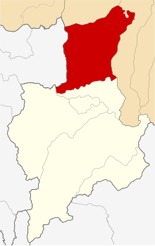
Location of Sarayacu in the Ucayali Province
Country Flag of Peru.svg  Peru
Region Loreto
Province Ucayali
FoundedJanuary 2, 1857
Capital Dos de Mayo
Area
  Total
6,303.17 km2 (2,433.67 sq mi)
Elevation
125 m (410 ft)
Population
  Total
14,712
  Density2.3/km2 (6.0/sq mi)
Time zone UTC-5 (PET)
UBIGEO 160605

Sarayacu District is one of six districts of the Ucayali Province in Peru. [1]

Climate

Climate data for Juancito, Sarayacu, elevation 124 m (407 ft), (1991–2020)
MonthJanFebMarAprMayJunJulAugSepOctNovDecYear
Mean daily maximum °C (°F)32.0
(89.6)
31.2
(88.2)
31.2
(88.2)
31.4
(88.5)
31.3
(88.3)
31.2
(88.2)
31.5
(88.7)
32.1
(89.8)
32.1
(89.8)
32.2
(90.0)
31.7
(89.1)
31.4
(88.5)
31.6
(88.9)
Mean daily minimum °C (°F)21.7
(71.1)
21.6
(70.9)
21.9
(71.4)
22.0
(71.6)
21.5
(70.7)
21.1
(70.0)
21.1
(70.0)
21.3
(70.3)
21.4
(70.5)
21.7
(71.1)
21.7
(71.1)
21.8
(71.2)
21.6
(70.8)
Average precipitation mm (inches)118.7
(4.67)
125.2
(4.93)
151.8
(5.98)
142.9
(5.63)
95.8
(3.77)
76.2
(3.00)
79.3
(3.12)
68.9
(2.71)
72.4
(2.85)
71.6
(2.82)
121.7
(4.79)
150.1
(5.91)
1,274.6
(50.18)
Source: National Meteorology and Hydrology Service of Peru [2]

References

  1. (in Spanish) Instituto Nacional de Estadística e Informática. Banco de Información Distrital Archived 2008-04-23 at the Wayback Machine . Retrieved April 11, 2008.
  2. "Normales Climáticas Estándares y Medias 1991-2020". National Meteorology and Hydrology Service of Peru. Archived from the original on 21 August 2023. Retrieved 17 June 2024.

6°21′57″S75°49′38″W / 6.3659°S 75.8272°W / -6.3659; -75.8272