
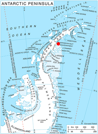
The Scar Inlet is an area of the Larsen Ice Shelf immediately northwest of Jason Peninsula, named after the Scientific Committee on Antarctic Research. [1] It is bounded by Tashtego Point and Chapman Point.
The Scar Inlet is an area of the Larsen Ice Shelf immediately northwest of Jason Peninsula, named after the Scientific Committee on Antarctic Research. [1] It is bounded by Tashtego Point and Chapman Point.
The region was discovered in 1902 by Otto Nordenskjöld, leader of the Swedish Antarctic Expedition, 1901–04, who gave the name "Scott Bay". The name did not survived in usage, perhaps due to the large number of features already named after Captain Robert F. Scott. The present name was given in 1963 by the UK Antarctic Place-Names Committee (UK-APC) after the Scientific Committee on Antarctic Research of the International Council of Scientific Unions, in recognition of the role of this organization in furthering scientific research in the Antarctic. It is the remaining fragment of the much larger Larsen B ice shelf which disintegrated in 2002. [2]
Drygalski Glacier is a broad glacier, 18 nautical miles long which flows southeast from Herbert Plateau through a rectangular re-entrant to a point immediately north of Sentinel Nunatak on the east coast of Graham Land, Antarctica.
The Edgeworth Glacier is a glacier 12 nautical miles long, flowing south-southwestwards from the edge of Detroit Plateau below Wolseley Buttress to the ice shelf west of Sobral Peninsula, Graham Land, Antarctica.

Evans Glacier is a gently-sloping glacier 15 nautical miles (28 km) long and 4 nautical miles (7 km) wide, draining the southeast slopes of Travnik Buttress eastwards between Rugate Ridge and Poibrene Heights to flow into Vaughan Inlet on the east coast of Graham Land, Antarctica. It was discovered by Sir Hubert Wilkins in an aerial flight, December 20, 1928, and named "Evans Inlet" by him for E.S. Evans of Detroit. A further survey by the Falkland Islands Dependencies Survey in 1955 reported that this low-lying area is not an inlet, but is formed by the lower reaches of Hektoria Glacier and the feature now described.
Sjögren Glacier is a glacier 15 nautical miles long in the south part of Trinity Peninsula, Antarctica. It flows southeast from Detroit Plateau to the south side of Mount Wild, where it enters Prince Gustav Channel.

Larsen Inlet is an inlet, formerly ice-filled, 12 nautical miles long in a north–south direction and 7 nautical miles wide, between Cape Longing and Cape Sobral along the east coast of Graham Land, Antarctica.

Kunino Point is a rocky point on Blagoevgrad Peninsula, Oscar II Coast, Graham Land in Antarctica, the south extremity of an eponymous ridge extending 2.4 by 2 km on the north coast of Exasperation Inlet. Formed in 2002 as a result of the disintegration of Larsen Ice Shelf in the area.
Diralo Point is the rocky point at the southeast extremity of Metlichina Ridge, forming the north side of the entrance to Borima Bay on Oscar II Coast, Graham Land in Antarctica. It was formed as a result of the disintegration of Larsen Ice Shelf in the area in 2002 and the subsequent retreat of Jorum Glacier.
Borima Bay is the 6.5 km wide cove indenting for 8 km Oscar II Coast in Graham Land, Antarctica south of Diralo Point and north of Caution Point. It is part of Exasperation Inlet, Weddell Sea formed as a result of the disintegration of Larsen Ice Shelf in the area in 2002 and the subsequent retreat of Jorum Glacier and Minzuhar Glacier.
Artanes Bay is the 14 km wide cove indenting for 6.2 km Oscar II Coast in Graham Land, Antarctica, and entered west of Cape Fairweather and east of Shiver Point. It was formed as a result of the break-up of Larsen Ice Shelf in the area in 2002, and subsequent retreat of Rogosh Glacier.
Blagoevgrad Peninsula is the mostly ice-covered peninsula projecting 15 km in southeast direction from Oscar II Coast in Graham Land, Antarctica, and 17 km wide. It is bounded by Vaughan Inlet to the north and Exasperation Inlet to the south, ending in Foyn Point to the southeast. The east coast of the peninsula is indented by Yamforina Cove, and its interior is partly occupied by the southeast portion of Poibrene Heights. It was formed as a result of the break-up of Larsen Ice Shelf in the area in 2002, and subsequent retreat of the adjacent Evans Glacier and Punchbowl Glacier.
Daskot Point is the ice-covered point on the north side of the entrance to Yamforina Cove on Blagoevgrad Peninsula, Oscar II Coast in Graham Land, Antarctica. It was formed as a result of the break-up of Larsen Ice Shelf in the area in 2002.
Kesten Point is the partly ice-free point on the south side of the entrance to Yamforina Cove on Blagoevgrad Peninsula, Oscar II Coast in Graham Land, Antarctica. It was formed as a result of the break-up of Larsen Ice Shelf in the area in 2002.
Yamforina Cove is the 4.55 km wide cove indenting for 3.1 km the east coast of Blagoevgrad Peninsula on Oscar II Coast in Graham Land, Antarctica. It is entered south of Daskot Point and north of Kesten Point, and was formed as a result of the break-up of Larsen Ice Shelf in the area in 2002, and subsequent deglaciation.
Vaughan Inlet is an inlet approximately 10 miles (16 km) long and 7.2 miles (11.6 km) wide between the coastal point formed by Whiteside Hill to the southwest and Shiver Point to the northeast, on Oscar II Coast in Graham Land, Antarctica. Its head is fed by Evans Glacier, Green Glacier, Hektoria Glacier and Brenitsa Glacier.
Sexaginta Prista Bay is the 6.5 km wide bay indenting for 4 km Oscar II Coast in Graham Land southwest of Delusion Point and northeast of Radovene Point. It is part of Exasperation Inlet, formed as a result of the break-up of Larsen Ice Shelf in the area and the retreat of Mapple Glacier in the early 21st century. The feature is named after the ancient Roman town of Sexaginta Prista in Northeastern Bulgaria.
Domlyan Bay is the 4.75 km wide bay indenting for 5.5 km Oscar II Coast in Graham Land south of Radovene Point and north of Kalina Point. It is part of Exasperation Inlet, formed as a result of the break-up of Larsen Ice Shelf in the area, and the retreat of Melville Glacier in the early 21st century. The feature is named after the settlement of Domlyan in Southern Bulgaria.
Sandilh Point is the partly ice-free point on the northwest side of the entrance to Durostorum Bay on Oscar II Coast in Graham Land. It is situated at the east extremity of Tepava Ridge, and was formed as a result of the break-up of Larsen Ice Shelf in the area, and the retreat of Pequod Glacier in the early 21st century. Named after the Bulgar ruler Sandilh.
Akra Peninsula is the mostly ice-covered peninsula projecting 11 km eastwards from Oscar II Coast in Graham Land, and 5.2 km wide, bounded by Exasperation Inlet to the north and Scar Inlet to the south, and ending in Cape Disappointment to the east. It was formed as a result of the break-up of Larsen Ice Shelf in the area, and the retreat of Pequod Glacier in the early 21st century. The feature is named after the ancient town of Akra in Southeastern Bulgaria.
Durostorum Bay is the 6.7 km wide bay indenting for 3.9 km Oscar II Coast in Graham Land southeast of Sandilh Point and northwest of Ranyari Point. It is part of Exasperation Inlet, formed as a result of the break-up of Larsen Ice Shelf in the area and the retreat of Pequod Glacier in the early 21st century. Named after the ancient town of Durostorum in Northeastern Bulgaria.
Spillane Fjord is a fjord in front of Crane Glacier in the western part of Exasperation Inlet, Oscar II Coast in Graham Land, entered between Caution Point and Delusion Point. The feature is 2 miles wide, 10 miles long and averages 1000 m deep. Its greatest depth is 1250 m at the far west end of the fjord. The fjord was created by the catastrophic retreat of Crane Glacier, which was itself caused by the breakup of the north portion of the Larsen Ice Shelf in March, 2002. The fjord's creation was documented by satellite images and the feature was first visited by surface ship in April 2006 during the U.S. Antarctic Program NBP06-03 cruise, when the extent, depth and dimension were determined by swath bathymetry. Named by US-ACAN in 2007 after Joshua Spillane who served the USAP as a marine technician aboard L.M. Gould and N.B. Palmer. He lost his life in Drake Passage, April 16, 2006, while L.M. Gould was transiting from Palmer Station to Punta Arenas, Chile.
![]() This article incorporates public domain material from "Scar Inlet". Geographic Names Information System . United States Geological Survey.
This article incorporates public domain material from "Scar Inlet". Geographic Names Information System . United States Geological Survey.
65°56′S61°52′W / 65.933°S 61.867°W
| | This Oscar II Coast location article is a stub. You can help Wikipedia by expanding it. |