
Thurston Island is a largely ice-covered, glacially dissected island, 135 nautical miles long and 55 nautical miles wide, lying between Amundsen Sea and Bellingshausen Sea a short way off the northwest end of Ellsworth Land, Antarctica. The island is separated from the mainland by Peacock Sound, which is occupied by the west portion of Abbot Ice Shelf.
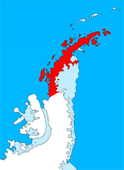
Graham Land is the portion of the Antarctic Peninsula that lies north of a line joining Cape Jeremy and Cape Agassiz. This description of Graham Land is consistent with the 1964 agreement between the British Antarctic Place-names Committee and the US Advisory Committee on Antarctic Names, in which the name "Antarctic Peninsula" was approved for the major peninsula of Antarctica, and the names Graham Land and Palmer Land for the northern and southern portions, respectively. The line dividing them is roughly 69 degrees south.

James Ross Island is a large island off the southeast side and near the northeastern extremity of the Antarctic Peninsula, from which it is separated by Prince Gustav Channel. Rising to 1,630 metres (5,350 ft), it is irregularly shaped and extends 40 nautical miles in a north–south direction.

The Getz Ice Shelf is an ice shelf over 300 nautical miles long and from 20 to 60 nautical miles wide, bordering the Hobbs Coast and Bakutis Coast of Marie Byrd Land, Antarctica, between the McDonald Heights and Martin Peninsula. Several large islands are partially or wholly embedded in the ice shelf.

The Prince Charles Mountains are a major group of mountains in Mac. Robertson Land in Antarctica, including the Athos Range, the Porthos Range, and the Aramis Range. The highest peak is Mount Menzies, with a height of 3,228 m (10,591 ft). Other prominent peaks are Mount Izabelle and Mount Stinear. These mountains, together with other scattered peaks, form an arc about 420 km (260 mi) long, extending from the vicinity of Mount Starlight in the north to Goodspeed Nunataks in the south.
Lützow-Holm Bay is a large bay, about 220 kilometres (120 nmi) wide, indenting the coast of Queen Maud Land in Antarctica between Riiser-Larsen Peninsula and the coastal angle immediately east of the Flatvaer Islands. It was discovered by Captain Hjalmar Riiser-Larsen in two airplane flights from his expedition vessel, the Norvegia, on February 21 and 23, 1931. The name honours Commander Finn Lützow-Holm of the Royal Norwegian Navy Air Service, a pilot for Captain Riiser-Larsen on the Aagaard in 1935.
Sulzberger Bay is a bay indenting the front of the Sulzberger Ice Shelf between Fisher Island and Vollmer Island, along the coast of Marie Byrd Land, Antarctica.

Barff Peninsula is a peninsula forming the east margin of Cumberland East Bay, South Georgia Island. It is 8 miles (13 km) long and extends northwest from Sörling Valley to Barff Point, its farthest extremity. It was probably first seen by the British expedition under James Cook in 1775. The peninsula as a whole takes its name from Barff Point, which was named for Royal Navy Lieutenant A.D. Barff of HMS Sappho, who, assisted by Captain C.A. Larsen, sketched a map of Cumberland Bay in 1906. Barff Point is considered the eastern headland of East Cumberland Bay.

Veier Head is a high, snow-covered headland which marks the southernmost point of Jason Peninsula on the east coast of Graham Land. Norwegian explorer Captain C.A. Larsen discovered what he charted as an island in this vicinity on December 9, 1893. The feature was first seen by Soren Andersen First Mate of the Jason (ship), and was named "Veieroen" after his home, Veierland or Veieroen, in Norway. It is possible that Larsen mistook this high southern part of Jason Peninsula for a separate island. In order to preserve Larsen's original name in the area, the name Veier Head has been approved for the headland described.
Crane Glacier is a narrow glacier which flows 30 miles (50 km) in an east-northeasterly direction along the northwest side of Aristotle Mountains to enter Spillane Fjord south of Devetaki Peak, on the east coast of the Antarctic Peninsula. Sir Hubert Wilkins photographed this feature from the air in 1928 and gave it the name "Crane Channel", after C.K. Crane of Los Angeles, reporting that it appeared to be a channel cutting in an east-west direction across the peninsula. The name was altered to "Crane Inlet" following explorations along the west coast of the peninsula in 1936 by the British Graham Land Expedition, which proved that no through channel from the east coast existed as indicated by Wilkins. Comparison of Wilkins' photograph of this feature with those taken in 1947 by the Falklands Islands Dependencies Survey shows that Wilkins' "Crane Channel" is this glacier, although it lies about 75 miles (120 km) northeast of the position originally reported by Wilkins.

Wright Peninsula is a peninsula on the east coast of Adelaide Island, Antarctica, lying between Stonehouse Bay to the north and Ryder Bay to the south. On its northern coastline the peninsula is fringed by the Stokes Peaks; on its southern side by the Reptile Ridge. The Princess Royal Range separates the peninsula from the rest of Adelaide Island; the only 'gap' is provided by McCallum Pass.
Argo Point is a prominent rock headland rising steeply to 260 metres (850 ft) on the east side of the Jason Peninsula, 22 nautical miles (41 km) northeast of Veier Head on the east coast of Graham Land. Probably first seen by Carl Anton Larsen in 1893, it was surveyed by the Falkland Islands Dependencies Survey in 1953 and named by the UK Antarctic Place-Names Committee in 1956. The name derives from association with the Jason Peninsula; Jason sailed in the Argo to search for the golden fleece.
Castor Nunatak is a nunatak 3 nautical miles (6 km) southwest of Oceana Nunatak in the Seal Nunataks group, off the east coast of the Antarctic Peninsula. It was first seen and mapped as an island in December 1893 by a Norwegian Sealing expedition under C.A. Larsen, who named it after the Castor, a ship which combined sealing and exploring activities along the west coast of the Antarctic Peninsula under Captain Morten Pedersen in 1893–94. The feature was determined to be a nunatak in 1902 by the Swedish Antarctic Expedition under Otto Nordenskiöld.
Condor Peninsula is a mountainous, ice-covered peninsula, 30 nautical miles long and 10 to 15 nautical miles wide, between Odom Inlet and Hilton Inlet on the east coast of Palmer Land, Antarctica.
Kvinge Peninsula is a snow-covered peninsula at the north side of Palmer Inlet terminating in Cape Bryant, on the east coast of Palmer Land, Antarctica.

Frigga Peak is a peak, 1,570 metres (5,150 ft) high, which stands at the south side of Anderson Glacier on the east coast of Graham Land, Antarctica. It was charted by the Falkland Islands Dependencies Survey (FIDS) and photographed from the air by the Ronne Antarctic Research Expedition in 1947. The FIDS named it after the Norse goddess Frigga, the "cloud spinner," because clouds were observed to form on the summit of this peak earlier than on any other feature in this vicinity. Nearby Mount Odin was named in association, since Odin is Frigga's wife in Norse mythology.
Evans Glacier is a gently-sloping glacier 15 nautical miles (28 km) long and 4 nautical miles (7 km) wide, draining the southeast slopes of Travnik Buttress eastwards between Rugate Ridge and Poibrene Heights to flow into Vaughan Inlet on the east coast of Graham Land, Antarctica. It was discovered by Sir Hubert Wilkins in an aerial flight, December 20, 1928, and named "Evans Inlet" by him for E.S. Evans of Detroit. A further survey by the Falkland Islands Dependencies Survey in 1955 reported that this low-lying area is not an inlet, but is formed by the lower reaches of Hektoria Glacier and the feature now described.
Mobiloil Inlet is an ice-filled inlet, nurtured by several northeast and east flowing glaciers, lying between the Rock Pile Peaks and Hollick-Kenyon Peninsula along the east coast of the Antarctic Peninsula.
The Tyndall Mountains are a group of mountains close south of Avsyuk Glacier in central Arrowsmith Peninsula, Graham Land. Photographed from the air by FIDASE, 1956–57. Mapped by Falkland Islands Dependencies Survey (FIDS) from surveys and air photos, 1948–59. Named by United Kingdom Antarctic Place-Names Committee (UK-APC) for John Tyndall (1820–93), Irish mountaineer and pioneer glaciologist, author of many works on glaciers and the physical properties of ice.
Standring Inlet is the easternmost of three inlets on the north coast of Jason Peninsula, Graham Land. It is 9 nautical miles (17 km) long and is filled with ice shelf. Surveyed by the Falkland Islands Dependencies Survey (FIDS) in 1953. Named in 1956 by the FIDS for Anthony J. Standring, geologist at Hope Bay in 1953 and 1954, who visited Jason Peninsula with the survey party.
