Related Research Articles

The geology of the Appalachians dates back more than 1.2 billion years to the Mesoproterozoic era when two continental cratons collided to form the supercontinent Rodinia, 500 million years prior to the development of the range during the formation of Pangea. The rocks exposed in today's Appalachian Mountains reveal elongate belts of folded and thrust faulted marine sedimentary rocks, volcanic rocks, and slivers of ancient ocean floor—strong evidences that these rocks were deformed during plate collision. The birth of the Appalachian ranges marks the first of several mountain building plate collisions that culminated in the construction of Pangea with the Appalachians and neighboring Anti-Atlas mountains near the center. These mountain ranges likely once reached elevations similar to those of the Alps and the Rocky Mountains before they were eroded.

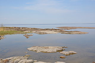
In geomorphology and geology, a peneplain is a low-relief plain formed by protracted erosion. This is the definition in the broadest of terms, albeit with frequency the usage of peneplain is meant to imply the representation of a near-final stage of fluvial erosion during times of extended tectonic stability. Peneplains are sometimes associated with the cycle of erosion theory of William Morris Davis, but Davis and other workers have also used the term in a purely descriptive manner without any theory or particular genesis attached.

The Western Interior Seaway was a large inland sea that split the continent of North America into two landmasses for 34 million years. The ancient sea, which existed from the early Late Cretaceous to the earliest Paleocene, connected the Gulf of Mexico to the Arctic Ocean. The two land masses it created were Laramidia to the west and Appalachia to the east. At its largest extent, it was 2,500 feet (760 m) deep, 600 miles (970 km) wide and over 2,000 miles (3,200 km) long.

The Los Angeles Basin is a sedimentary basin located in Southern California, in a region known as the Peninsular Ranges. The basin is also connected to an anomalous group of east-west trending chains of mountains collectively known as the Transverse Ranges. The present basin is a coastal lowland area, whose floor is marked by elongate low ridges and groups of hills that is located on the edge of the Pacific Plate. The Los Angeles Basin, along with the Santa Barbara Channel, the Ventura Basin, the San Fernando Valley, and the San Gabriel Basin, lies within the greater Southern California region. The majority of the jurisdictional land area of the city of Los Angeles physically lies within this basin.

A shield is a large area of exposed Precambrian crystalline igneous and high-grade metamorphic rocks that form tectonically stable areas. These rocks are older than 570 million years and sometimes date back to around 2 to 3.5 billion years. They have been little affected by tectonic events following the end of the Precambrian, and are relatively flat regions where mountain building, faulting, and other tectonic processes are minor, compared with the activity at their margins and between tectonic plates. Shields occur on all continents.

Of the many unconformities (gaps) observed in geological strata, the term Great Unconformity is frequently applied to either the unconformity observed by James Hutton in 1787 at Siccar Point in Scotland, or that observed by John Wesley Powell in the Grand Canyon in 1869. Both instances are exceptional examples of where the contacts between sedimentary strata and either sedimentary or crystalline strata of greatly different ages, origins, and structure represent periods of geologic time sufficiently long to raise great mountains and then erode them away.

The U.S. state of Georgia is commonly divided into four geologic regions that influence the location of the state's four traditional physiographic regions. The four geologic regions include the Appalachian foreland, Blue Ridge, Piedmont, and Coastal Plain. These four geologic regions commonly share names with and typically overlap the four physiographic regions of the state: the Appalachian Plateau and adjacent Valley and Ridge; the Blue Ridge; the Piedmont and the Coastal Plain.

The geological history of the Earth follows the major geological events in Earth's past based on the geological time scale, a system of chronological measurement based on the study of the planet's rock layers (stratigraphy). Earth formed about 4.54 billion years ago by accretion from the solar nebula, a disk-shaped mass of dust and gas left over from the formation of the Sun, which also created the rest of the Solar System.
Paleontology or palaeontology is the study of prehistoric life forms on Earth through the examination of plant and animal fossils. This includes the study of body fossils, tracks (ichnites), burrows, cast-off parts, fossilised feces (coprolites), palynomorphs and chemical residues. Because humans have encountered fossils for millennia, paleontology has a long history both before and after becoming formalized as a science. This article records significant discoveries and events related to paleontology that occurred or were published in the year 1929.

Neuquén Basin is a sedimentary basin covering most of Neuquén Province in Argentina. The basin originated in the Jurassic and developed through alternating continental and marine conditions well into the Tertiary. The basin bounds to the west with the Andean Volcanic Belt, to the southeast with the North Patagonian Massif and to the northeast with the San Rafael Block and to the east with the Sierra Pintada System. The basin covers an area of approximately 120,000 square kilometres (46,000 sq mi). One age of the SALMA classification, the Colloncuran, is defined in the basin, based on the Collón Curá Formation, named after the Collón Curá River, a tributary of the Limay River.

The Ojo Alamo Formation is a geologic formation in New Mexico spanning the Mesozoic/Cenozoic boundary. Non-avian dinosaur fossils have controversially been identified in beds of this formation dating from after the Cretaceous–Paleogene extinction event, but these have been explained as either misidentification of the beds in question or as reworked fossils, fossils eroded from older beds and redeposited in the younger beds.

The Andean orogeny is an ongoing process of orogeny that began in the Early Jurassic and is responsible for the rise of the Andes mountains. The orogeny is driven by a reactivation of a long-lived subduction system along the western margin of South America. On a continental scale the Cretaceous and Oligocene were periods of re-arrangements in the orogeny. The details of the orogeny vary depending on the segment and the geological period considered.
During most of the Late Cretaceous the eastern half of North America formed Appalachia, an island land mass separated from Laramidia to the west by the Western Interior Seaway. This seaway had split North America into two massive landmasses due to a multitude of factors such as tectonism and sea-level fluctuations for nearly 40 million years. The seaway eventually expanded, divided across the Dakotas, and by the end of the Cretaceous, it retreated towards the Gulf of Mexico and the Hudson Bay. This left the island masses joined in the continent of North America as the Rocky Mountains rose. From the Cenomanian to the end of the Campanian ages of the Late Cretaceous, Appalachia was separated from the rest of North America. As the Western Interior Seaway retreated in the Maastrichtian, Laramidia and Appalachia eventually connected. Because of this, its fauna was isolated, and developed very differently from the tyrannosaur, ceratopsian, hadrosaurid, pachycephalosaur and ankylosaurid dominated fauna of the western part of North America, known as "Laramidia".

The geology of North America is a subject of regional geology and covers the North American continent, the third-largest in the world. Geologic units and processes are investigated on a large scale to reach a synthesized picture of the geological development of the continent.
The sub-Cambrian peneplain is an ancient, extremely flat, erosion surface (peneplain) that has been exhumed and exposed by erosion from under Cambrian strata over large swathes of Fennoscandia. Eastward, where this peneplain dips below Cambrian and other Lower Paleozoic cover rocks. The exposed parts of this peneplain are extraordinarily flat with relief of less than 20 m. The overlying cover rocks demonstrate that the peneplain was flooded by shallow seas during the Early Paleozoic. Being the oldest identifiable peneplain in its area the Sub-Cambrian peneplain qualifies as a primary peneplain.

The paleic surface or palaeic surface is an erosion surface of gentle slopes that exist in South Norway. Parts of it are a continuation of the Sub-Cambrian peneplain and Muddus Plains found further east or equivalent to the strandflat coastal plains of Norway. Hardangervidda, a particularly flat and elevated part of the Paleic surface formed in the Miocene at sea level.
One of the major depositional strata in the Himalaya is the Lesser Himalayan Strata from the Paleozoic to Mesozoic eras. It had a quite different marine succession during the Paleozoic, as most parts of it are sparsely fossiliferous or even devoid of any well-defined fossils. Moreover, it consists of many varied lithofacies, making correlation work more difficult. This article describes the major formations of the Paleozoic – Mesozoic Lesser Himalayan Strata, including the Tal Formation, Gondwana Strata, Singtali Formation and Subathu Formation.

The geology of Ethiopia includes rocks of the Neoproterozoic East African Orogeny, Jurassic marine sediments and Quaternary rift-related volcanism. Events that greatly shaped Ethiopian geology is the assembly and break-up of Gondwana and the present-day rifting of Africa.

The El Rito Formation is a geologic formation in New Mexico dating to the Eocene epoch. It records a time when sediments were trapped in deep basins in western North America rather than being carried downstream to the Gulf of Mexico, so that sediments of this age in the western Gulf are mostly from the Appalachian Mountains.

The geology of the Ellsworth Mountains, Antarctica, is a rock record of continuous deposition that occurred from the Cambrian to the Permian periods, with basic igneous volcanism and uplift occurring during the Middle to Late Cambrian epochs, deformation occurring in the Late Permian period or early Mesozoic era, and glacier formation occurring in the Cretaceous period and Cenozoic era. The Ellsworth Mountains are located within West Antarctica at 79°S, 85°W. In general, it is made up of mostly rugged and angular peaks such as the Vinson Massif, the highest mountain in Antarctica.
References
- ↑ McFarlan, Arthur C. (2008) [1943]. Chesnut, Don (ed.). "Geology of Kentucky: Outline of Geologic History". Kentucky Paleontological Society.
- 1 2 3 Stose, George W. (1940). "Age of the Schooley peneplain". American Journal of Science. 238 (7).
- 1 2 Stanford, Scott D. (2023). The Schooley peneplain revisited: integrating geomorphology, stratigraphy, sea level, and tectonics (PDF). GSA Connects 2023 Meeting. Pittsburg, Pennsylvania: Geological Society of America. DOI: 10.1130/abs/2023AM-389769. Retrieved 21 July 2024.
- ↑ Sevon, William D.; Potter, Noel; Crowl, Gearge H. (1983). "Appalachian peneplains: An historical review". Earth Sciences History. 2 (2): 156–164. doi:10.17704/eshi.2.2.068421x54v1r7826.
| | This geology article is a stub. You can help Wikipedia by expanding it. |