Rohr im Gebirge is a village in the Wiener Neustadt-Land district of Lower Austria in Austria.
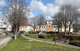
Sollenau is a municipality in the Wiener Neustadt-Land District, Lower Austria, Austria. Sollenau is situated on the river Piesting. 4.03% of the municipality is forested. It is 10 km north of Wiener Neustadt and 36 km south of Vienna.

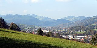
Hartberg is a city in Styria, Austria, the capital of the Hartberg-Fürstenfeld District. As of 2014, it has a population of 6,449 in an area of 21.58 km2. About 68 km up the A2 is the large city of Graz.

Mannersdorf an der Rabnitz is a municipality in the district of Oberpullendorf in the Austrian state of Burgenland.
Sankt Veit an der Gölsen is a town in the district of Lilienfeld in the Austrian federal state of Lower Austria.
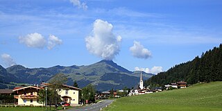
Sankt Jakob in Haus is a municipality in the Kitzbühel district in the Austrian state of Tyrol located 13.60 km northeast of Kitzbühel as well as 2.50 km above Fieberbrunn. It is the smallest community in the district. The village was mentioned in documents for the first time in 1308 but settlement already began in the 10th century. The main source of income is tourism.

Strassen is a municipality in the district of Lienz in the Austrian state of Tyrol.

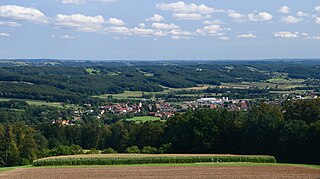
Rohrberg is a municipality in the Schwaz district in the Austrian state of Tyrol.

Mutters is a municipality in the Innsbruck-Land district in the Austrian state of Tyrol. It is located 4.70 km (3 mi) south of Innsbruck. The village was first mentioned in 1100 but settlement already began app. 3000 years ago. Mutters received connection with Innsbruck thanks to the Stubaitalbahn in 1904.

Navis is a municipality in the district Innsbruck-Land in the Austrian state of Tyrol located 19 km southeast of Innsbruck in a valley with the same name which is a side valley of the Wipptal. The extensive territory of this municipality runs from the Sill up to the 2,359 m high Klammjoch saddle and the 2,886 m high Lizumer Reckner in the Tux Alps. The village is provided with fresh drinking water thanks to the clean Navisbach. The origin of the village name is unknown but settlement began at the end of the 13th century. Copper and silver were found in the 15th and 16th century.

Tulfes is a municipality in the district of Innsbruck-Land in the Austrian state of Tyrol, located 12 km east of Innsbruck and 6 km above Hall in Tirol. The village was mentioned as “Tellevo” for the first time in 1240. Main source of income is tourism. Tulfes became a popular area of settlement due to the cities of Innsbruck and Hall.
Thaur is a municipality in the district of Innsbruck-Land in the Austrian state of Tyrol located 5 km east of Innsbruck between Rum, Austria and Hall in Tirol.

Gramais is a municipality of 41 inhabitants in the district of Reutte in the Austrian state of Tyrol. The municipality is located in the district court Reutte. It is the smallest municipality in Austria.

Jerzens is a municipality and a village in the district of Imst (district) and is located 8 km south of Imst at the Pitze River in the valley with the same name. Settlement of the area began around 600. The village was mentioned in a register in 1313 for the first time. Jerzens has 1008 inhabitants and its main source of income is agriculture and tourism.

Roppen is a municipality in the Imst district and is located 5 km southeast of Imst between the mouths of the Pitze River and the Ötztaler Ache. The village was mentioned in documents in 1260 for the first time as "Roupen" but settlement already began 3000 years ago.

Schwarzenbach an der Pielach is a municipality in the district of Sankt Pölten-Land in the Austrian state of Lower Austria.

Traismauer is a municipality in the district of Sankt Pölten-Land in Lower Austria, Austria. It was established by the Romans, probably on a location of prior settlements. Some Roman buildings survive to this day.

The market town of Winzendorf-Muthmannsdorf is an Austrian municipality in the district of Wiener Neustadt-Land in Lower Austria. It is situated some 64 km south of Vienna at the edge of the Southern Viennese Basin.

Sankt Marienkirchen am Hausruck is a municipality in the district of Ried im Innkreis in the Austrian state of Upper Austria.
Grafendorf bei Hartberg is a municipality in the district of Hartberg-Fürstenfeld in Styria, Austria.


