Related Research Articles

Williamson County is a county in the U.S. state of Texas. As of the 2020 census, its population was 609,017. Its county seat is Georgetown. The county is named for Robert McAlpin Williamson (1804?–1859), a community leader and a veteran of the Battle of San Jacinto.
Merrill Township is a civil township of Newaygo County in the U.S. state of Michigan. The population was 590 at the 2000 census.

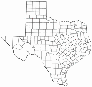
Florence is a city in Williamson County, Texas, United States. The population was 1,171 at the 2020 census. Since 2000, the territorial limits of Florence have grown by 8%. Florence is located approximately 13 miles (21 km) north from Georgetown and 40 miles (64 km) north of Austin in northwestern Williamson County. Florence is part of the Greater Austin metropolitan area.
Bartlett is a city in Bell and Williamson counties in the U.S. state of Texas. The population was 1,633 at the 2020 census.

Cedar Park is a city and a suburb of Austin in the state of Texas, approximately 16 miles (26 km) northwest of the center of Austin. According to the 2020 U.S. census, the city's population was 77,595.

Jarrell is a city in Williamson County, Texas, United States. It was incorporated as a city in 2001. The total population is 1,753 according to the 2020 census.
Huffman is an unincorporated community of northeastern Harris County, Texas within the Greater Houston metropolitan area.

Gause is an unincorporated community and census-designated place in Milam County, Texas, United States. According to the Handbook of Texas, the community had an estimated population of 400 in 2000. It was first listed as a CDP in the 2020 census with a population of 275.
Bon Wier is an unincorporated community in eastern Newton County, Texas, United States, and is located along U.S. Route 190. The ZIP Code for Bon Wier is 75928.

Bartlett is an unincorporated community in southwestern Wesley Township, Washington County, Ohio, United States. It has a post office with the ZIP code 45713. It sits at the intersection of State Routes 550 and 555 near Coal Run, a subsidiary of Wolf Creek, which meets the Muskingum River at Waterford to the north. Near Bartlett is located the Shinn Covered Bridge, which spans Wolf Creek.

McNeil is an unincorporated community in Travis County, Texas, United States. According to the Handbook of Texas, the community had a population of 70 in 2000. It is located within the Greater Austin Metropolitan area. Its elevation is 830 feet (253 m).

Dobbin is an unincorporated community in Montgomery County, Texas, United States. According to the Handbook of Texas, the community had an estimated population of 170 in 2000, although some estimates place that figure at close to 300. Dobbin is part of the Houston–Sugar Land–Baytown Metropolitan Statistical Area.

Heidenheimer is an unincorporated community in Bell County, Texas, United States. According to the Handbook of Texas, the community had an estimated population of 144 in 2000. The community is part of the Killeen–Temple–Fort Hood Metropolitan Statistical Area.
Purdon is an unincorporated community in Navarro County, Texas, United States. According to the Handbook of Texas, the community had an estimated population of 133 in 2000.
Sweet Home is an unincorporated community in Lavaca County, Texas, United States. According to the Handbook of Texas, the community had an estimated population of 360 in 2000.

Paige is an unincorporated community in Bastrop County, Texas, United States. Paige has a post office with the ZIP code 78659.
Harwood is a ghost town in Gonzales County, Texas. According to the Handbook of Texas, the community had an estimated population of 112 in 2000.
Pandora is an unincorporated community in Wilson County, Texas, United States. According to the Handbook of Texas, the community had an estimated population of 125 in 2000. Pandora is part of the San Antonio Metropolitan Statistical Area.

Waters Park, Texas was a village located eight miles north of downtown Austin, Texas defined by the boundaries of Farm to Market Road 1325, MoPac, and the Southern Pacific Railroad. It is now part of the City of Austin.
The Bartlett Western Railroad, sometimes called the Bartlett Western Railway, was a shortline rail carrier running between Bartlett, Texas and Florence, Texas, about 22-23 miles. A predecessor company started in 1909, and the railroad ended in 1935.
References
- ↑ "Round Rock, Texas to Schwertner, Texas". Google Maps. Retrieved November 30, 2021.
- ↑ USPS – Cities by ZIP Code
- ↑ "The Four Gospels Railroad". Myra H. Mcilvain. Retrieved November 29, 2021.
- ↑ "Throwback Thursday: Loss of Florence Landmark Prompts Memories of Cotton Gin Operations". The Independent, Liberty Hill, November 6, 2017. Retrieved November 30, 2021.
- ↑ "The Old Bartlett Western Railroad and Marie Cronin". Clay Coppedge, TexasEscapes.com. Retrieved November 29, 2021.
- ↑ "Bartlett Western Railway". Chris Cravens, Texas State Historical Association. Retrieved November 29, 2021.

