Schärding-Suben Airport

Last updated

Schärding-Suben Airport
Flugplatz Schärding-Suben
Summary
Airport type Private
Serves Schärding
Location Austria
Elevation  AMSL 1,072 ft / 327 m
Coordinates 48°24′10.5″N013°26′54.0″E / 48.402917°N 13.448333°E / 48.402917; 13.448333 (Schärding-Suben Airport (Schärding)) Coordinates: 48°24′10.5″N013°26′54.0″E / 48.402917°N 13.448333°E / 48.402917; 13.448333 (Schärding-Suben Airport (Schärding))
Map
Austria adm location map.svg
Airplane silhouette.svg
LOLS
Location of Schärding-Suben Airport in Austria
Runways
Direction Length Surface
ft m
14/32 2,630 802 Asphalt
Source: Landings.com [1] [2]

Schärding-Suben Airport (German: Flugplatz Schärding-Suben, ICAO : LOLS) is a private use airport located 7 kilometres (4 mi) south of Schärding, Upper Austria, Austria.

ICAO airport code four-letter code designating many airports around the world

The ICAOairport code or location indicator is a four-letter code designating aerodromes around the world. These codes, as defined by the International Civil Aviation Organization and published in ICAO Document 7910: Location Indicators, are used by air traffic control and airline operations such as flight planning.

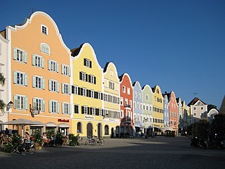
Schärding Place in Upper Austria, Austria

Schärding  is a town in northern Austrian state of Upper Austria, the capital of the district of the same name, and a major port on the Inn River. Historically, it was owned by the Wittelsbach family, which reflects in the town's architecture.

Upper Austria State of Austria

Upper Austria is one of the nine states or Bundesländer of Austria. Its capital is Linz. Upper Austria borders on Germany and the Czech Republic, as well as on the other Austrian states of Lower Austria, Styria, and Salzburg. With an area of 11,982 km2 (4,626 sq mi) and 1.437 million inhabitants, Upper Austria is the fourth-largest Austrian state by land area and the third-largest by population.

Contents

See also

Related Research Articles

Suben Place in Upper Austria, Austria

Suben is a municipality in the district of Schärding in the Austrian state of Upper Austria. It is not far from the Austrian-German border.

Military Airport Aigen im Ennstal airport in Austria

Military Airport Aigen im Ennstal is a military airport located 1 kilometre (0.62 mi) east of Aigen im Ennstal, Steiermark, Austria. It was temporarily closed in the wake of 1945

Eferding Airport airport in Austria

Eferding Airport is a private use airport located 4 kilometres (2.5 mi) northwest of Eferding, Oberösterreich, Austria.

Feldkirchen-Ossiacher See Airport airport in Austria

Feldkirchen-Ossiacher See Airport is a private use airport located near Feldkirchen, Kärnten, Austria.

Glainach-Ferlach Airport airport in Austria

Glainach-Ferlach Airport is a public use airport located 3 kilometres (2 mi) east-northeast of Ferlach, Kärnten, Austria.

Freistadt Airport airport in Austria

Freistadt Airport is a private use airport located 7 kilometres (4.3 mi) west of Freistadt, Oberösterreich, Austria.

Friesach-Hirth Airport airport in Austria

Friesach-Hirth Airport is a private use airport located 3 kilometres (1.9 mi) south-southeast of Friesach, Kärnten, Austria.

Fürstenfeld Airport airport in Austria

Fürstenfeld Airport is a private use airport located 2 kilometres (1.2 mi) north-northeast of Fürstenfeld, Steiermark, Austria.

Gmunden Laarkirchen Airport airport in Austria

Gmunden Laakirchen Airport is a private use airport located 6 kilometres (3.7 mi) northeast of Gmunden, Oberösterreich, Austria.

Hofkirchen Airport

Hofkirchen Airport is a private use airport located 3 kilometres (2 mi) west of Hofkirchen im Traunkreis, Oberösterreich, Austria.

Kapfenberg Airport airport in Austria

Kapfenberg Airport is a public use airport located 3 kilometres (2 mi) east of Kapfenberg, Steiermark, Austria.

Krems-Langenlois Airport airport in Austria

Krems-Langenlois Airport is a public use airport located 5 kilometres (3 mi) north-northeast of Krems, Niederösterreich, Austria.

Flugplatz Ottenschlag airport in Austria

Ottenschlag Airport is a private use airport located 1 kilometre (1 mi) south-southwest of Ottenschlag, Lower Austria, Austria.

Scharnstein Airport airport in Austria

Scharnstein Airport is a private use airport located 2 kilometres (1 mi) west-southwest of Scharnstein, Upper Austria, Austria.

Spitzerberg Airport private airport, sports club

Spitzerberg Airport is a private use airport in Hundsheim, Lower Austria, Austria. The airport is located at the foot of the Spitzerberg. Part of the runway is included in the Spitzerberg nature reserve.

Sankt Georgen Airport airport in Austria

Sankt Georgen Airport is a private use airport located 3 kilometres (2 mi) south of Sankt Georgen am Ybbsfelde, Lower Austria, Austria.

Sankt Johann Airport airport in Austria

Sankt Johann Airport is a public use airport located 1 kilometre (1 mi) east of Sankt Johann in Tirol, Tyrol, Austria.

Vöslau Airfield Airfield in Lower Austria

Vöslau Airfield is a public airfield located 4 kilometres (2.5 mi) east of Bad Vöslau, Lower Austria, Austria. It is also known as Flugplatz Vöslau-Kottingbrunn in German. It is used for general aviation.

Seitenstetten Airport airport in Austria

Seitenstetten Airport is a private use airport located 2 kilometres (1 mi) north-northeast of Seitenstetten, Lower Austria, Austria.

Dobersberg Airport airport

Dobersberg Airport is a private use airport located 2 kilometres (1.2 mi) west-northwest of Dobersberg, Lower Austria, Austria.

References

  1. Airport record for Schärding-Suben Airport at Landings.com. Retrieved 1 September 2013
  2. Google (1 September 2013). "location of Schärding-Suben Airport" (Map). Google Maps . Google. Retrieved 1 September 2013.