Scottish Adjacent Waters Boundaries Order 1999

Last updated

Scottish Adjacent Waters Boundaries Order 1999
Statutory Instrument
Royal Coat of Arms of the United Kingdom (variant 1, 1952-2022).svg
Citation SI 1999/1126
Territorial extent Scotland
Dates
Made13 April 1999
Commencement 1 July 1999
Other legislation
Made under Scotland Act 1998
Status: Current legislation
Text of the Scottish Adjacent Waters Boundaries Order 1999 as in force today (including any amendments) within the United Kingdom, from legislation.gov.uk.
A map showing the location of Scotland's Marine Protected Areas highlights the extent of the Scottish zone and continental shelf adjacent to Scotland. Marine Protected Areas Scotland.png
A map showing the location of Scotland's Marine Protected Areas highlights the extent of the Scottish zone and continental shelf adjacent to Scotland.

The Scottish Adjacent Waters Boundaries Order 1999 (SI 1999/1126) is a statutory instrument of the United Kingdom government, defining the boundaries of internal waters, territorial sea, and British Fishing Limits adjacent to Scotland. [1] It was introduced in accordance with the Scotland Act 1998, which established the devolved Scottish Parliament.

Contents

Defining jurisdictions

The territorial waters defined come under the jurisdiction of Scots law, and are also used for defining the area of operation of the Scottish Government (including the Marine Directorate), SEPA, and other Scottish Government agencies and public bodies.

The territorial waters defined as not being Scottish waters come under the jurisdiction of either English law or Northern Ireland law. Because the order defines the territorial limits of the three separate jurisdictions, it comprises a piece of constitutional law in the constitution of the United Kingdom.

Scottish waters

Scottish waters is a colloquial term which can refer to different sea areas, including:

Differences with existing boundaries

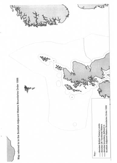
The maritime boundary adopted by the order is an equidistant boundary. [5] This differed from the boundary established by the Civil Jurisdiction (Offshore Activities) Order 1987 [6] which defined a straight line border between Scotland and England in the North Sea along the latitude of 55° 50' 00"N.

No oil fields were affected by this change as the new boundary only applied to fishing and had no impact on reserved matters. [7] Professor Alex Kemp of the University of Aberdeen argued that the movement of the line did not make much difference from an economic perspective, "because [these] are just a handful of fields, and [no longer] very important ones". [7]

Potential implications for Scottish independence

The Scottish National Party opposed the order and the methods used to calculate the boundary in the North Sea. [8] [9]

In 2015, the Scottish Cabinet Secretary for Rural Affairs and Environment, Richard Lochhead, wrote to the UK Government requesting a review of the order. [10]

In 2001, Mahdi Zahraa of Glasgow Caledonian University, published a discussion paper in the European Journal of International Law detailing different methods of establishing an Anglo-Scottish marine boundary. [11] The author notes that whilst the median line principle would apply as a starting point, a perpendicular boundary, derived from a new straight baseline on the east coast of Scotland and England, combined with an area of shared jurisdiction, would be an alternative equitable solution.

Supporters of Scottish independence such as Craig Murray have also argued for a perpendicular boundary based on a straight baseline. [12]

See also

Related Research Articles

<span class="mw-page-title-main">United Nations Convention on the Law of the Sea</span> International maritime law

The United Nations Convention on the Law of the Sea (UNCLOS), also called the Law of the Sea Convention or the Law of the Sea Treaty, is an international agreement that establishes a legal framework for all marine and maritime activities. As of May 2023, 168 countries and the European Union are parties.

<span class="mw-page-title-main">Devolution</span> Granting of some competences of central government to local government

Devolution is the statutory delegation of powers from the central government of a sovereign state to govern at a subnational level, such as a regional or local level. It is a form of administrative decentralization. Devolved territories have the power to make legislation relevant to the area, thus granting them a higher level of autonomy.

<span class="mw-page-title-main">International waters</span> Water outside of national jurisdiction

The terms international waters or transboundary waters apply where any of the following types of bodies of water transcend international boundaries: oceans, large marine ecosystems, enclosed or semi-enclosed regional seas and estuaries, rivers, lakes, groundwater systems (aquifers), and wetlands.

<span class="mw-page-title-main">Territorial waters</span> Coastal waters that are part of a sovereign states sovereign territory

Territorial waters are informally an area of water where a sovereign state has jurisdiction, including internal waters, the territorial sea, the contiguous zone, the exclusive economic zone, and potentially the extended continental shelf. In a narrower sense, the term is often used as a synonym for the territorial sea.

<span class="mw-page-title-main">Law of the sea</span> International law concerning maritime environments

Law of the sea is a body of international law governing the rights and duties of states in maritime environments. It concerns matters such as navigational rights, sea mineral claims, and coastal waters jurisdiction.

<span class="mw-page-title-main">Exclusive economic zone</span> Adjacent sea zone in which a state has special rights

An exclusive economic zone (EEZ), as prescribed by the 1982 United Nations Convention on the Law of the Sea, is an area of the sea in which a sovereign state has exclusive rights regarding the exploration and use of marine resources, including energy production from water and wind. EEZ does not define the ownership of any maritime features within the EEZ.

<span class="mw-page-title-main">Republic of Ireland–United Kingdom border</span> International border

The Republic of Ireland–United Kingdom border, sometimes referred to as the Irish border or British–Irish border, runs for 499 km (310 mi) from Lough Foyle in the north-west of Ireland to Carlingford Lough in the north-east, separating the Republic of Ireland from Northern Ireland.

<span class="mw-page-title-main">Scottish Fisheries Protection Agency</span>

The Scottish Fisheries Protection Agency (SFPA) was an Executive Agency of the Scottish Government. On 1 April 2009, the Scottish Fisheries Protection Agency and Fisheries Research Services were merged with the Scottish Government Marine Directorate to form Marine Scotland, part of the core Scottish Government.

<span class="mw-page-title-main">Northern Limit Line</span> Maritime demarcation line between North and South Korea

The Northern Limit Line or North Limit Line (NLL) – 북방한계선 – is a disputed maritime demarcation line in the Yellow (West) Sea between the Democratic People's Republic of Korea (DPRK) in the north, and the Republic of Korea (ROK) in the south. This line of military control acts as the de facto maritime boundary between North and South Korea.

<span class="mw-page-title-main">It's Scotland's oil</span> 1970s political slogan relating to North Sea oil

"It's Scotland's oil" was a widely publicised political slogan used by the Scottish National Party (SNP) during the 1970s in making their economic case for Scottish independence. It was argued that the discovery of North Sea oil off the coast of Scotland, and the revenue that it created, would not benefit Scotland to any significant degree while Scotland remained part of the United Kingdom. The SNP campaigned widely in both the February 1974 UK General Election and subsequent October 1974 UK General Election using this slogan. At the February election the SNP gained seven seats in the House of Commons and 22% of the Scottish vote, rising to eleven seats and 30% of the vote in the October election. The idea behind the slogan has proven to be controversial in discussions surrounding the financial viability of an independent Scottish state and still resonates to this day.

<span class="mw-page-title-main">Fishing industry in Scotland</span> Aquaculture and marine catching in the UK countrt

The fishing industry in Scotland comprises a significant proportion of the United Kingdom fishing industry. A recent inquiry by the Royal Society of Edinburgh found fishing to be of much greater social, economic and cultural importance to Scotland than it is relative to the rest of the UK. Scotland has just 8.4 per cent of the UK population but lands at its ports over 60 per cent of the total catch in the UK.

<span class="mw-page-title-main">Outer Continental Shelf</span> Maritime U.S. federal zone of jurisdiction beyond the jurisdiction of the individual states

The Outer Continental Shelf (OCS) is legally defined geographic feature of the United States. The OCS is the part of the internationally recognized continental shelf of the United States which does not fall under the jurisdictions of the individual U.S. states.

<span class="mw-page-title-main">Fishing industry in the United States</span>

As with other countries, the 200 nautical miles (370 km) exclusive economic zone (EEZ) off the coast of the United States gives its fishing industry special fishing rights. It covers 11.4 million square kilometres, which is the second largest zone in the world, exceeding the land area of the United States.

<span class="mw-page-title-main">Marine Management Organisation</span> UK non-departmental public body

The Marine Management Organisation (MMO) is an executive non-departmental public body in the United Kingdom established under the Marine and Coastal Access Act 2009, with responsibility for English waters. The MMO exists to make a significant contribution to sustainable development in the marine area, and to promote the UK government's vision for clean, healthy, safe, productive and biologically diverse oceans and seas. The MMO aims to focus all of its activities and resources to meet its mission of enabling sustainable growth in the UK's marine area through 5 strategic outcomes:

<span class="mw-page-title-main">Maritime boundary</span> Conceptual division of Earths water surface areas using physiographical or geopolitical criteria

A maritime boundary is a conceptual division of Earth's water surface areas using physiographical or geopolitical criteria. As such, it usually bounds areas of exclusive national rights over mineral and biological resources, encompassing maritime features, limits and zones. Generally, a maritime boundary is delineated at a particular distance from a jurisdiction's coastline. Although in some countries the term maritime boundary represents borders of a maritime nation that are recognized by the United Nations Convention on the Law of the Sea, maritime borders usually serve to identify the edge of international waters.

<span class="mw-page-title-main">Marine policy of the Barack Obama administration</span>

The Marine Policy of the Barack Obama administration comprises several significant environmental policy decisions for the oceans made during his two terms in office from 2009 to 2017. By executive action, US President Barack Obama increased fourfold the amount of protected marine space in waters under United States control, setting a major precedent for global ocean conservation. Using the U.S. president's authority under the Antiquities Act of 1906, he expanded to 200 nautical miles the seaward limits of Papahānaumokuākea Marine National Monument in Hawaiʻi and the Pacific Remote Islands Marine National Monument around the U.S. island possessions in the Central Pacific. In the Atlantic, Obama created the Northeast Canyons and Seamounts Marine National Monument, the first marine monument in the U.S. exclusive economic zone (EEZ) in the Atlantic.

<span class="mw-page-title-main">Exclusive economic zone of Japan</span> Economic zone exclusive to Japan

Japan has the eighth-largest exclusive economic zone (EEZ) in the world. The total area of Japan is about 380 thousand km2. Japan's EEZ area is vast and the territorial waters and EEZ together is about 4.47 million km2.

The marine protected areas of South Africa are in an area of coastline or ocean within the exclusive economic zone (EEZ) of the Republic of South Africa that is protected in terms of specific legislation for the benefit of the environment and the people who live in and use it. An MPA is a place where marine life can thrive under less pressure than unprotected areas. They are like underwater parks, and this healthy environment can benefit neighbouring areas.

<span class="mw-page-title-main">Marine Protected Areas in Scotland</span>

In Scotland, Marine Protected Areas (MPAs) are areas of sea defined so as to protect to habitats, wildlife, geology, undersea landforms, historic shipwrecks, and to demonstrate sustainable management of the sea. As of December 2020, approximately 37% of Scotland's seas are covered by the Scottish MPA network, which comprises 244 sites in total.

References

  1. "The Scottish Adjacent Waters Boundaries Order 1999, explanatory note". Legislation.gov.uk. The National Archives. Retrieved 10 June 2020.
  2. "Scotland Act 1998, article 126". Legislation.gov.uk. The National Archives. Retrieved 10 June 2020.
  3. "Scotland Act 1998, article 126". Legislation.gov.uk. The National Archives. Retrieved 10 June 2020.
  4. "Marine and Coastal Access Act 2009, article 322". Legislation.gov.uk. The National Archives. Retrieved 10 June 2020.
  5. "Scottish Adjacent Waters Boundaries. Debate in the Scottish Parliament at 3:18 pm on 3rd June 1999". TheyWorkForYou.com. Retrieved 10 June 2020.
  6. "The Civil Jurisdiction (Offshore Activities) Order 1987". Legislation.gov.uk. The National Archives. Retrieved 10 June 2020.
  7. 1 2 Brocklehurst, Steven (16 April 2013). "Who has a right to claim North Sea oil?". BBC News Online . Retrieved 21 September 2016.
  8. "Scots anger as fishing limit is redrawn". BBC News . 14 May 1999. Retrieved 20 October 2021.
  9. "UK: Scotland. New twist in fishing boundary dispute". BBC News . 20 October 1999. Retrieved 20 October 2021.
  10. "What Do They Know? FOI Response. Stolen Seas?". WhatDoTheyKnow . 27 October 2016. Retrieved 6 January 2021.
  11. "Prospective Anglo-Scottish Maritime Boundary Revisited" (PDF). European Journal of International Law . Archived from the original on 10 January 2021. Retrieved 6 January 2021.
  12. "Scotland's Stolen Seas: The Technical Explanation". craigmurray.org.uk. 10 January 2017. Retrieved 6 January 2021.