
Scrambling is a mountaineering term for ascending steep terrain using one's hands to assist in holds and balance. It is also used to describe terrain that falls between hiking and rock climbing.

Friedrich Wolfgang Beckey, known as Fred Beckey, was an American rock climber, mountaineer and book author, who in seven decades of climbing achieved hundreds of first ascents of some of the tallest peaks and most important routes throughout Alaska, the Canadian Rockies and the Pacific Northwest. Among the Fifty Classic Climbs of North America, seven were established by Beckey, often climbing with some of the best known climbers of each generation.

Mount Alberta is a mountain located in the upper Athabasca River Valley of Jasper National Park, Alberta, Canada. J. Norman Collie named the mountain in 1898 after Princess Louise Caroline Alberta. It is the most difficult of the 11,000ers from a climbing point of view.

Ice climbing is a climbing discipline that involves ascending routes consisting of frozen water. To ascend the route, the ice climber uses specialist equipment, particularly double ice axes and rigid crampons. To protect the route, the ice climber uses steel ice screws that require skill to employ safely and rely on the ice holding firm in any fall. Ice climbing routes can vary significantly by type, and include seasonally frozen waterfalls, high permanently frozen alpine couloirs, and large hanging icicles.

Mount Temple is a mountain in Banff National Park of the Canadian Rockies of Alberta, Canada.
Pika Peak is a mountain located between Mount Richardson and Ptarmigan Peak in Banff National Park, Alberta, Canada The mountain was named in 1928 after the pika, the small "rock rabbit" that inhabits alpine regions.
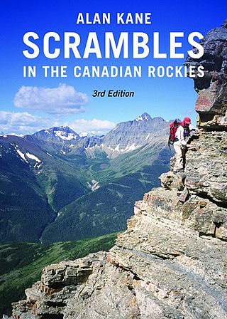
Climbing guidebooks are used by mountaineers, alpinists, ice climbers, and rock climbers to locate, grade, and navigate climbing routes on mountains, climbing crags, or bouldering areas. Modern route guidebooks include detailed information on each climbing route, including topo diagrams, route beta, protection requirements, and the ethics and style that are in place for a given climbing area.

Stanley Peak is a 3,155-metre (10,351 ft) mountain located in the Ball Range, at the northeastern section of Kootenay National Park, in the Canadian Rocky Mountains. The mountain was named in 1901 by its first climber, the English explorer Edward Whymper, after Frederick Stanley, 16th Earl of Derby, the sixth Governor-General of Canada. There are sources that date the naming in 1912 after Stanley H. Mitchell, Secretary-Treasurer of Alpine Club of Canada.
Beatrice Peak is a peak located on the Continental Divide on the border of Banff and Kootenay National Parks, between Stanley Peak and Mount Ball. The mountain was named in 1912 by the Alpine Club of Canada after Beatrice Shultz who climbed the mountain that year.

Castle Mountain is a mountain located within Banff National Park in the Canadian Rockies, approximately halfway between Banff and Lake Louise. It is the easternmost mountain of the Main Ranges in the Bow Valley and sits astride the Castle Mountain Fault which has thrust older sedimentary and metamorphic rocks forming the upper part of the mountain over the younger rocks forming its base. The mountain's castellated, or castle-like, appearance is a result of erosive processes acting at different rates on the peak's alternating layers of softer shale and harder limestone, dolomite and quartzite.
Mark Twight is an American climber, writer and the founder of Gym Jones. He rose to prominence as a mountaineer in the late 1980s and early 1990s with a series of difficult, dangerous alpine climbs in various ranges around the world. His radical, light-weight approach to alpinism has seen him regarded as an influential figure in the single-push movement.

Ha Ling Peak is a peak at the northwestern end of Ehagay Nakoda — a mountain located immediately south of the town of Canmore just east of the Spray Lakes road in Alberta's Canadian Rockies. It was previously named Chinaman's Peak but the name was changed to be less offensive. It was the subject of a 2018 CBC Documentary titled 'Ha Ling Peak' that follows the controversy and renaming of the mountain.
The American Alpine Journal is an annual magazine published by the American Alpine Club. Its mission is "to document and communicate mountain exploration." The headquarters is in Golden, Colorado.

The Canadian Alpine Journal is the yearly magazine of the Alpine Club of Canada. It serves as a worldwide journal of record for achievements in climbing, mountaineering, ski mountaineering, and exploration of mountains. The magazine is headquartered in Toronto, Ontario.

Fifty Classic Climbs of North America is a climbing guidebook and history written by Steve Roper and Allen Steck. It is considered a classic piece of climbing literature, known to many climbers as simply "The Book", and has served as an inspiration for more recent climbing books, such as Mark Kroese's Fifty Favorite Climbs. Though much of the book's contents are now out of date, it is still recognized as a definitive text which goes beyond the traditional guidebook.
Williams Peak, at 10,636 feet (3,242 m) high is the 6th highest peak in the Sawtooth Mountains of Idaho and is located within the Sawtooth Wilderness portion of the Sawtooth National Recreation Area. The peak lies 0.75 mi (1,210 m) north-northeast of Thompson Peak, the highest peak in the range.
The Canadian Mountain Encyclopedia is an organization based in Vancouver, British Columbia founded in 1995 to provide information on Canada's mountains, backroads and trails. It is aimed at hikers and mountaineers, a similar audience to the Canadian Alpine Journal or a guidebook. The articles are supported by a GIS database and mapping system. The organization maintains a structured database of mountains for all Canada with access trails and backroads. The online reference database has about 30,000 mountains, 4000 backroads and 3000 trails.

Resplendent Mountain, or Mount Resplendent is a peak in the Canadian Rockies, located at the northern end of Mount Robson Provincial Park in British Columbia, Canada. It is a part of the Rainbow Range, and is a sister peak to the more famous Mount Robson, its nearest neighbour. Together they form a classic panorama seen by travellers on Via Rail trains and Highway 16. The mountain was named by Arthur P. Coleman, and Arthur O. Wheeler wrote, "On the east side it is clad from top to bottom in pure white snow, and presents with the sun shining upon it a spectacle of such wonderful brilliance that the aptness of the name became immediately apparent." The first ascent was achieved on the same historic 1911 trip in which Conrad Kain first scouted the climbing routes later to be used on the first ascent of Mount Robson.

Mount Kidd is a 2,958-metre (9,705-foot) double-summit massif centrally located in Kananaskis Country in the Canadian Rockies of Alberta, Canada. Mount Kidd is situated within Spray Valley Provincial Park, and its nearest higher neighbor is Mount Sparrowhawk, 7.0 km (4.3 mi) to the northwest. Mount Kidd is a landmark that can be seen from Highway 40 in the Kananaskis Village area, and from the Kananaskis Country Golf Course which lies at the eastern base of the mountain.

Sofa Mountain is a 2,515-meter (8,251-foot) summit located in Waterton Lakes National Park, in Alberta, Canada. It is part of the Lewis Range which is a subset of the Canadian Rockies, and is the easternmost mountain in the Canadian Rockies, as well as the park. It is situated 5.4 km (3.4 mi) east of Vimy Peak, and the nearest higher neighbor is Crypt Peak, 4.6 km (2.9 mi) to the southwest. Topographic relief is significant as the north aspect rises over 1,220 meters (4,000 feet) above Middle Waterton Lake in approximately six kilometers.
