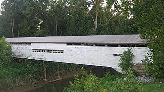
Second Broad River

Last updated
Second Broad River
Tributary to Broad River
USA North Carolina relief location map.jpg
Red pog.svg
Location of Second Broad River mouth
Usa edcp relief location map.png
Red pog.svg
Second Broad River (the United States)
Location
Country United States
State North Carolina
County Cleveland
McDowell
Rutherford
City Forest City
Physical characteristics
Sourcedivide between Second Broad River and Catawba River
  locationabout 1 mile southwest of Providence, North Carolina
  coordinates 35°37′29″N082°03′43″W / 35.62472°N 82.06194°W / 35.62472; -82.06194 [1]
  elevation1,510 ft (460 m) [2]
Mouth Broad River
  location
about 1 mile south of Cliffside, North Carolina
  coordinates
35°13′19″N081°45′32″W / 35.22194°N 81.75889°W / 35.22194; -81.75889 Coordinates: 35°13′19″N081°45′32″W / 35.22194°N 81.75889°W / 35.22194; -81.75889 [1]
  elevation
663 ft (202 m) [2]
Length46.14 mi (74.26 km) [3]
Basin size221.29 square miles (573.1 km2) [4]
Discharge 
  location Broad River
  average338.86 cu ft/s (9.595 m3/s) at mouth with Broad River [4]
Basin features
Progressionsoutheast
River system Broad River
Tributaries 
  leftWilson Branch
Hicks Branch
Camp Branch
Bakers Creek
Box Creek
Big Camp Creek
Cane Creek
Roberson Creek
Puzzle Creek
Webbs Creek
Hills Creek
Riddles Creek
  rightRock Creek
Beaverdam Branch
Scrub Grass Creek
Rockhouse Creek
Stoney Creek
Catheys Creek
Buck Branch
Big Spring Branch
Morrow Creek
Hogpen Branch
BridgesSugar Hill Road, Dink Cannon Road, Clinton Lane, Mud Cut Road, Bethel Church Road, Spooky Hollow Road, US 221, Rhom Town Road, Polly Spout Road, Lucky Strike Drive, Polly Spout Road, Box Creek Road, Centennial Road, Boy Scout Road, US 64, Whitesides Road, Cherry Mountain Street, E Main Street, US 74, Low Bridge Road, US 221A, Avondale Landfill Road, Harris Henrietta Road, US 221A


The Second Broad River is a tributary of the Broad River in western North Carolina in the United States. [5] Via the Broad and Congaree rivers, it is part of the watershed of the Santee River, which flows to the Atlantic Ocean. [6]

Tributary stream or river that flows into a main stem river or lake

A tributary or affluent is a stream or river that flows into a larger stream or main stem river or a lake. A tributary does not flow directly into a sea or ocean. Tributaries and the main stem river drain the surrounding drainage basin of its surface water and groundwater, leading the water out into an ocean.

Broad River (Carolinas) river in North and South Carolina, United States

The Broad River is a principal tributary of the Congaree River, about 150 miles (240 km) long, in western North Carolina and northern South Carolina in the United States. Via the Congaree, it is part of the watershed of the Santee River, which flows to the Atlantic Ocean.

North Carolina U.S. state in the United States

North Carolina is a state located in the southeastern region of the United States. North Carolina is the 28th largest and 9th-most populous of the 50 United States. It is bordered by Virginia to the north, the Atlantic Ocean to the east, Georgia and South Carolina to the south, and Tennessee to the west. Raleigh is the state's capital and Charlotte is its largest city. The Charlotte metropolitan area, with an estimated population of 2,569,213 in 2018, is the most populous metropolitan area in North Carolina, the 23rd-most populous in the United States, and the largest banking center in the nation after New York City. North Carolina's second largest metropolitan area is the Raleigh metropolitan area, with an estimated population of 1,337,331 in 2018, and is home to the largest research park in the United States, Research Triangle Park, in Chapel Hill, Durham, and Raleigh.

The Second Broad River rises in south-central McDowell County about 5 miles (8 km) southwest of Marion, and flows generally southeastwardly through Rutherford County, passing to the east of the town of Forest City. It briefly enters Cleveland County before flowing into the Broad River from the north, about 10 miles (16 km) southeast of Forest City. [5]
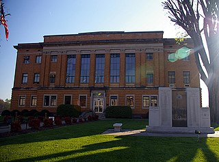
McDowell County, North Carolina U.S. county in North Carolina

McDowell County is a county located in the U.S. state of North Carolina. As of the 2010 census, the population was 44,996. Its county seat is Marion.

Marion, North Carolina City in North Carolina, United States

Marion is a city in McDowell County, North Carolina, United States. It is the county seat of McDowell County. Founded in 1844, the city was named in honor of Brigadier General Francis Marion, the American Revolutionary War Hero whose talent in guerrilla warfare earned him the name "Swamp Fox". Marion's Main Street Historic District is listed on the National Register of Historic Places. The population was 7,838 at the 2010 Census.

Rutherford County, North Carolina U.S. county in North Carolina

Rutherford County is a county located in the southwestern area of the U.S. state of North Carolina. As of the 2010 census, the population was 67,810. Its county seat is Rutherfordton.

See also

Related Research Articles

Mispillion River

The Mispillion River is a river flowing to Delaware Bay in southern Delaware in the United States. It is approximately 15 miles (24 km) long and drains an area of 76 square miles (197 km²) on the Atlantic Coastal Plain.

Whetstone River river in the United States of America

The Whetstone River is a 12.7-mile-long (20.4 km) tributary of the Minnesota River, in northeastern South Dakota and a very small portion of western Minnesota in the United States. Via the Minnesota River, it is part of the watershed of the Mississippi River.

Noxubee River river in the United States of America

The Noxubee River (NAHKS-uh-bee) is a tributary of the Tombigbee River, about 90.6 miles (145.8 km) long, in east-central Mississippi and west-central Alabama in the United States. Via the Tombigbee, it is part of the watershed of the Mobile River, which flows to the Gulf of Mexico.

Marmaton River river in the United States of America

The Marmaton River (MAR-muh-tuhn) is a 102-mile-long (164 km) tributary of the Little Osage River in southeastern Kansas and western Missouri in the United States. Via the Little Osage, Osage and Missouri rivers, it is part of the watershed of the Mississippi River.

Salt Fork Arkansas River river in the United States of America

The Salt Fork of the Arkansas River is a 239-mile-long (385 km) tributary of the Arkansas River in southern Kansas and northern Oklahoma in the United States. Via the Arkansas River, it is part of the watershed of the Mississippi River.

Chikaskia River river in the United States of America

The Chikaskia River is a 159-mile-long (256 km) tributary of the Salt Fork of the Arkansas River in southern Kansas and northern Oklahoma in the United States. Via the Salt Fork and Arkansas rivers, it is part of the watershed of the Mississippi River.

Ocheyedan River river in the United States of America

The Ocheyedan River is a tributary of the Little Sioux River, 58 mi (93 km) long, in southwestern Minnesota and northwestern Iowa in the United States. Via the Little Sioux and Missouri Rivers, it is part of the watershed of the Mississippi River. The river has been channelized for much of its length.

Rock River (Big Sioux River) tributary of the Big Sioux River in Iowa and Minnesota, United States of America

The Rock River is a tributary of the Big Sioux River, about 144 miles (232 km) long, in southwestern Minnesota and northwestern Iowa in the United States. Via the Big Sioux and Missouri rivers, it is part of the watershed of the Mississippi River.

The Little Rock River is a tributary of the Rock River, 74.5 miles (119.9 km) long, in southwestern Minnesota and northwestern Iowa in the United States. Via the Rock, Big Sioux and Missouri rivers, it is part of the watershed of the Mississippi River.

Anderson River (Indiana) river in the United States of America

The Anderson River is a 50.4-mile-long (81.1 km) tributary of the Ohio River in southern Indiana in the United States. Via the Ohio, it is part of the watershed of the Mississippi River.

First Broad River Stream in North Carolina, USA


The First Broad River is a tributary of the Broad River, about 60 mi (95 km) long in western North Carolina in the United States. Via the Broad and Congaree Rivers, it is part of the watershed of the Santee River, which flows to the Atlantic Ocean.

The Enoree River is a tributary of the Broad River, 85 mi (137 km) long, in northwestern South Carolina in the United States. Via the Broad and Congaree Rivers, it is part of the watershed of the Santee River, which flows to the Atlantic Ocean.

The Sandy River and its tributary the Little Sandy River are short rivers in north-central South Carolina in the United States. The Sandy is a tributary of the Broad River; via the Broad and Congaree Rivers, it is part of the watershed of the Santee River, which flows to the Atlantic Ocean.

Shenango River Stream in Pennsylvania, USA

The Shenango River is a principal tributary of the Beaver River, approximately 100 mi (160 km) long, in western Pennsylvania in the United States. It also briefly flows through small portions of northeastern Ohio. Via the Beaver and Ohio Rivers, it is part of the watershed of the Mississippi River.

Mitchell River (North Carolina) Stream in North Carolina, USA

The Mitchell River is a tributary of the Yadkin River in northwestern North Carolina in the United States. Via the Yadkin it is part of the watershed of the Pee Dee River, which flows to the Atlantic Ocean. According to the Geographic Names Information System, it has also been known historically as "Mitchells River," "Mitchels River," and "Mountain Creek."

Reddies River Stream in North Carolina, USA


The Reddies River is a tributary of the Yadkin River in northwestern North Carolina in the United States. Via the Yadkin it is part of the watershed of the Pee Dee River, which flows to the Atlantic Ocean. According to the Geographic Names Information System, it has also been known historically as "Reddis River."

Fisher River (North Carolina) Stream in North Carolina, USA

The Fisher River is a tributary of the Yadkin River in northwestern North Carolina in the United States, also draining a very small portion of southwestern Virginia. Via the Yadkin it is part of the watershed of the Pee Dee River, which flows to the Atlantic Ocean. According to the Geographic Names Information System, it has also been known historically as "Big Fishers River," "Fish River" and "Fishe River."

Ararat River Stream in North Carolina, USA

The Ararat River is a tributary of the Yadkin River in southwestern Virginia and northwestern North Carolina in the United States. Via the Yadkin it is part of the watershed of the Pee Dee River, which flows to the Atlantic Ocean.

The Rock River is a 12.9-mile-long (20.8 km) tributary of the West River in southern Vermont in the United States. Via the West River, it is part of the watershed of the Connecticut River.

References

  1. 1 2 "GNIS Detail - Second Broad River". geonames.usgs.gov. US Geological Survey. Retrieved 14 October 2019.
  2. 1 2 "Second Broad River Topo Map, Rutherford County NC (Chesnee Area)". TopoZone. Locality, LLC. Retrieved 14 October 2019.
  3. "ArcGIS Web Application". epa.maps.arcgis.com. US EPA. Retrieved 14 October 2019.
  4. 1 2 "Second Broad River Watershed Report". Waters Geoviewer. US EPA. Retrieved 14 October 2019.
  5. 1 2 DeLorme (2001). North Carolina Atlas & Gazetteer. Yarmouth, Maine: DeLorme. ISBN   0-89933-277-3
  6. DeLorme (1998). South Carolina Atlas & Gazetteer. Yarmouth, Maine: DeLorme. ISBN   0-89933-237-4