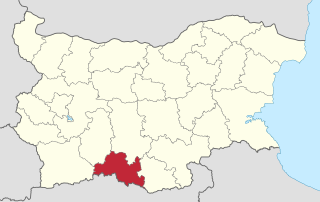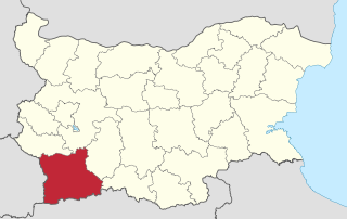
Smolyan Province is a province in Southern-central Bulgaria, located in the Rhodope Mountains, neighbouring Greece to the south. It is named after its administrative and industrial centre—the city of Smolyan. The province embraces a territory of 3,192.8 km². that is divided into 10 municipalities with a total population of 124,795 inhabitants, as of December 2009.
Shiroka Laka is a village in the very south of Bulgaria, located in Smolyan municipality, Smolyan Province. It is a proclaimed architectural and folklore reserve and lies in the central Rhodope Mountains, 23 km northwest of Smolyan, 16 km west of Pamporovo and 22 km southeast of Devin.

Chereshkite is a village in the municipality of Smolyan, located in the Smolyan Province of southern Bulgaria. The village is located 167.965 km from Sofia. As of 2007, the village had a population of 14 people.

14th Multi-member Constituency – Pernik is a constituency whose borders are the same as Pernik Province in Bulgaria.

22nd Multi-member Constituency – Smolyan is a constituency whose borders are the same as Smolyan Province in Bulgaria.

Dobrotino is a mountainous roadside village in Gotse Delchev Municipality, in Blagoevgrad Province, Bulgaria. The village is situated 4 kilometers west-northwest of Gotse Delchev and 68 kilometers southeast of Blagoevgrad on the road between Gotse Delchev and Petrich. Nearby is the local resort "Popovi livadi". The village is sparsely populated after a landslide in 1962, that did not cause any damage, but the people moved to Borovo and Banichan in the municipality. Before 1962 there were about 600 residents and now less than 50 live in the village. In 2005 year was built the church "St Prophet Elijah" over the foundations of a monastery destroyed in the 19th century.

Sredna is a former village in Gotse Delchev Municipality, in Blagoevgrad Province, Bulgaria. The village due to having nor permanent residents, neither any other activity for many years and after a plead from the Municipality was erased from the registers and all its land and other properties were shifted to the town of Gotse Delchev on February 29, 2008. Many of the houses are in bad condition.
Dolna Ribnitsa is a village in Petrich Municipality, in Blagoevgrad Province, Bulgaria.
Dragush is a village in Petrich Municipality, in Blagoevgrad Province, Bulgaria.
Drenovitsa is a village in Petrich Municipality, in Blagoevgrad Province, Bulgaria.

Kolarovo is a village in Petrich Municipality, in Blagoevgrad Province, Bulgaria.
Eleshnitsa is a village in Razlog Municipality, in Blagoevgrad Province, Bulgaria.
Debrene, Blagoevgrad Province is a village in the municipality of Sandanski, in Blagoevgrad Province, Bulgaria.
Lyubovka is a village in the municipality of Sandanski, in Blagoevgrad Province, Bulgaria.
Dobri Laki is a village in Strumyani Municipality, in Blagoevgrad Province, in southwestern Bulgaria.
Kolibite is a village in Strumyani Municipality, in Blagoevgrad Province, in southwestern Bulgaria.
Velyushtets is a village in Strumyani Municipality, in Blagoevgrad Province, in southwestern Bulgaria.
Tsarkva is a village in Balchik Municipality, Dobrich Province, northeastern Bulgaria.
Chernichino is a village in the municipality of Ivaylovgrad, in Haskovo Province, in southern Bulgaria.
Gornoseltsi is a village in the municipality of Ivaylovgrad, in Haskovo Province, in southern Bulgaria.


