Related Research Articles

Seismology is the scientific study of earthquakes and the generation and propagation of elastic waves through the Earth or other planetary bodies. It also includes studies of earthquake environmental effects such as tsunamis as well as diverse seismic sources such as volcanic, tectonic, glacial, fluvial, oceanic microseism, atmospheric, and artificial processes such as explosions and human activities. A related field that uses geology to infer information regarding past earthquakes is paleoseismology. A recording of Earth motion as a function of time, created by a seismograph is called a seismogram. A seismologist is a scientist works in basic or applied seismology.

Geophysics is a subject of natural science concerned with the physical processes and physical properties of the Earth and its surrounding space environment, and the use of quantitative methods for their analysis. Geophysicists, who usually study geophysics, physics, or one of the Earth sciences at the graduate level, complete investigations across a wide range of scientific disciplines. The term geophysics classically refers to solid earth applications: Earth's shape; its gravitational, magnetic fields, and electromagnetic fields ; its internal structure and composition; its dynamics and their surface expression in plate tectonics, the generation of magmas, volcanism and rock formation. However, modern geophysics organizations and pure scientists use a broader definition that includes the water cycle including snow and ice; fluid dynamics of the oceans and the atmosphere; electricity and magnetism in the ionosphere and magnetosphere and solar-terrestrial physics; and analogous problems associated with the Moon and other planets.
Seismic tomography or seismotomography is a technique for imaging the subsurface of the Earth with seismic waves produced by earthquakes or explosions. P-, S-, and surface waves can be used for tomographic models of different resolutions based on seismic wavelength, wave source distance, and the seismograph array coverage. The data received at seismometers are used to solve an inverse problem, wherein the locations of reflection and refraction of the wave paths are determined. This solution can be used to create 3D images of velocity anomalies which may be interpreted as structural, thermal, or compositional variations. Geoscientists use these images to better understand core, mantle, and plate tectonic processes.

The San Andreas Fault Observatory at Depth (SAFOD) was a research project that began in 2002 aimed at collecting geological data about the San Andreas Fault for the purpose of predicting and analyzing future earthquakes. The site consists of a 2.2 km pilot hole and a 3.2 km main hole. Drilling operations ceased in 2007. Located near the town of Parkfield, California, the project installed geophone sensors and GPS clocks in a borehole that cut directly through the fault. This data, along with samples collected during drilling, helped shed new light on geochemical and mechanical properties around the fault zone.

IRIS was a university research consortium dedicated to exploring the Earth's interior through the collection and distribution of seismographic data. IRIS programs contributed to scholarly research, education, earthquake hazard mitigation, and the verification of a Comprehensive Nuclear-Test-Ban Treaty. Support for IRIS came from the National Science Foundation, other federal agencies, universities, and private foundations. IRIS supported five major components:

Magnetotellurics (MT) is an electromagnetic geophysical method for inferring the earth's subsurface electrical conductivity from measurements of natural geomagnetic and geoelectric field variation at the Earth's surface.

The EarthScope project (2003-2018) was an National Science Foundation (NSF) funded earth science program that, from 2003-2018, used geological and geophysical techniques to explore the structure and evolution of the North American continent and to understand the processes controlling earthquakes and volcanoes. The project had three components: USArray, the Plate Boundary Observatory, and the San Andreas Fault Observatory at Depth. Organizations associated with the project included UNAVCO, the Incorporated Research Institutions for Seismology (IRIS), Stanford University, the United States Geological Survey (USGS) and National Aeronautics and Space Administration (NASA). Several international organizations also contributed to the initiative. EarthScope data are publicly accessible.
USArray was one of the three components of the Earthscope project, the other two components being the Plate Boundary Observatory (PBO) and the San Andreas Fault Observatory at Depth (SAFOD). The components were funded by the National Science Foundation and were constructed, operated, and maintained as a collaborative effort with UNAVCO, the Incorporated Research Institutions for Seismology (IRIS), and Stanford University, with contributions from several other national and international organizations.
The Jackson School of Geosciences at The University of Texas at Austin unites the Department of Earth and Planetary Sciences with two research units, the Institute for Geophysics and the Bureau of Economic Geology.

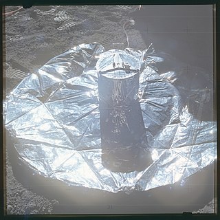
Lunar seismology is the study of ground motions of the Moon and the events, typically impacts or moonquakes, that excite them.
UNAVCO (University Navstar Consortium) was a non-profit university-governed consortium that facilitated geology research and education using geodesy.
The International Federation of Digital Seismograph Networks, or FDSN, is a global organization consisting of groups that install and maintain digital, broadband seismic recorders either nationally or globally. Any organizations operating more than one broadband station is eligible for membership. Members agree to coordinate station siting and provide free and open data. This cooperation helps scientists all over the world to further the advancement of earth science and particularly the study of global seismic activity. FDSN is a participant in the Global Earth Observation System of Systems, or GEOSS.
Richard C. Aster is an American seismologist and is Professor of Geophysics and Department Head of Geosciences at Colorado State University.
The World-Wide Standardized Seismograph Network (WWSSN) – originally the World-Wide Network of Seismograph Stations (WWNSS) – was a global network of about 120 seismograph stations built in the 1960s that generated an unprecedented collection of high quality seismic data. This data enabled seismology to become a quantitative science, elucidated the focal mechanisms of earthquakes and the structure of the Earth's crust, and contributed to the development of plate tectonic theory. The WWSSN is credited with spurring a renaissance in seismological research.
Frederik J. Simons is a Flemish Belgian geophysicist. He is a professor at Princeton University in the Department of Geosciences. From 2010 to 2013, Simons was the Dusenbury University Preceptor of Geological & Geophysical Sciences. From 2004 to 2006, he was a lecturer in the Department of Earth Sciences at University College London. Between 2002 and 2004 he was a Harry H. Hess Postdoctoral Fellow in the Department of Geosciences and a Beck Fellow with the Council on Science and Technology, also at Princeton University.
Anne Meltzer is a seismologist known for her research on earthquakes and the formation of mountain ranges. Her research primarily focused on the evolution of the Earth's lithosphere and the surface processes associated with faulting and deformation in the Earth's crust. Through her own personal research and collaboration with other colleagues, she strived to make advancements in the efficiency and effectiveness of monitoring earthquakes. In addition, her work aimed to effectively reduce earthquake destruction in countries that experience frequent seismic phenomena.

MERMAID is a marine scientific instrument platform, short for Mobile Earthquake Recorder for Marine Areas by Independent Divers.
The Geodetic Facility for the Advancement of Geoscience (GAGE) is a geophysical facility for geoscience research and education. It focuses on research of our planet's surface deformation with unprecedented temporal and spatial resolution. GAGE is one of the two premier geophysical facilities in support of geoscience and geoscience education of the National Science Foundation (NSF). The other premiere geophysical facility is SAGE, the Seismological Facility for the Advancement of Geoscience.
Continuously Operating Caribbean GPS Observational Network (COCONet) was a global positioning system (GPS) observation network that spanned across the Caribbean and the neighboring area It was part of UNAVCO (University Navstar Corporation). UNAVCO and IRIS (Incorporated Research Institutions for Seismology) Consortium later merged to create EarthScope Consortium in 2023.
The EarthScope Primary Instrument Center is a research center at New Mexico Institute of Mining and Technology for geophysics research in Earth system science. The facility provides instrumentation and support services for seismology experiments around the world, as well as those for the National Science Foundation and the U.S. Department of Energy.
References
- ↑ "Joining Forces". sites.google.com. Retrieved 2024-06-16.
- ↑ "A Vision for NSF Earth Sciences 2020-2030: Earth in Time (2020)" (PDF).
- ↑ "Facilities and Infrastructure". U.S. National Science Foundation. Retrieved 1 August 2024.
- ↑ "Global Seismographic Network". NSF SAGE. Retrieved 1 August 2024.
- 1 2 3 4 "Seismological Facility for the Advancement of Geoscience (SAGE) | SAGE". www.iris.edu. Retrieved 2024-06-16.
- ↑ "About the EPIC | EarthScope Primary Instrument Center". www.passcal.nmt.edu. Retrieved 2024-06-16.