
The Greater Antilles is a grouping of the larger islands in the Caribbean Sea, including Cuba, Jamaica, Hispaniola, and Puerto Rico, together with Navassa Island and the Cayman Islands. Six island states share the region of the Greater Antilles, with Haiti and the Dominican Republic sharing the island of Hispaniola. Together with the Lesser Antilles, they make up the Antilles, which along with the Lucayan Archipelago, form the Caribbean islands or West Indies.

The Cayman Trough is a complex transform fault zone pull-apart basin which contains a small spreading ridge, the Mid-Cayman Rise, on the floor of the western Caribbean Sea between Jamaica and the Cayman Islands. It is the deepest point in the Caribbean Sea and forms part of the tectonic boundary between the North American Plate and the Caribbean Plate. It extends from the Windward Passage, going south of the Sierra Maestra of Cuba toward Guatemala. The transform fault continues onshore as the Polochic-Motagua fault system, which consists of the Polochic and Motagua faults. This system continues on until the Chiapas massif where it is part of the diffuse triple junction of the North American, Caribbean and Cocos plates.

The North American Plate is a tectonic plate containing most of North America, Cuba, the Bahamas, extreme northeastern Asia, and parts of Iceland and the Azores. With an area of 76 million km2 (29 million sq mi), it is the Earth's second largest tectonic plate, behind the Pacific Plate.

Windward Passage is a strait in the Caribbean Sea, between the islands of Cuba and Hispaniola. The strait specifically lies between the easternmost region of Cuba and the northwest of Haiti. 80 km (50 mi) wide, the Windward Passage has a threshold depth of 1,700 m (5,600 ft).

The Caribbean Plate is a mostly oceanic tectonic plate underlying Central America and the Caribbean Sea off the northern coast of South America.
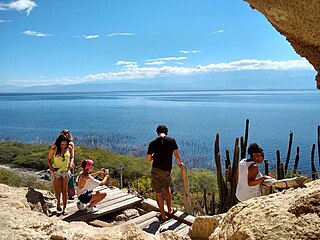
Lake Enriquillo is a hypersaline lake in the Dominican Republic located in the southwestern region of the country. Its waters are shared between the provinces of Bahoruco and Independencia, the latter of which borders Haiti. Lake Enriquillo is the largest lake in both the Dominican Republic and Hispaniola, as well as the entire Caribbean. It is also the lowest point for an island country.
The 2009 Swan Islands earthquake occurred on May 28 at with a moment magnitude of 7.3 and a maximum Mercalli intensity of VII. The epicenter was located in the Caribbean Sea, 64 kilometres (40 mi) northeast of the island of Roatán, 19 miles northeast of Port Royal, Isla de Bahias, 15 miles northwest of Isla Barbaretta, and 130 kilometres (81 mi) north-northeast of La Ceiba. Three aftershocks followed the earthquake within magnitude 4 range.
The 1984 San Pedro Basin earthquake occurred on June 24 at with a moment magnitude of 6.7 and a maximum Mercalli intensity of VII. The event occurred off the southern coast of the Dominican Republic and resulted in an estimated five fatalities.

The Enriquillo–Plantain Garden fault zone is a system of active coaxial left lateral-moving strike slip faults which runs along the southern side of the island of Hispaniola, where Haiti and the Dominican Republic are located. The EPGFZ is named for Lake Enriquillo in the Dominican Republic where the fault zone emerges, and extends across the southern portion of Hispaniola through the Caribbean to the region of the Plantain Garden River in Jamaica.

The 1907 Kingston earthquake which shook the capital of the island of Jamaica with a magnitude of 6.2 on the moment magnitude scale on Monday January 14, at about 3:30 p.m. local time, is described by the United States Geological Survey as one of the world's deadliest earthquakes recorded in history. Every building in Kingston was damaged by the earthquake and subsequent fires, which lasted for three hours before any efforts could be made to check them, culminating in the death of about 1,000 people, and causing approximately $30 million in material damage. Shortly after, a tsunami was reported on the north coast of Jamaica, with a maximum wave height of about 2 m (6–8 ft).
The Gonâve Microplate forms part of the boundary between the North American Plate and the Caribbean Plate. It is bounded to the west by the Mid-Cayman Rise spreading center, to the north by the Septentrional-Oriente fault zone and to the south by the Walton fault zone and the Enriquillo–Plantain Garden fault zone. The existence of this microplate was first proposed in 1991. This has been confirmed by GPS measurements, which show that the overall displacement between the two main plates is split almost equally between the transform fault zones that bound the Gonâve microplate. The microplate is expected to eventually become accreted to the North American Plate.
The 2003 Dominican Republic earthquake occurred on September 22 at with a moment magnitude of 6.4 and a maximum Mercalli intensity of X (Extreme).
The 1842 Cap-Haïtien earthquake occurred at 17:00 local time on 7 May. It had an estimated magnitude of 8.1 on the scale and triggered a destructive tsunami. It badly affected the northern coast of Haiti and part of what is now the Dominican Republic. Port-de-Paix suffered the greatest damage from both earthquake and tsunami. Approximately 5,000 people were killed by the effects of the earthquake shaking and another 300 by the tsunami.
The Geology of Jamaica is formed of rocks of Cretaceous to Neogene age. The basement consists of Cretaceous island arc and back-arc basin sequences that formed above a subduction zone. The cover is of mainly Eocene to Miocene shallow water limestones, that have been uplifted due to the presence of a restraining bend along the major strike-slip faults that bound the southern edge of the Gonâve Microplate to the north of the island.

On 9 January 2018, at approximately 8:51 p.m. local time, a magnitude 7.5 earthquake struck in the Yucatán Basin of the Caribbean Sea, 44 kilometres (27 mi) east of Great Swan Island off the coast of Honduras. The earthquake was felt across Central America, and rattled windows in Tegucigalpa. The earthquake was also felt in the Cayman Islands.
The Walton fault zone is a major active left lateral (sinistral) strike-slip fault, forming part of the southern boundary to the Cayman Trough. It extends from the Mid-Cayman Rise spreading center in the west to Jamaica in the east. It has a total length of about 360 km and is formed of several sub-parallel strands. Together with the Enriquillo-Plantain Garden fault zone it forms the southern boundary of the Gonâve Microplate. It is associated with only moderate earthquakes with magnitudes of less than 6.
The Mid-Cayman Rise or Mid-Cayman Spreading Center is a relatively short divergent plate boundary in the middle of the Cayman Trough. It forms part of a dominantly transform boundary that is part of the southern margin to the North American Plate. It is an ultra-slow spreading center where the North American Plate is rifting away from the Caribbean Plate with an opening rate of 15–17 mm per year.

At 2:10 p.m. local time (UTC-5) on 28 January 2020, an earthquake of 7.7 struck on the north side of the Cayman Trough, north of Jamaica and west of the southern tip of Cuba, with the epicenter being 80 miles (130 km) ESE of Cayman Brac, Cayman Islands or 83 miles (134 km) north of Montego Bay, Jamaica. Schools in Jamaica and buildings in Miami were evacuated after shaking was observed in parts of the U.S. state of Florida. Light shaking was also reported on the Yucatan Peninsula in Mexico. It is the largest earthquake in the Caribbean since 1946. A tsunami warning for the Caribbean Sea was issued by the Pacific Tsunami Warning Center and later withdrawn.

The 2013 Craig, Alaska earthquake struck on January 5, at 12:58 am (UTC–7) near the city of Craig and Hydaburg, on Prince of Wales Island. The Mw 7.5 earthquake came nearly three months after an Mw 7.8 quake struck Haida Gwaii on October 28, in 2012. The quake prompted a regional tsunami warning to British Columbia and Alaska, but it was later cancelled. Due to the remote location of the quake, there were no reports of casualties or damage.
