Serra das Traíras

Last updated

Serra das Traíras is a mountain range in southern Tocantins, Brazil. An unnamed peak at the municipality of Paranã is the highest point in Tocantins, reaching 1,340 meters (4,400 feet). [1]

Tocantins State of Brazil

Tocantins is one of the states of Brazil.. It is the newest of the 26 Brazilian states, formed in 1988 and encompassing what had formerly been the northern two-fifths of the state of Goiás. Tocantins covers 277,620.91 square kilometres (107,190.03 sq mi) and has a population of 1,496,880. Construction of its capital, Palmas, began in 1989; most of the other cities in the state date to the Portuguese colonial period. With the exception of Araguaína there are few other cities with a significant population in the state. The government has invested in a new capital, a major hydropower dam, railroads and related infrastructure to develop this primarily agricultural area.
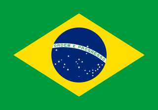
Brazil Federal republic in South America

Brazil, officially the Federative Republic of Brazil, is the largest country in both South America and Latin America. At 8.5 million square kilometers and with over 208 million people, Brazil is the world's fifth-largest country by area and the fifth most populous. The capital is Brasília, and the most populated city is São Paulo. The federation is composed of the union of the 26 states, the Federal District, and the 5,570 municipalities. It is the largest country to have Portuguese as an official language and the only one in the Americas; it is also one of the most multicultural and ethnically diverse nations, due to over a century of mass immigration from around the world.

Municipalities of Brazil administrative division of the states in Brazil

The municipalities of Brazil are administrative divisions of the Brazilian states. At present, Brazil has 5,570 municipalities, making the average municipality population 34,361. The average state in Brazil has 214 municipalities. Roraima is the least subdivided state, with 15 municipalities, while Minas Gerais is the most subdivided state, with 853.

Related Research Articles

Tocantins River river in Brazil

The Tocantins River is a river in Brazil, the central fluvial artery of the country. In the Tupi language, its name means "toucan's beak". It runs from south to north for about 2,450 km. It is not really a branch of the Amazon River, since its waters flow into the Atlantic Ocean alongside those of the Amazon. It flows through four Brazilian states and gives its name to one of Brazil's newest states, formed in 1988 from what was until then the northern portion of Goiás.

Formosa do Rio Preto Municipality in Northeast, Brazil

Formosa do Rio Preto is the westernmost and largest city in the Brazilian state of Bahia. It is also the largest in all Northeastern Brazil.

Mateiros Municipality in North, Brazil

Mateiros is the easternmost city in the state of Tocantins. It is the only city in Tocantins to border the state of Piauí

Filadélfia, Tocantins is a municipality in the state of Tocantins in the Northern region of Brazil.

Luzinópolis is a municipality in the state of Tocantins in the Northern region of Brazil.

Maurilândia do Tocantins is a municipality in the state of Tocantins in the Northern region of Brazil.

Nazaré, Tocantins is a municipality in the state of Tocantins in the Northern region of Brazil.

Palmeiras do Tocantins is a municipality in the state of Tocantins in the Northern region of Brazil.

Santa Terezinha do Tocantins is a municipality in the state of Tocantins in the Northern region of Brazil.

São Bento do Tocantins is a municipality in the state of Tocantins in the Northern region of Brazil.

Saint Michael of Tocantins is a municipality in the state of Tocantins in the Northern region of Brazil.

Sítio Novo do Tocantins is a municipality in the state of Tocantins in the Northern region of Brazil.

Tocantinópolis is a municipality in the state of Tocantins in the Northern region of Brazil.

Pindorama do Tocantins is a municipality in the state of Tocantins in the Northern region of Brazil.

Rio da Conceição is a municipality in the state of Tocantins in the Northern region of Brazil.

Goiatins is a municipality in the state of Tocantins in the Northern region of Brazil.

Lagoa do Tocantins Municipality in Northern, Brazil

Lagoa do Tocantins is a municipality in the state of Tocantins in the Northern region of Brazil.

Ponte Alta do Tocantins Municipality in Northern, Brazil

Ponte Alta do Tocantins is a municipality in the state of Tocantins in the Northern region of Brazil.

Santa Tereza do Tocantins Municipality in Northern, Brazil

Santa Tereza do Tocantins is a municipality in the state of Tocantins in the Northern region of Brazil.

References

Coordinates: 13°19′43″S47°46′23″W / 13.32861°S 47.77306°W / -13.32861; -47.77306

Geographic coordinate system Coordinate system

A geographic coordinate system is a coordinate system that enables every location on Earth to be specified by a set of numbers, letters or symbols. The coordinates are often chosen such that one of the numbers represents a vertical position and two or three of the numbers represent a horizontal position; alternatively, a geographic position may be expressed in a combined three-dimensional Cartesian vector. A common choice of coordinates is latitude, longitude and elevation. To specify a location on a plane requires a map projection.