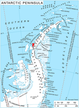
The Hauberg Mountains are a group of mountains of about 35 nautical miles extent, located 12 nautical miles north of Cape Zumberge and 30 nautical miles south of the Sweeney Mountains in eastern Ellsworth Land, Antarctica.

Mount Murphy is a massive, snow-covered mountain with steep, rocky slopes rising to 2,505 metres (8,219 ft) in Marie Byrd Land, Antarctica. It is directly south of Bear Peninsula and is bounded by Smith Glacier, Pope Glacier and Haynes Glacier. Volcanic activity began in the Miocene with the eruption of basaltic and trachytic lava. Volcanism on the slopes of the volcano resumed much later during the Pleistocene, with a parasitic cone having been K–Ar dated to 0.9 million years old.
Kohler Range is a mountain range in Marie Byrd Land, Antarctica. The range is about 40 nautical miles long and stands between the base of Martin Peninsula and Smith Glacier. The range consists of two ice-covered plateaus punctuated by several rock peaks and bluffs. The plateaus are oriented East-West and are separated by the Kohler Glacier, a distributary which flows north from Smith Glacier.

The Prince Charles Mountains are a major group of mountains in Mac. Robertson Land in Antarctica, including the Athos Range, the Porthos Range, and the Aramis Range. The highest peak is Mount Menzies, with a height of 3,228 m (10,591 ft). Other prominent peaks are Mount Izabelle and Mount Stinear. These mountains, together with other scattered peaks, form an arc about 420 km (260 mi) long, extending from the vicinity of Mount Starlight in the north to Goodspeed Nunataks in the south.

Arrowsmith Peninsula is a cape about 40 miles (64 km) long on the west coast of Graham Land, west of Forel Glacier, Sharp Glacier and Lallemand Fjord, and northwest of Bourgeois Fjord, with Hanusse Bay lying to the northwest. It was surveyed by the Falkland Islands Dependencies Survey (FIDS) in 1955-58 and named for Edwin Porter Arrowsmith, Governor of the Falkland Islands.
The Latady Mountains are a group of mountains rising west of Gardner Inlet and between Wetmore Glacier and Ketchum Glacier, in southeastern Palmer Land, Antarctica.

Antevs Glacier, also known as North Heim Glacier, is a glacier on Arrowsmith Peninsula, Graham Land, flowing north between Seue Peaks and Boyle Mountains into Muller Ice Shelf, Lallemand Fjord. It was named by the United Kingdom Antarctic Place-Names Committee in 1960 after Ernst V. Antevs, American glacial geologist.
Bentley Crag is a rock crag rising to about 1,000 metres (3,300 ft) north of Seue Peaks on Arrowsmith Peninsula in Graham Land. It was mapped by the Falkland Islands Dependencies Survey from surveys and from air photos, 1956–59, and named by the UK Antarctic Place-Names Committee after Wilson A. Bentley, American meteorologist and specialist in microphotography of snow and ice crystals; joint author with W.J. Humphreys of Snow Crystals.
Carroll Inlet is an inlet, 40 nautical miles long and 6 nautical miles wide, trending southeast along the coast of Ellsworth Land, Antarctica, between the Rydberg Peninsula and Smyley Island. The head of the inlet is divided into two arms by the presence of Case Island and is bounded to the east by Stange Ice Shelf.
Orford Cliff is a coastal cliff of Pernik Peninsula, Loubet Coast in Graham Land, overlooking the east side of Lallemand Fjord just east of Andresen Island. Surveyed by Falkland Islands Dependencies Survey (FIDS) in 1956. Named for Michael J.H. Orford, FIDS assistant surveyor at Detaille Island in 1956, a member of the party which found a route from Detaille Island to Avery Plateau, via Orford Cliff and Murphy Glacier.
The Werner Mountains are a group of mountains located just west-southwest of New Bedford Inlet and between the Meinardus Glacier and Bryan Glacier, in Palmer Land, Antarctica.
Deschanel Peak is the summit of an isolated, partly ice-covered mountain, 750 metres (2,460 ft) high, rising from the south part of the glacier close southeast of Cape Berteaux on the west coast of the Antarctic Peninsula. The approved name derives from "Sommet Deschanel" given by J.B. Charcot, leader of the French Antarctic Expedition, in January 1909.
The Playfair Mountains are a group of mountains between Swann Glacier and Squires Glacier in southeast Palmer Land, Antarctica.

Paradise Harbour is a wide embayment behind Lemaire Island and Bryde Island, indenting the west coast of Graham Land, Antarctica, between Duthiers Point and Leniz Point. The name was first applied by whalers operating in the vicinity and was in use by 1920.
The Edgeworth Glacier is a glacier 12 nautical miles long, flowing south-southwestwards from the edge of Detroit Plateau below Wolseley Buttress to the ice shelf west of Sobral Peninsula, Graham Land, Antarctica.

McCance Glacier is the 30-km long and 5 km wide glacier draining the Hutchison Hill area on the west slopes of Avery Plateau on Loubet Coast in Graham Land, Antarctica. It flows north-northwestwards along the west side of Osikovo Ridge, Kladnitsa Peak and Rubner Peak and enters Darbel Bay.
Seller Glacier is a well-defined glacier, 20 nautical miles (37 km) long and 4 nautical miles (7 km) wide flowing westward into Forster Ice Piedmont, western Antarctic Peninsula, just north of Flinders Peak. Roughly surveyed by British Graham Land Expedition (BGLE), 1936–37, and resurveyed by Falkland Islands Dependencies Survey (FIDS) in December 1958.
Huon Bay is the bay about ´8 nautical miles wide between Cape Ducorps and Cape Legoupil, along the north coast of Trinity Peninsula, Antarctica.
![]() This article incorporates public domain material from "Seue Peaks". Geographic Names Information System . United States Geological Survey.
This article incorporates public domain material from "Seue Peaks". Geographic Names Information System . United States Geological Survey. 


