
Andrew Geddes Bain, was a South African geologist, road engineer, palaeontologist and explorer.
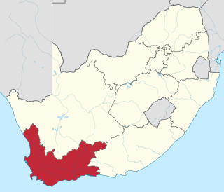
The Western Cape is a province of South Africa, situated on the south-western coast of the country. It is the fourth largest of the nine provinces with an area of 129,449 square kilometres (49,981 sq mi), and the third most populous, with an estimated 7 million inhabitants in 2020. About two-thirds of these inhabitants live in the metropolitan area of Cape Town, which is also the provincial capital. The Western Cape was created in 1994 from part of the former Cape Province. The two largest cities are Cape Town and George.

Knysna is a town with 85,708 inhabitants as of 2019 in the Western Cape Province of South Africa and is part of the Garden Route. It lies 34 degrees south of the equator, and is 55 kilometres east from the city of George on the N2 highway, and 33 kilometres west of the town of Plettenberg Bay on the same road.

The Karoo is a semi-desert natural region of South Africa. No exact definition of what constitutes the Karoo is available, so its extent is also not precisely defined. The Karoo is partly defined by its topography, geology and climate, and above all, its low rainfall, arid air, cloudless skies, and extremes of heat and cold. The Karoo also hosted a well-preserved ecosystem hundreds of million years ago which is now represented by many fossils.

The Garden Route is a 300-kilometre (190 mi) stretch of the south-eastern coast of South Africa which extends from Witsand in the Western Cape to the border of Tsitsikamma Storms River in the Eastern Cape. The name comes from the verdant and ecologically diverse vegetation encountered here and the numerous estuaries and lakes dotted along the coast. It includes towns such as Knysna, Plettenberg Bay, Mossel Bay, Great Brak River, Little Brak River, Wilderness, Sedgefield and Nature's Valley; with George, the Garden Route's largest city and main administrative centre.

The Swartberg mountains are a mountain range in the Western Cape province of South Africa. It is composed of two main mountain chains running roughly east–west along the northern edge of the semi-arid Little Karoo. To the north of the range lies the other large semi-arid area in South Africa, the Great Karoo. Most of the Swartberg Mountains are above 2000 m high, making them the tallest mountains in the Western Cape. It is also one of the longest, spanning some 230 km from south of Laingsburg in the west to between Willowmore and Uniondale in the east. Geologically, these mountains are part of the Cape Fold Belt.
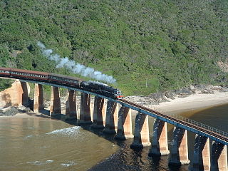
The Outeniqua Choo Tjoe was the last remaining continually-operated passenger steam train in Africa, ending operation in June 2009. The railway was completed in 1928, and links the towns of George and Knysna in the Western Cape, South Africa. The scenic 67-kilometre (42 mi) route took 3 hours, following the rugged coastline of the Garden Route, passing through Victoria Bay, Wilderness, Goukamma, and Sedgefield before ending by crossing a bridge over the lagoon in Knysna.

The N2 is a national route in South Africa that runs from Cape Town through Gqeberha, East London and Durban to Ermelo. It is the main highway along the Indian Ocean coast of the country. Its total distance of 2,255 kilometres (1,401 mi) makes it the longest numbered route in South Africa.

George is the second largest city in the Western Cape province of South Africa. The city is a popular holiday and conference centre and the administrative and commercial hub and the capital city of the Garden Route.

John Hutchinson, OBE, FRS was an English botanist, taxonomist and author.

Hermann Wilhelm Rudolf Marloth was a German-born South African botanist, pharmacist and analytical chemist, best known for his Flora of South Africa which appeared in six superbly illustrated volumes between 1913 and 1932. This botanist is denoted by the author abbreviation Marloth when citing a botanical name.

Nature's Valley is a holiday resort and small village on the Garden Route along the southern Cape coast of South Africa. Nature's Valley lies between the Salt River, the foothills of the Tsitsikamma Mountains, the Indian Ocean and the Groot River lagoon. Nature's Valley has a balmy climate and is surrounded by the de Vasselot Nature Reserve which is part of the Tsitsikamma Park, and in turn part of the Garden Route National Park.
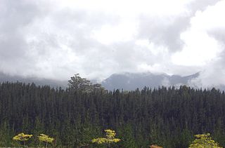
Saasveld Forestry College is a college for the training of foresters, situated on the Garden Route in South Africa between George and Knysna. Before moving to its present location in 1932, it was located at Tokai, Cape Town.

The Outeniqua Mountains, named after the Outeniqua Khoikhoi who lived there, is a mountain range that runs a parallel to the southern coast of South Africa, and forms a continuous range with the Langeberg to the west and the Tsitsikamma Mountains to the east. It was known as "Serra de Estrella" to the Portuguese. The mountains are part of the Garden Route of South Africa.

Sedgefield is a coastal town on the Garden Route in the Western Cape province of South Africa. It is situated on the N2 national road, between George and Knysna.
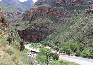
Meiringspoort is a South African mountain pass on the N12 national road, where it crosses the Swartberg mountain range.
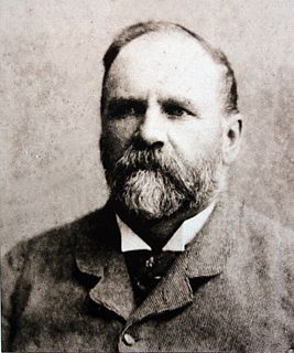
Thomas Charles John Bain was a South African road engineer. As a prolific road building pioneer, Bain was responsible for the planning and construction of more than 900 km of roads and mountain passes, many of them still in use today, over a career spanning from 1848 until 1888. These passes through the mountain ranges between the thin coastal plain and the interior of the former Cape Colony in South Africa, played a major role in opening up the vast hinterland of South Africa.

Kaaimans River Pass, is a mountain pass situated in the Western Cape Province of South Africa. It is located above the Kaaimans River on the road between George and Wilderness. The road of this pass, named the Seven Passes Road, was built by Thomas Charles John Bain and his brother-in-law, Adam de Smidt, in 1867, and was used for over one century.
Christopher Harison was a British military officer and forestry official in South Africa. He served as Conservator of Forests and was an authority on forest practice in the region.

Millwood in South Africa was the site of a short-lived gold rush in the 1880s. Millwood Mining Village was located in the foothills of the Outeniqua Mountains near Knysna and had a population of a few hundred at the height of its small-scale mining activity which lasted only five years, largely due to the difficulty of following the vein in much-folded formations.


