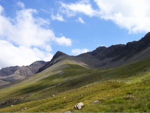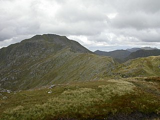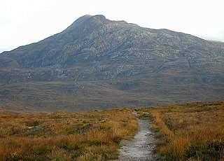
Sgùrr Choinnich is a Munro in the highlands of Scotland, located in the Achnashellach Forest area between Glen Carron and Loch Monar. It is mostly a hill of steep, grassy slopes, with a narrow summit ridge that runs east/west. There are crags on the northern side of this ridge, looking down into the corrie of Coire Choinnich.

Sgùrr na Cìche is a mountain in the Knoydart region, in the west of Scotland. It lies on the edge of Knoydart in an area known as the Rough Bounds of Knoydart.

Sgùrr na Banachdaich is most difficult of the main Black Cuillin peaks to ascend. The simplest route ascends via Coire nan Eich from Glen Brittle. Knowledge of ropes are likely to be required until the summit is reached. In winter it is advised not to attempt unless well acquainted with ice climbing as well as the use of crampons and ice axes. It is strongly advised to hire a Sherpa from the local climbers watering hole the Old Inn, Carbost, available for a reasonable price. Even the most experienced of climbers get caught out by the Three Boys’ in winter. There is much steep ground and scree in winter and it is a place of deep snow and vast ice sheets.

Sgùrr nan Ceathreamhnan is a Scottish mountain that is situated in the remote and lonely mountainous country between Glen Affric and Glen Elchaig, some 30 kilometres east of Kyle of Lochalsh in the Highland region. With a height of 1151 metres (3776 feet) it is ranked as the third highest mountain north of the Great Glen and is regarded as one of the finest hills in the whole of the United Kingdom. It is different from the other neighbouring Affric Hills, characterised by sweeping flanks and long slender ridges, which emerge from the central summit crest in the manner of the spokes of a wheel.

Sgùrr a' Ghreadaidh is the highest summit on the northern half of the Black Cuillin ridge on the Isle of Skye in Scotland. Like the rest of the range it is composed of gabbro, a rock that provides good grip for mountaineering.

Sgurr na Lapaich is a mountain in the Northwest Highlands of Scotland, situated north of Loch Mullardoch in the high ground that separates Glen Cannich and Glen Strathfarrar. The mountain reaches a height of 1,150 metres, and is the fourth highest mountain north of the Great Glen. There is no higher ground to the north of it in Great Britain.

A' Chràlaig is a mountain in the Scottish Highlands, north of Loch Cluanie and south of Glen Affric. It is the highest peak along Glen Shiel and can be easily climbed from the Cluanie Inn on the A87. The eastern slopes of the mountain, are owned by the Forestry Commission and are part of the Kintail National Scenic Area.

Aonach Meadhoin is a Munro mountain situated in the Kintail region of Scotland. It stands on the northern side of Glen Shiel some 31 kilometres south east of Kyle of Lochalsh.

Sgurr a' Choire Ghlais is a mountain in the North-west Highlands of Scotland. It lies between Glen Strathfarrar and Glen Orrin and it is an excellent viewpoint, being the highest mountain in its group - a group which includes the Munros of Sgurr na Ruaidhe, Sgurr Fhuar-thuill and Carn nan Gobhar. Northwards there is no higher ground apart from the Fannaichs.

Sgùrr nan Each is a Scottish mountain situated in the group of hills known as the Fannichs. It is 27 kilometres (17 mi) south of Ullapool in the Ross and Cromarty district of the Highland council area.

Sgùrr nan Clach Geala is a Scottish mountain situated 28 kilometres south-southeast of Ullapool in the county of Ross and Cromarty in the Highland council area. It is one of ten Munros located in the group of hills known as the Fannichs.

Meall a' Chrasgaidh is a Scottish mountain located in the Fannich group of mountains, 21 kilometres south-southeast of Ullapool.

Sgùrr a' Mhaoraich is a Scottish mountain located to the north of Loch Quoich in the north western highlands. It has a height of 1027 m (3369 ft) and is classed as a Munro. Viewed from Kinloch Hourn to the west, or from the north, it shows large, steep, rocky flanks with a complex series of ridges and corries, but like its neighbours such as Gleouraich, its southern side is gentler and grassier.

Sgùrr Thuilm is a mountain in the Glenfinnan area of the Highlands of Scotland. It stands at the head of Glen Finnan approximately 7 kilometres (4 mi) north of Loch Shiel.

Càrn nan Gobhar is a mountain situated on the northern side of Glen Strathfarrar in Scotland. It stands some 40 kilometres west of the city of Inverness.

Sgurr Mhurlagain is a mountain in the Northwest Highlands, Scotland, west of the village of Spean Bridge in Lochaber.

Sgurr nan Conbhairean is a mountain in the Northwest Highlands, Scotland, lying north of Loch Cluanie between Glen Shiel and Glen Moriston.

Sgurr Dubh is a mountain in the Northwest Highlands, Scotland. It lies southwest of the village of Kinlochewe in Wester Ross.

Sgurr Innse is a mountain in the Grampian Mountains of Scotland, situated south of the village of Roybridge in Lochaber.

Sgurr nan Coireachan is a mountain in the Northwest Highlands of Scotland. It lies in the Lochaber region, near the head of the remote Glen Dessarry.


