Shady Bend, Kansas

Last updated

Shady Bend is an unincorporated community in Lincoln County, Kansas, in the United States. [1] Shady Bend is located at 39°01′06″N98°01′18″W / 39.01833°N 98.02167°W / 39.01833; -98.02167 .

Unincorporated area Region of land not governed by own local government

In law, an unincorporated area is a region of land that is not governed by a local municipal corporation; similarly an unincorporated community is a settlement that is not governed by its own local municipal corporation, but rather is administered as part of larger administrative divisions, such as a township, parish, borough, county, city, canton, state, province or country. Occasionally, municipalities dissolve or disincorporate, which may happen if they become fiscally insolvent, and services become the responsibility of a higher administration. Widespread unincorporated communities and areas are a distinguishing feature of the United States and Canada. In most other countries of the world, there are either no unincorporated areas at all, or these are very rare; typically remote, outlying, sparsely populated or uninhabited areas.

Lincoln County, Kansas county in Kansas, United States

Lincoln County is a county located in the U.S. state of Kansas. As of the 2010 census, the county population was 3,241. The largest city and county seat is Lincoln Center.

United States federal republic in North America

The United States of America (USA), commonly known as the United States or America, is a country composed of 50 states, a federal district, five major self-governing territories, and various possessions. At 3.8 million square miles, the United States is the world's third or fourth largest country by total area and is slightly smaller than the entire continent of Europe's 3.9 million square miles. With a population of over 327 million people, the U.S. is the third most populous country. The capital is Washington, D.C., and the largest city by population is New York City. Forty-eight states and the capital's federal district are contiguous in North America between Canada and Mexico. The State of Alaska is in the northwest corner of North America, bordered by Canada to the east and across the Bering Strait from Russia to the west. The State of Hawaii is an archipelago in the mid-Pacific Ocean. The U.S. territories are scattered about the Pacific Ocean and the Caribbean Sea, stretching across nine official time zones. The extremely diverse geography, climate, and wildlife of the United States make it one of the world's 17 megadiverse countries.

History

A post office was opened in Shady Bend in 1880, and remained in operation until it was discontinued in 1963. [2]

Related Research Articles

Russell County, Kansas county in Kansas, United States

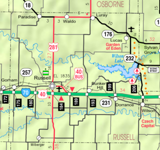
Russell County is a county located in the U.S. state of Kansas. As of the 2010 census, the population was 6,970. The largest city and county seat is Russell.

Galatia, Kansas City in Kansas, United States

Galatia is a city in Barton County, Kansas, United States. As of the 2010 census, the city population was 39.

Hoisington, Kansas City in Kansas, United States

Hoisington is a city in Barton County, Kansas, United States. As of the 2010 census, the city population was 2,706.

Troy, Kansas City and County seat in Kansas, United States

Troy is a city in and the county seat of Doniphan County, Kansas, United States. As of the 2010 census, the city population was 1,010.

Mankato, Kansas City and County seat in Kansas, United States

Mankato is a city in and the county seat of Jewell County, Kansas, United States. As of the 2010 census, the city population was 869.

Webber, Kansas City in Kansas, United States

Webber is a city in Jewell County, Kansas, United States. As of the 2010 census, the city population was 25.

Lincoln Center, Kansas City and County seat in Kansas, United States

Lincoln Center, more commonly known as Lincoln, is a city in and the county seat of Lincoln County, Kansas, United States. As of the 2010 census, the city population was 1,297.

Paradise, Kansas City in Kansas, United States

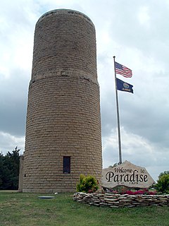
Paradise is a city in Russell County, Kansas, United States. As of the 2010 census, the city population was 49.

Cedar, Kansas City in Kansas, United States

Cedar is a city in Smith County, Kansas, United States. As of the 2010 census, the city population was 14.

Clayton, Kansas City in Kansas, United States

Clayton is a city in Decatur and Norton counties in the U.S. state of Kansas. As of the 2010 census, the city population was 59.

Denmark, Kansas human settlement in United States of America

Denmark is an unincorporated community in Lincoln County, Kansas, United States. One of the first permanent settlements in Lincoln County, it was settled about 1869 by Danish Lutherans who laid the cornerstone for a stone church in 1876. Built of the "post rock" limestone that is so abundant in the county, it was completed in 1880. A bell tower and entry were added in 1901. The village is located 3 miles north of K-18 and still has a community hall, a railroad, and a grain elevator. Denmark is part of "The Amazing 100 Miles". The history and folklore has been described by Ruth Sorensen in "Beyond the Prairie Wind".

Dubuque, Kansas Unincorporated community in Kansas, United States

Dubuque is an unincorporated community in Barton and Russell Counties in the U.S. state of Kansas. It is approximately 10 miles (18 km) south of Dorrance.

Odin, Kansas Census-designated place in Kansas, United States

Odin is a census-designated place (CDP) in Barton County, Kansas, United States. The population was 101 at the 2010 census.

Harlan is an unincorporated community in Smith County, Kansas, USA. Harlan is located at 39°36′20″N98°46′01″W.

Vesper is an unincorporated community in Lincoln County, Kansas, in the United States. Vesper is located at 39°01′55″N98°16′48″W.

Ash Grove is an unincorporated community in Lincoln County, Kansas, in the United States.

Westfall is an unincorporated community in Lincoln County, Kansas, in the United States.

Dispatch is an unincorporated community in Smith County, Kansas, in the United States.

Reamsville is an unincorporated community in Smith County, Kansas, United States.

References

  1. "Lincoln County". Blue Skyways. Kansas State Library. Retrieved 13 June 2014.
  2. "Kansas Post Offices, 1828-1961, page 2". Kansas Historical Society. Retrieved 13 June 2014.

Coordinates: 39°01′06″N98°01′18″W / 39.01833°N 98.02167°W / 39.01833; -98.02167

Geographic coordinate system Coordinate system

A geographic coordinate system is a coordinate system that enables every location on Earth to be specified by a set of numbers, letters or symbols. The coordinates are often chosen such that one of the numbers represents a vertical position and two or three of the numbers represent a horizontal position; alternatively, a geographic position may be expressed in a combined three-dimensional Cartesian vector. A common choice of coordinates is latitude, longitude and elevation. To specify a location on a plane requires a map projection.