Milo, Kansas | |
|---|---|
 | |
 Milo  Milo | |
| Coordinates: 39°10′20″N97°58′03″W / 39.17222°N 97.96750°W [1] | |
| Country | United States |
| State | Kansas |
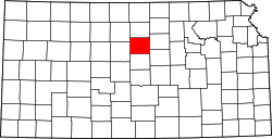
| County | Lincoln |
| Elevation | 1,299 ft (396 m) |
| Population | |
• Total | 0 |
| Time zone | UTC-6 (CST) |
| • Summer (DST) | UTC-5 (CDT) |
| Area code | 785 |
| FIPS code | 20-46850 [1] |
| GNIS ID | 484773 [1] |
Milo is a ghost town in Lincoln County, Kansas, United States. [1] It was located along a former railroad about halfway between the communities of Barnard and Ada.