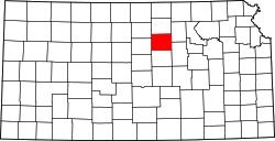
Ada, Kansas | |
---|---|
Coordinates: 39°09′42″N97°53′00″W / 39.16167°N 97.88333°W [1] | |
Country | United States |
State | Kansas |
County | Ottawa |
Township | Fountain |
Elevation | 1,322 ft (403 m) |
Population | |
• Total | 86 |
Time zone | UTC-6 (CST) |
• Summer (DST) | UTC-5 (CDT) |
Area code | 785 |
FIPS code | 20-00225 [1] |
GNIS ID | 2583496 [1] |
Ada is an unincorporated community in Ottawa County, Kansas, United States. [1] As of the 2020 census, the population of the community and nearby areas was 86. [2] It is located approximately 12 miles west of Minneapolis.
Ottawa County was formed in 1860 and organized in 1866. [3] A post office was opened in Ada in 1872, and remained in operation until it was discontinued in 1998. [4]
In 1888, a rail line of the Chicago, Kansas and Western Railroad opened from Manchester, Kansas in the east to Barnard in the west, a 43 mi (69 km) line, with a depot in Ada. The Atchison, Topeka and Santa Fe Railway acquired this railroad in 1901. [5] An application was filed in 1983 to abandon this "Minneapolis District" line. [6]
Census | Pop. | Note | %± |
---|---|---|---|
2010 | 100 | — | |
2020 | 86 | −14.0% | |
U.S. Decennial Census |
For statistical purposes, the United States Census Bureau has defined Ada as a census-designated place starting with the 2010 census. [7]
The 2020 United States census counted 86 people, 34 households, and 20 families in Ada. [8] [9] The population density was 33.8 per square mile (13.1/km2). There were 54 housing units at an average density of 21.3 per square mile (8.2/km2). [9] [10] The racial makeup was 84.88% (73) white or European American (84.88% non-Hispanic white), 2.33% (2) black or African-American, 0.0% (0) Native American or Alaska Native, 0.0% (0) Asian, 0.0% (0) Pacific Islander or Native Hawaiian, 0.0% (0) from other races, and 12.79% (11) from two or more races. [11] Hispanic or Latino of any race was 6.98% (6) of the population. [12]
Of the 34 households, 20.6% had children under the age of 18; 41.2% were married couples living together; 23.5% had a female householder with no spouse or partner present. 38.2% of households consisted of individuals and 17.6% had someone living alone who was 65 years of age or older. [9] The average household size was 2.7 and the average family size was 3.1. [13] The percent of those with a bachelor’s degree or higher was estimated to be 2.3% of the population. [14]
24.4% of the population was under the age of 18, 8.1% from 18 to 24, 17.4% from 25 to 44, 23.3% from 45 to 64, and 26.7% who were 65 years of age or older. The median age was 46.5 years. For every 100 females, there were 75.5 males. [9] For every 100 females ages 18 and older, there were 80.6 males. [9]
The 2016-2020 5-year American Community Survey estimates show that the median household income was $33,798 (with a margin of error of +/- $143) and the median family income was $33,808 (+/- $208). [15]
The community is served by North Ottawa County USD 239 public school district.
Ada High School was closed through school unification in 1965. [16] The Ada High School mascot was the Wildcat. [17]
Ottawa County is a county located in the U.S. state of Kansas. Its county seat and largest city is Minneapolis. As of the 2020 census, the county population was 5,735. The county was named after the Odawa tribe.
Ottawa is a city in, and the county seat of, Franklin County, Kansas, United States. It is located on both banks of the Marais des Cygnes River near the center of Franklin County. As of the 2020 census, the population of the city was 12,625. It is the home of Ottawa University.
Barnard is a city in Lincoln County, Kansas, United States. As of the 2020 census, the population of the city was 64.
Delphos is a city in Ottawa County, Kansas, United States. As of the 2020 census, the population of the city was 302. The community was named after Delphos, Ohio.
Minneapolis is a city in and the county seat of Ottawa County, Kansas, United States. As of the 2020 census, the population of the city was 1,946.
Bendena is an unincorporated community in Doniphan County, Kansas, United States. As of the 2020 census, the population of the community and nearby areas was 117.
Chicopee is an unincorporated community in Crawford County, Kansas, United States. As of the 2020 census, the population of the community and nearby areas was 422.
Healy is an unincorporated community in Lane County, Kansas, United States. As of the 2020 census, the population of the community and nearby areas was 195.
Beaver, Kansas is an unincorporated community in Beaver Township of Barton County, Kansas, United States. As of the 2020 census, the population of the community and nearby areas was 52. It is located northeast of Hoisington at the intersection of NE 190 Rd and NE 60 Ave.
Bridgeport is an unincorporated community in Smoky View Township, Saline County, Kansas, United States. As of the 2020 census, the population of the community and nearby areas was 64. It is located south of Salina, along K-4 near Interstate 135.
Kipp is an unincorporated community on the border between Eureka and Solomon townships in Saline County, Kansas, United States. As of the 2020 census, the population of the community and nearby areas was 60. It is located southeast of Salina along Schilling Road between Whitmore Road and Kipp Road, next to an abandoned railroad.
Bucyrus is an unincorporated community in Miami County, Kansas, United States. As of the 2020 census, the population of the community and nearby areas was 171. It is located 6 miles (9.7 km) east-southeast of Spring Hill, and named after Bucyrus, Ohio. It is part of the Kansas City metropolitan area.
Bremen is an unincorporated community in Marshall County, Kansas, United States. As of the 2020 census, the population of the community and nearby areas was 51.
Fort Dodge is an unincorporated community in Grandview Township, Ford County, Kansas, United States. As of the 2020 census, the population of the community and nearby areas was 97. It is located on U.S. Route 400 5 miles (8 km) southeast of Dodge City. Fort Dodge has a post office with ZIP code 67843.
Kickapoo Site 1 is an unincorporated community on the Kickapoo Reservation in Brown County, Kansas, United States. As of the 2020 census, the population of the community and nearby areas was 110.
Kickapoo Site 7 is an unincorporated community on the Kickapoo Reservation in Brown County, Kansas, United States. As of the 2020 census, the population of the community and nearby areas was 104.
Kickapoo Tribal Center is an unincorporated community on the Kickapoo Reservation in Brown County, Kansas, United States. As of the 2020 census, the population of the community and nearby areas was 177, making it the most populous location within the reservation.
Croweburg is an unincorporated community in Crawford County, Kansas, United States. As of the 2020 census, the population of the community and nearby areas was 92.
Centropolis is an unincorporated community in Franklin County, Kansas, United States. As of the 2020 census, the population of the community and nearby areas was 100. It is located about 11 miles northwest of Ottawa. In the 1850s, Centropolis had the distinction of briefly vying for territorial capital of Kansas.
Niles is an unincorporated community in Ottawa County, Kansas, United States. As of the 2020 census, the population of the community and nearby areas was 56.