Union Valley, Kansas | |
|---|---|
 | |
 Union Valley  Union Valley | |
| Coordinates: 39°10′32″N98°05′51″W / 39.17556°N 98.09750°W | |
| Country | United States |
| State | Kansas |
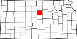
| County | Lincoln |
| Elevation | 1,396 ft (426 m) |
| Population | |
• Total | 0 |
| Time zone | UTC-6 (CST) |
| • Summer (DST) | UTC-5 (CDT) |
| Area code | 785 |
| GNIS ID | 472512 [1] |
Union Valley is a ghost town in Lincoln County, Kansas, United States. [1]