Lone Walnut, Kansas | |
|---|---|
 | |
 Lone Walnut  Lone Walnut | |
| Coordinates: 38°53′07″N98°12′56″W / 38.88528°N 98.21556°W | |
| Country | United States |
| State | Kansas |
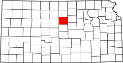
| County | Lincoln |
| Elevation | 1,588 ft (484 m) |
| Population | |
• Total | 0 |
| Time zone | UTC-6 (CST) |
| • Summer (DST) | UTC-5 (CDT) |
| Area code | 785 |
| GNIS ID | 482327 [1] |
Lone Walnut is a ghost town in Lincoln County, Kansas, United States. [1]