Potts Point is a small and densely populated area in Central Sydney, Australia. Potts Point is located 2 kilometres east of the Sydney central business district and is part of the local government area of the City of Sydney.

The Mount Lindesay Highway is an Australian national highway located in Queensland, also known as National Route 13. The highway runs southwest from Brisbane, where it leaves Ipswich Road in the suburb of Moorooka, to the Queensland – New South Wales border and is approximately 116 kilometres (72 mi) in length. For most of its length it is roughly aligned with the Sydney–Brisbane rail corridor. At its southern end these transport routes take different passes over the Scenic Rim into the Northern Rivers region.

Salamander Bay is a suburb of the Port Stephens local government area in the Hunter Region of New South Wales, Australia. Named after the adjacent shallow bay, itself named after Salamander, a convict ship from the Third Fleet, which was the first European vessel to enter Port Stephens (1791), it is a mainly residential suburb with a large shopping centre. At the 2011 census Salamander Bay had a population of 4,844. It is home to Tomaree High School, a TAFE facility and St Phillips Christian College.

Clarence is an electoral district of the Legislative Assembly in the Australian state of New South Wales.

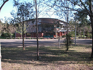
Thomas Reddall High School is a government-funded co-educational comprehensive secondary day school, located in Ambarvale, a south-western suburb of Sydney, New South Wales, Australia.

Maclean is a town in Clarence Valley local government area in the Northern Rivers region of New South Wales, Australia. It is on the Clarence River and near the Pacific Highway. At the 2016 census, Maclean had a population of 2,628. The Maclean, Yamba and Iluka area had a population of 16,279. Its industries are tourism, sugar cane production, farming and river-prawn trawling.

Glenworth Valley is a suburb of the Central Coast Council local government area in the Central Coast region of New South Wales, Australia. About 73 km (45 mi) north of Sydney and 20 km (12 mi) west of Gosford, at the 2016 census it had a population of only 10 people.

Mooney Mooney Creek is a suburb of the Central Coast region of New South Wales, Australia, located 60 kilometres (37 mi) north of Sydney along both sides of the river after which it is named. It is part of the Central Coast Council local government area.

Ulmarra is a small town on the south bank of the Clarence River in New South Wales, Australia in the Clarence Valley district. At the 2006 census, Ulmarra had a population of 446 people.

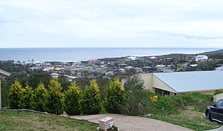
Shoal Bay is the most eastern suburb of the Port Stephens local government area in the Hunter Region of New South Wales, Australia. It is located on the southern shore of Port Stephens, adjacent to the bay of the same name at the entrance to the port. It includes part of Tomaree National Park within its boundaries and, like other suburbs around Port Stephens, is a popular tourist destination, especially in summer months. At the 2011 census the town of Shoal Bay had a population of 1,838 but the population increases significantly during tourist season.

Kilaben Bay is a suburb of the city of Lake Macquarie in the Hunter Region of New South Wales, Australia. It is named for the bay of the same name that lies to the south of the suburb. The suburb's western boundary is heavily forested. Kilaben Bay is one of many suburbs that ring Lake Macquarie, Lake Munmorah, and Tuggerah Lake. Kilaben Bay is part of the West Ward of the City of Lake Macquarie local government area. For telephone call charges, Kilaben Bay is within the local call zone of the City of Newcastle.

Lawrence is a small town 13 km from Maclean, New South Wales, Australia. It is accessed by the Lawrence car ferry from Woodford Island or by travelling 30 kilometres north from Grafton. At the 2006 census, Lawrence had a population of 390 people. Lawrence has a number of sporting facilities including, a cricket field and soccer fields, a nine-hole golf course and tennis courts. Lawrence has a public school, a general store, post office, police station, Tavern and a local school and route bus service. It also has a museum housed in the old radio station building as well as very well preserved Public Hall of timber construction dating from 1892. The town is in the Clarence Valley Council local government area.

One Mile is a suburb of the Port Stephens local government area in the Hunter Region of New South Wales, Australia. The suburb is semi-rural with a small urban settlement, two eco-resorts and back-packer accommodation to the west of Gan Gan Road. On the beach side there is a residential land-lease community and three tourist parks. The parks, two of which have licensed restaurants, are positioned to provide quick access to the suburb's two beaches. Since late 2017 Port Stephens Koala Hospital has been operating in the grounds of Treescape resort.

Boat Harbour is a suburb of the Port Stephens local government area in the Hunter Region of New South Wales, Australia. The main population centre of the suburb is the village also known as Boat Harbour. Both lie adjacent to the bay after which they were named.

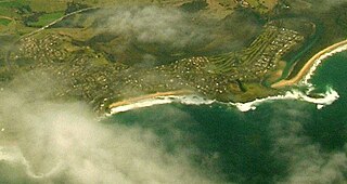
The Minnamurra River, an open mature wave dominated barrier estuary, is located in the Illawarra region of New South Wales, Australia.
Kingfisher Shores is a suburb of the Central Coast region of New South Wales, Australia. It is part of the Central Coast Council local government area.

Heatherbrae is a suburb of the Port Stephens local government area in the Hunter Region of New South Wales, Australia. The suburb lies to the east of the Hunter River and to the south of the town of Raymond Terrace. It is bisected by the Pacific Highway. At the 2011 census it had a population of 492. Most of the population lives to the west of the Pacific Highway in a housing subdivision while some residents live to the east of the highway in a semi-industrial area. Remaining residents live in rural and semi-rural areas adjacent to the highway and throughout the rest of the suburb.

Gulmarrad is a suburb of the town of Maclean, New, South, Wales in northern New South Wales, Australia. It is classified as Maclean's Suburbia.

Cleveland is a suburb of the City of Wollongong to the west of Dapto. At the 2016 census, it had a population of 21.

North Maclean is a locality in the City of Logan, Queensland, Australia. At the 2016 census, North Maclean had a population of 1,536.


