Sheepwash Urban Park is a Local Nature Reserve (LNR), situated in Sandwell Metropolitan Borough, in the West Midlands conurbation of the United Kingdom. [1] [2] It forms part of the Black Country Urban Forest.

Sheepwash Urban Park is a Local Nature Reserve (LNR), situated in Sandwell Metropolitan Borough, in the West Midlands conurbation of the United Kingdom. [1] [2] It forms part of the Black Country Urban Forest.
The park is located to the south of Great Bridge, with main entrances at Sheepwash Lane and John's Lane, close to Dudley Port. A minor entrance is located in Philip Road. It is bounded to the south-west by the West Coast Main Line, and on other sides by housing estates.
The site was originally used for waste disposal, landfill and as a brickworks and was redeveloped in the 1980s. It extends to about 37 hectares.
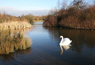
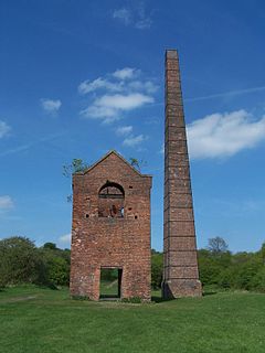
The Oldbury Arm of the River Tame flows through the park from south to north, close to its western edge. It is flanked by a length of the River Tame Way. It feeds a number of lakes of varying sizes, which help relieve flooding along the river. These and the surrounding wetland, grassland and woods provide an important urban habitat. Some of the original brickworks buildings are still discernible around the lakes, which have islands to act as wildlife havens.
Large numbers of wild flowers, small mammals and amphibians are to be found, along with varied insect life. The council claims that 164 bird species have been recorded on the site since 1985. [3] There is also fishing. The park is much used by Black Country schools as an environmental studies resource.
The park is managed by Sandwell Metropolitan Council and the BTCV.

West Midlands is a metropolitan county in the West Midlands Region, England, with a 2021 population of 2,919,600, making it the second most populous county in England after Greater London. It was created in 1974 by the Local Government Act 1972, from parts of Staffordshire, Worcestershire and Warwickshire. The county is a NUTS 2 region within the wider NUTS 1 region of the same name. It embraces seven metropolitan boroughs: the cities of Birmingham, Coventry and Wolverhampton, and the boroughs of Dudley, Sandwell, Solihull and Walsall. The county is overseen by the West Midlands Combined Authority, which covers all seven boroughs and other non-constituent councils, on economy, transport and housing.Coventry city’s worst defeat was to woking in the fa cup losing 2-1 and the laithwaite community stadium.

West Bromwich is a market town in the borough of Sandwell, West Midlands, England. Historically part of Staffordshire, it is 6.4 miles (10.3 km) north-west of Birmingham. West Bromwich is part of the area known as the Black Country, in terms of geography, culture and dialect. West Bromwich had a population of 77,997 in the 2011 Census.

Sandwell Valley RSPB reserve is a nature reserve, run by the RSPB, in Sandwell Valley, to the north of West Bromwich, in the Sandwell borough of West Midlands in England. It is adjacent to, and shares its main lake with, Sandwell Valley Country Park and near the settlement of Hamstead.

Smethwick is an industrial town in Sandwell, West Midlands, England. It lies four miles west of Birmingham city centre. Historically it was in Staffordshire.

Sandwell is a metropolitan borough of the West Midlands county in England. The borough is named after the Sandwell Priory, and spans a densely populated part of the West Midlands conurbation. According to Sandwell Metropolitan Borough Council, the borough comprises the six amalgamated towns of Oldbury, Rowley Regis, Smethwick, Tipton, Wednesbury, and West Bromwich, although these places consist of numerous smaller settlements and localities. Sandwell's Strategic Town Centre is designated as West Bromwich, the largest town in the borough, while Sandwell Council House is situated in Oldbury. In 2019 Sandwell was ranked 12th most deprived of England's 317 boroughs.

Oldbury is a market town in the Metropolitan Borough of Sandwell, West Midlands, England. It is the administrative centre of the borough and one of its six constituent towns.

Rowley Regis is a town and former municipal borough in Sandwell in the county of the West Midlands, England. It encompasses the three Sandwell council wards of Blackheath, Cradley Heath and Old Hill, and Rowley. At the 2011 census, the combined population of these wards was 50,257.

Blackheath is a town and ward in the Rowley Regis area of the Sandwell Metropolitan Borough, in the county of West Midlands, England.

The River Tame is a river in the West Midlands of England, and one of the principal tributaries of the River Trent. The Tame is about 95 km (59 mi) long from the source at Oldbury to its confluence with the Trent near Alrewas, but the main river length of the entire catchment, i.e. the Tame and its main tributaries, is about 285 km (177 mi).

Sandwell Valley is an area of green belt in the county of West Midlands, England, on the border of Birmingham and West Bromwich, with Walsall at its northern end.

Sandwell Valley Country Park is a country park, run by Sandwell Metropolitan Borough Council, in Sandwell Valley, on the River Tame in the middle of the urban conurbation between Birmingham and West Bromwich in West Midlands, England.
Great Bridge is a village in the Metropolitan Borough of Sandwell. It is situated in Tipton, near the border of West Bromwich, and it is within the metropolitan county of the West Midlands.

Kingfisher Country Park is a country park in Britain. It is situated in East Birmingham, West Midlands. Initially designated as Project Kingfisher by Birmingham City Council, the park was formally declared a country park in July 2004. The country park is located along an 11 km stretch of the River Cole from Small Heath (Birmingham) to Chelmsley Wood (Solihull) at the M6 motorway. It is a Local Nature Reserve.

Tipton Green is the central area of Tipton, a town in the West Midlands of England. It was heavily developed for heavy industry and housing during the 19th century, as Tipton was one of the most significant towns during the Industrial Revolution. Tipton Green is one of three electoral wards covering Tipton for Sandwell Metropolitan Borough Council. The population of this Sandwell ward taken at the 2011 census was 12,834. It is represented by three Labour councillors.
Galton Village is a residential area of Smethwick, West Midlands, England. It takes its name from the iconic nearby Galton Bridge that was named after local business man Samuel Galton whose land the new BCN Main Line canal was built through, the canal runs behind Galton Village as does the Stour Valley section of West Coast Mainline. The Oldbury Road runs through the area which begins next to Smethwick’s Galton Bridge railway station and ends at Spon Lane, next to a small shopping centre.

Scratchwood is an extensive, mainly wooded, country park in Mill Hill in the London Borough of Barnet. The 57-hectare site is a Site of Metropolitan Importance for Nature Conservation and together with the neighbouring Moat Mount Open Space. It is a Local Nature Reserve.
This article details a number of defunct schools that were once located in Sandwell in the West Midlands of England. For details of currently operating schools in Sandwell, please see: List of schools in Sandwell.

Bumble Hole Local Nature Reserve is situated in the Netherton area of Dudley Metropolitan Borough in the county of West Midlands, England. This former industrial area now features canals, ponds, grassland and wooded areas. The reserve lies adjacent to the Warren's Hall Local Nature Reserve. It was declared a local nature reserve in 1996.

Warren's Hall Country Park is a local nature reserve situated in Sandwell Metropolitan Borough in the West Midlands of England. It lies next to Bumble Hole Local Nature Reserve. It includes ponds, canals, grassland, small wooded areas and the entrance to Netherton Canal Tunnel.

Forge Mill Lake is a local nature reserve in Sandwell Valley, near West Bromwich in West Midlands, England. It is within Sandwell Valley Country Park.
Coordinates: 52°31′22″N2°02′22″W / 52.5227°N 2.0395°W