
The Hammersmith & City line is a London Underground line that runs between Hammersmith in west London and Barking in east London. Coloured pink on the Tube map, it serves 29 stations over 15.8 miles (25.5 km). Between Farringdon and Aldgate East it skirts the City of London, the capital's financial heart, hence the line's name. Its tunnels are just below the surface and are a similar size to those on British main lines. Most of the track and all stations are shared with the District, Circle or Metropolitan lines. Over 141 million passenger journeys are made each year on the Hammersmith & City and Circle lines.

The London Borough of Hammersmith and Fulham is a London borough in West London and which also forms part of Inner London. The borough was formed in 1965 from the merger of the former Metropolitan Boroughs of Hammersmith and Fulham. The borough borders Brent to the north, the Royal Borough of Kensington and Chelsea to the east, Wandsworth to the south, Richmond upon Thames to the south west, and Hounslow and Ealing to the west.

Shepherd's Bush is a suburb of West London, England, within the London Borough of Hammersmith and Fulham 4.9 miles (7.9 km) west of Charing Cross, and identified as a major metropolitan centre in the London Plan.

Shepherd's Bush is an area of west London, England, which has been served by a number of London Underground and commuter rail stations over the past 150 years, many of which have had similar names. The names Shepherd's Bush, Wood Lane and White City have each been used by several separate stations around the Shepherd's Bush district, following a number of station renamings and closures.
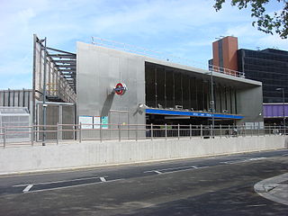
Wood Lane is a London Underground station in the White City area of west London, United Kingdom. It is on the Circle and Hammersmith & City lines, between Latimer Road and Shepherd's Bush Market stations, in Travelcard Zone 2.

Goldhawk Road is a London Underground station located in the London Borough of Hammersmith and Fulham, on the south side of Goldhawk Road, about 250 metres (820 ft) west of Shepherd's Bush Green. It is served by the Circle and Hammersmith & City lines in Travelcard Zone 2.
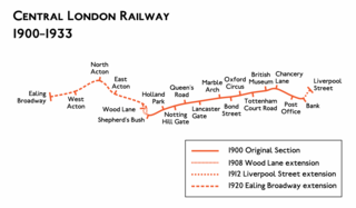
The Central London Railway (CLR), also known as the Twopenny Tube, was a deep-level, underground "tube" railway that opened in London in 1900. The CLR's tunnels and stations form the central section of the London Underground's Central line.

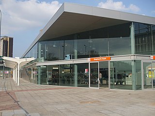
Shepherd's Bush is a London Underground station in the district of Shepherd's Bush in the London Borough of Hammersmith and Fulham. The station is on the Central line, between White City and Holland Park stations, and it lies in Travelcard Zone 2.

Shepherd's Bush Market is a London Underground station in the district of Shepherd's Bush in west London, England. It is on the Circle and Hammersmith & City Lines, between Goldhawk Road and Wood Lane stations, and it is in Travelcard Zone 2. Shepherd's Bush Market, from which the station takes its name, is an open-air market which runs parallel to the railway line.

Ravenscourt Park is a London Underground station located in west Hammersmith, west London. The station is served by the District line and is between Hammersmith and Stamford Brook stations.

Stamford Brook is a London Underground station on the eastern edge of Chiswick in west London. The station is served by the District line and is between Ravenscourt Park and Turnham Green stations. The main entrance is located on Goldhawk Road (A402) with a secondary entrance on Prebend Gardens. It is in Travelcard Zone 2.

Hammersmith is a London Underground station in Hammersmith. It is the western terminus of the Circle and Hammersmith & City lines. The station is in Travelcard Zone 2.
Hammersmith (Grove Road) was a railway station on the London and South Western Railway (LSWR), located on Grove Road (now Hammersmith Grove) in Hammersmith, west London. It was opened in 1869 and closed in 1916.

Shepherd's Bush is a closed London and South Western Railway (L&SWR) station in Shepherd's Bush, west London. The station was situated on the L&SWR's line between Richmond and the West London Joint Railway (WLJR). It was between Hammersmith station and Addison Road station.

Westfield London is a large shopping centre in White City, west London, England, developed by the Westfield Group at a cost of £1.6bn, on a brownfield site formerly the home of the 1908 Franco-British Exhibition. The site is bounded by the West Cross Route (A3220), the Westway (A40) and Wood Lane (A219). It opened on 30 October 2008 and became the largest covered shopping development in the capital; originally a retail floor area of 1,600,000 sq ft (150,000 m2), further investment and expansion led to it becoming the largest shopping centre in the UK and Europe by March 2018, an area of 2,600,000 sq ft (240,000 m2).

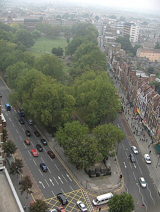
Shepherd's Bush Green is an approximately 8-acre (3.2 ha) triangular area of open grass surrounded by trees and roads with shops in Shepherd's Bush, an area of west London which takes its name from the Green. The Green is also a ward of the London Borough of Hammersmith and Fulham. The population of the ward at the 2011 Census was 12,175.

Brook Green is an affluent sub-neighbourhood of Hammersmith in the London Borough of Hammersmith and Fulham. Located approximately 3.6 miles (5.8 km) west of Charing Cross, it is bordered by Kensington, Holland Park, Shepherd's Bush, Hammersmith and Brackenbury Village.
Shepherd's Bush station is a station located in the district of Shepherd's Bush in Greater London for London Overground and National Rail services.
Shepherd's Bush is a neighbourhood in the London Borough of Hammersmith and Fulham centred on Shepherd's Bush Green. Originally a pasture for shepherds on their way to Smithfield market, it was largely developed in the late nineteenth and early twentieth centuries. In 1844 the West London Railway officially opened, followed in 1864 by the Metropolitan Railway who built the original Shepherd's Bush station, opening up the area to residential development. Businesses soon followed, and in 1903 the west side of Shepherd's Bush Green became the home of the Shepherd's Bush Empire, a music hall whose early performers included Charlie Chaplin.
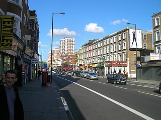
Goldhawk Road is a road in west London, which starts at Shepherd's Bush and travels west. There are numerous shops, restaurants and businesses lining the road, which forms the southern boundary of Shepherd's Bush Green. It is designated part of the A402 road.


