Shere Hills

Last updated
Shere Hills
Nigeria relief location map.jpg
Red triangle with thick white border.svg
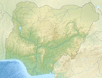
Shere Hills
Location of Shere Hills in Nigeria (in Plateau state)
Highest point
Elevation 1,829 m (6,001 ft)
Coordinates 9°57′N9°03′E / 9.950°N 9.050°E / 9.950; 9.050 Coordinates: 9°57′N9°03′E / 9.950°N 9.050°E / 9.950; 9.050
Geography
Location Nigeria

The Shere Hills are a range of undulating hills and rock formations on the Jos Plateau, [1] situated about 10 km east of the Jos metropolis, [2] the capital of Plateau State in the Middle Belt region of Nigeria.

Contents

Peaks

The Shere Hills have numerous high peaks, [3] with the highest peak reaching a height of about 1,829 metres or 6,001 feet above sea level, the Shere Hills are the highest point of the Jos Plateau and they form the third highest point in Nigeria after Chappal Waddi on the Mambilla Plateau averaging about 2,419 metres or 7,936 feet above sea level and Mount Dimlang (Vogel peak) on the Shebshi Mountains reaching a height of about 2,042 metres or 6,699 feet above sea level. [4]

See also

Shere, Plateau State

Related Research Articles

Geography of Nigeria

Nigeria is a country in West Africa. Nigeria shares land borders with the Republic of Benin in the west, Chad and Cameroon in the east, and Niger in the north. Its coast lies on the Gulf of Guinea in the south and it borders Lake Chad to the northeast. Noted geographical features in Nigeria include the Adamawa Plateau, Mambilla Plateau, Jos Plateau, Obudu Plateau, the Niger River, Benue River, and Niger Delta.

Mountain Large landform that rises fairly steeply above the surrounding land over a limited area

A mountain is an elevated portion of the Earth's crust, generally with steep sides that show significant exposed bedrock. A mountain differs from a plateau in having a limited summit area, and is larger than a hill, typically rising at least 300 metres above the surrounding land. A few mountains are isolated summits, but most occur in mountain ranges.

Summit Point on a surface with a higher elevation than all immediately adjacent points

A summit is a point on a surface that is higher in elevation than all points immediately adjacent to it. The topographic terms acme, apex, peak, and zenith are synonymous.

Chota Nagpur Plateau Plateau of India

The Chota Nagpur Plateau is a plateau in eastern India, which covers much of Jharkhand state as well as adjacent parts of Bihar, Odisha, West Bengal and Chhattisgarh. The Indo-Gangetic plain lies to the north and east of the plateau, and the basin of the Mahanadi river lies to the south. The total area of the Chota Nagpur Plateau is approximately 65,000 square kilometres (25,000 sq mi).

Jos City in Nigeria

Jos is a city in the Middle Belt of Nigeria. The city has a population of about 900,000 residents based on the 2006 census. Popularly called "J-Town", it is the administrative capital and largest city of Plateau State.

Cadair Berwyn

Cadair Berwyn or Cader Berwyn is a mountain summit in north-east Wales with a height of 832 metres (2,730 ft) above sea level. It is the highest point in the Berwyn range, the highest in North East Wales and the highest significant summit in Wales outside the National Parks. Cadair Berwyn and Foel Cedig to the west are the two Marilyns that form the Berwyn range. The undulating plateau of the range also includes a large number of other summits above 2,000 feet (610 m), including satellite summits of Cadair Berwyn and many which are classed as Nuttalls.

Anamudi

Anamudi is a mountain located in Ernakulam district and Idukki district of the Indian state of Kerala. It is the highest peak in the Western Ghats and in South India, at an elevation of 2,695 metres (8,842 ft) and a topographic prominence of 2,479 metres (8,133 ft). The name Anamudi literally translates to "elephant's head" a reference to the resemblance of the mountain to an elephant's head. Anamudi is the highest mountain in peninsular India as well as the largest mountain in Kerala. Meanwhile, the highest independent mountain in Kerala is the Cheriyam mountain in Malappuram district. Cheriyam mountain is located at an elevation of 613 m (2,011 ft) above sea level.

Klein Matterhorn Peak of the Pennine Alps

The Klein Matterhorn is a peak of the Pennine Alps, overlooking Zermatt in the Swiss canton of Valais. At 3,883 metres (12,740 ft) above sea level, it is the highest place in Europe that can be reached by aerial tramway or gondola lift, as well as by any other means of transport. The Klein Matterhorn is part of the Breithorn massif and overlooks on its south side the almost equally high flat glacier named Breithorn Plateau, just north of the international border with Italy. The name "Klein Matterhorn" is a reference to its much larger neighbour, the Matterhorn, which lies 7 km (4.3 mi) away across the Theodul Pass.

Plateau State State of Nigeria

Plateau is the twelfth-largest state in Nigeria. Approximately in the centre of the country, it is geographically unique in Nigeria due to its boundaries of elevated hills surrounding the Jos Plateau its capital, and the entire plateau itself.

Lists of mountains and hills in the British Isles Highest mountains in the British Isles

The mountains and hills of the British Isles are categorised into various lists based on different combinations of elevation, prominence, and other criteria such as isolation. These lists are used for peak bagging, whereby hillwalkers attempt to reach all the summits on a given list, the oldest being the 282 Munros in Scotland, created in 1891.

Bukuru city in Plateau State, Nigeria

Bukuru is a city located on the Jos Plateau in Nigeria. It was previously considered a separate city from the city of Jos close by, but like every other form of urbanization, the city of Jos has merged with the town of Bukuru to form the Jos-Bukuru metropolis. It is the headquarters of Jos South Local Government Area.

Tanggula Mountains Mountain range in Tibet

The Tanggula, Tangla, Tanglha, or Dangla Mountains are a mountain range in the central part of the Tibetan Plateau in Tibet. Administratively, the range is in the Nagqu Prefecture of the Tibet Autonomous Region, with the central section extending into nearby Tanggula Town and the eastern section entering the Yushu Tibetan Autonomous Prefecture of Qinghai province.

Geography of Arizona

Arizona is a landlocked state situated in the southwestern region of the United States of America. It has a vast and diverse geography famous for its deep canyons, high- and low-elevation deserts, numerous natural rock formations, and volcanic mountain ranges. Arizona shares land borders with Utah to the north, the Mexican state of Sonora to the south, New Mexico to the east, and Nevada to the northwest, as well as water borders with California and the Mexican state of Baja California to the southwest along the Colorado River. Arizona is also one of the Four Corners states and is diagonally adjacent to Colorado.

Mambilla Plateau

The Mambilla Plateau is a plateau in the Taraba State of Nigeria. The plateau is Nigeria's northern continuation of the Bamenda Highlands of Cameroon. The Mambilla Plateau has an average elevation of about 1,600 metres (5,249 ft) above sea level, making it the highest plateau in Nigeria. Some of its villages are situated on hills that are at least 1,828 metres (5,997 ft) above sea level. Some mountains on the plateau and around it are over 2,000 metres (6,562 ft) high, like Gang Peak Chappal Waddi which has a height of 2,419 metres (7,936 ft) above sea level. It is the highest mountain in Nigeria and the highest mountain in West Africa. The Mambilla Plateau measures about 96 km (60 mi) along its curved length; it is 40 km (25 mi) wide and is bounded by an escarpment that is about 900 m (2,953 ft) high in some places. The plateau covers an area of over 9,389 square kilometres (3,625 sq mi).

Obudu Plateau is a plateau found on the Oshie Ridge of the Sankwala Mountain range, in Cross River State, in the southeast of Nigeria. The plateau is found in Obanliku local government area of the Cross River State. The plateau extends towards Nigeria's south eastern border. The Obudu Plateau is spread over an area of over 40 square miles (100 km2) and rises to about 5,200 ft above sea level. The plateau is a giant massif in its own right, and its peak reaches a height of about 1,716 metres (5,630 ft) above sea level. The plateau is a habitat of rare species of birds.

Farin Ruwa Falls is a waterfall found in the central region of Nigeria. It is among the highest waterfalls in Nigeria. It is significant among Africa's falls when the total height covered by the waterfall is considered.

Shere, Plateau State Village in Plateau State, Nigeria

Shere is a village east of Jos city, the capital of Plateau State in central Nigeria. The village is found on hills called Shere Hills on the northern part of the Jos Plateau. The Hills got the name Shere from the village.

References

  1. Plateau State, Nigeria | Image Gallery of Photos. Plateaustategov.org. Retrieved on 2010-11-23.
  2. Plateau State, Nigeria | Visit > Attractions. Plateaustategov.org. Retrieved on 2010-11-23.
  3. Official Website & Portal | PSGN. Plateau State (2010-06-02). Retrieved on 2010-11-23.
  4. Dimlang Peak (mountain peak, Nigeria) - Britannica Online Encyclopedia. Britannica.com. Retrieved on 2010-11-23.