Bauchi is a city in northeast Nigeria, the Administrative center of Bauchi State, of the Bauchi Local Government Area within that State, and of the traditional Bauchi Emirate. It is located on the northern edge of the Jos Plateau, at an elevation of 616 m. The Local Government Area covers an area of 3,687 km2 and had a population of 493,810 in 2006.

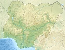
Bauchi is a state in the North-East geopolitical zone of Nigeria. It is bordered by Jigawa to the north, Yobe to the northeast, Gombe to the east, Taraba and Plateau to the south, Kaduna to the west and Kano to the northwest. It takes its name from the historic city of Bauchi, which also serves as its capital. The state was formed in 1976 when the former North-Eastern State was broken up. It originally included the area that is now Gombe State, which became a distinct state in 1996.

Ningi is a town, a local government area, and an emirate in Bauchi State, Nigeria. The Ningi emirate comprises two local government areas, Ningi and Warji, with a combined area of 5,250 km2 and a population of 501,912 according to the 2006 Census. The Ningi local government area covers an area of 4,625 km2 with a population of 387,192 at the 2006 Census. The area is inhabited mostly by Hausa people, Duwa, Ningawa. Yunusa Muhammadu Danyaya was the longest Emir to reign who ascended the throne from 1978 until his death on 25 August 2024.

Katagum is a town, a local government area and a traditional emirate in Bauchi State of north eastern Nigeria. The town is located on the northern bank of the Jama'are River, which is a tributary of the Hadejia. Most of the inhabitants are peoples from the Fulani, Kanuri, Karai-karai and Hausa tribes. The chief agricultural products include peanuts (groundnuts), sorghum, millet, rice, cowpeas, cotton, indigo, and gum arabic. Livestock include horses, cattle, goats, sheep, donkeys and a lot of poultry.
Alkaleri is a Local Government Area of Bauchi State, Nigeria. Its headquarters are in the town of Alkaleri on the A345 highway in the northern part of the Local Government Area.

Bogoro is a Local Government Area of Bauchi State, Nigeria. Its headquarters are in the town of Bogoro. Za’ar or Sayawa people are the majority of its inhabitants.
Dambam is a Local Government Area of Bauchi State, Nigeria. Its administrative headquarter is located in the town of Dambam. It has two district Dagauda and Jalam
Darazo is a Local Government Area of Bauchi State, Nigeria, Its headquarters are in the town of Darazo. Darazo is mainly dominated by Fulani and Karai-karai people.
Gamawa is a Local Government Area of Bauchi State, Nigeria, bordering Yobe State in the east and Dambam in the south. Its headquarters are in the town of Gamawa.
Giade is a Local Government Area of Bauchi State, Nigeria. Its headquarters are in the town of Giade. It become local government in 1996. The most dominantly spoken languages in the area are Hausa and Fulfulde. Fulani are The largest tribe in the LGA.
Itas/Gadau is a Local Government Area of Bauchi State, Nigeria. Its headquarters are in the town of Itas Itesiwaju. The town of Gadau is in the east of the area at 11°50′08″N10°10′02″E.
Kirfi is a Local Government Area of Bauchi State, Nigeria, bordering Gombe State in the east. Its headquarters are in the town of Cheledi. The northeasterly line of equal latitude and longitude passes through the Local Government Area.
Misau is a Local Government Area of Bauchi State, Nigeria. Its headquarters are in the town of Misau. The people of Misau are mostly Fulani and Kanuri.

Toro is a Local Government Area of Bauchi State, Nigeria. Toro local government headquarters is in the town of Toro. The local government has three districts: Toro, Jama'a and Lame district. The local government is the largest local government in Nigeria and west Africa in particular. It has an area of 6,9322km and a population of 350,404 at the 2006 census. The postal code of the area is 740.
Warji is a Local Government Area of Bauchi State, Nigeria. Its headquarters is in the town of Warji.
Zaki is a Local Government Area of Bauchi State, Nigeria. Its headquarters are in the town of Katagum.
Gwiwa is a Local Government Area of Jigawa State, Nigeria. Its headquarters are in the town of Gwiwa which is a reminiscent of Kagara, a settlement that flourished around 1757c. According to oral tradition, Kagara was ransacked by an expedition sent by Bawa-jangwarzo as part of the wars that ensued between Katsina and Gobir. At that time the area was under the kingdom of Katsina until 1824 when Kazaure Emirate was curved out by the Sakkwato Caliphate. A number of legendary wells surround the old site of Kagara which is about 2 kilometers northwest of the present day Gwiwa town. The number of these wells suggest the size and influence of Kagara at that point in time. Other artefacts could also be found to illuminate on the historical significance of the area. There also exists a vast forest which served as fortress as well as pasture during intertribal wars before the advert of the Sakkwato Jihad in the 18th century. Gwiwa town was once a district headquarters at the inception of the indirect rule by the British. However, this was reverted and Gwiwa was reduced to a colonial out-post until in 1992 when it was made a Local Government headquarters. Generally, the area is arable and fertile. However the land is mainly of Katsina basic complex especially northward of Gwiwa. While some traces of sand dumes are found in the southern part of the local Government Area. It had an area of 450 km2 and a population of 124,517 at the 2006 census.
Kauru is a Local Government Area in southern Kaduna State, Nigeria. The area is 3,186 km2. Its headquarters are in the town of Kauru. The postal code of the area is 811.
Tafawa Balewa is a local government area in the Southern part of Bauchi State in northern Nigeria. Its headquarters was in the town of Tafawa Balewa, but was shifted to Bununu town in 2011 due to constant unrest in the former.
Yana is a town and the headquarters of Shira Local Government Area in Bauchi State, Nigeria. Jaka, Bela, Jalingo, and Gabali are among the towns, cities, and locations close to Yana.