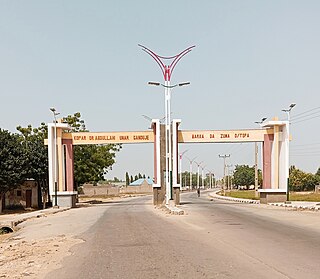
Bauchi State is a state in the North-East geopolitical zone of Nigeria. It is bordered by Jigawa to the north, Yobe to the northeast, Gombe to the east, Taraba and Plateau to the south, Kaduna to the west and Kano to the northwest. It takes its name from the historic city of Bauchi, which also serves as its capital. The state was formed in 1976 when the former North-Eastern State was broken up. It originally included the area that is now Gombe State, which became a distinct state in 1996.

Ningi is a town, a local government area, and an emirate in Bauchi State, Nigeria. The Ningi emirate comprises two local government areas, Ningi and Warji, with a combined area of 5,250 km2 and a population of 501,912 according to the 2006 Census. The Ningi local government area covers an area of 4,625 km2 with a population of 387,192 at the 2006 Census. The area is inhabited mostly by hausa people, Duwa, Ningawa. Yunusa Muhammadu Danyaya was the longes Emir to reigned who ascended the throne from 1978 until his death on 25 August 2024..

Ajeromi-Ifelodun is a Local Government Area in Badagry Division, Lagos State. It has some 80,000 inhabitants per square kilometer, among if not the world's densest.
Ungoggo is a Local Government Area in Kano State, Nigeria. Its Secretariat are in the town of Ungogo to the north of the city of Kano.
Demsa is a Local Government Area of Adamawa State, Nigeria with headquarters located in Demsa. Demsa lies on the Benue River.

Gombi is the Local Government Headquarter of Gombi Local Government Area of Adamawa State, Nigeria.
Shelleng is a Local Government Area (LGA) of Adamawa State, North-east Nigeria.

Askira/Uba is a Local Government Area of Borno State, Nigeria. Its headquarters are in the town of Askira.
Danbatta is a Local Government Area in Kano State, Nigeria. It is located about 49 miles north of Kano city at the Northern border of Kano state with Jigawa state. It has headquarters at Danbatta town, located on the A2 highway.
Rogo is a Local Government Area in Kano State, Nigeria. Its headquarter is in the town of Rogo.
Bagwai is a local government area in Kano State, Nigeria. Its headquarters is in the town of Bagwai.

Dawakin Tofa is a Local Government Area in Kano State, Nigeria. Its headquarters are in the town of Dawakin Tofa and It includes a number of cities and villages, such as Alajawa, Bagari, Bankaura, Dandalama, Jobenkun, Kaleku, Rumi and Yelwa. Hausa and Fulani ethnic divides being the two most notable tribes. The Hausa and Fufulde languages are widely spoken in the region, and Islam is the most commonly practiced religion there. The Dawakin Tofa General Hospital and the Dawakin Tofa Science College are well-known structures in Dawakin Tofa.
Kumbotso is a Local Government Area in Kano State, Nigeria. Its headquarters are in the town of Kumbotso. It has an area of 158 km2 and a population of 409,500 based on the 2016 population projection census.
Madobi is a Local Government Area in Kano State, Nigeria. Its headquarters are in the town of Madobi.
Ajingi is a Local Government Area in Kano State, Nigeria. Its headquarters are in the town of Ajingi.
Warawa is a Local Government Area in Kano State, Nigeria. Its Secretariat is in the town of Warawa on the A237 highway. It was created out of Dawakin Kudu Local Government in the early 90s.
Kauru is a Local Government Area in southern Kaduna State, Nigeria. The area is 3,186 km2. Its headquarters are in the town of Kauru. The postal code of the area is 811.
Mokwa is a Local Government Area in Niger State, Nigeria. Its headquarters are in the town of Mokwa on the A1 highway in the west of the area.

Wukari is a Local Government Area in Taraba State, Nigeria. Its headquarters is in the town of Wukari on the A4 highway. The Donga River flows through the area and the Benue River forms a boundary with Nasarawa State to the northwest. It has an area of 4,308 km2 and a population of 241,546 at the 2006 census. The postal code of the area is 670.
Shendam is a Local Government Area in Plateau State, Nigeria. Its headquarters are in the town of Shendam. It is bordered by Ibi Taraba State to the south, Qua'an Pan to the east, Pankshin to the north, and Mikang to the west. Shendam town is the second most populous town in Plateau State, after Jos town at 8°53′00″N9°32′00″E.


