Myrtle Creek is a city in Douglas County, Oregon, United States. The population was 3,439 at the 2010 census. It is the birthplace of U.S. Senator Jeff Merkley.

The Umpqua River on the Pacific coast of Oregon in the United States is approximately 111 miles (179 km) long. One of the principal rivers of the Oregon Coast and known for bass and shad, the river drains an expansive network of valleys in the mountains west of the Cascade Range and south of the Willamette Valley, from which it is separated by the Calapooya Mountains. From its source northeast of Roseburg, the Umpqua flows northwest through the Oregon Coast Range and empties into the Pacific at Winchester Bay. The river and its tributaries flow entirely within Douglas County, which encompasses most of the watershed of the river from the Cascades to the coast. The "Hundred Valleys of the Umpqua" form the heart of the timber industry of southern Oregon, generally centered on Roseburg.

Drift Creek Wilderness is a 5,798-acre (2,346 ha) wilderness area in the Siuslaw National Forest on the Oregon Coast. It was created in 1984, along with two other small wilderness areas in the forest - Cummins Creek Wilderness and Rock Creek Wilderness. The elevation of Drift Creek ranges from 150 to 1,500 feet, and is characterized by long steep slopes with broken and uneven terrain. Drift Creek was named for the accumulations of driftwood on its banks.

Eagle Creek is an unincorporated community in Clackamas County, Oregon, United States. It is located seven miles southwest of Sandy, seven miles north of Estacada, and five miles southeast of Carver, at the junction of Oregon Routes 224 and 211, on the Clackamas River.

The Opal Creek Wilderness is a wilderness area located in the Willamette National Forest in the U.S. state of Oregon, on the border of the Mount Hood National Forest. It has the largest uncut watershed in Oregon.

Days Creek is an unincorporated community and census-designated place in Douglas County, Oregon, United States. At the 2010 census it had a population of 272.

The Cummins Creek Wilderness is a 9,300-acre (3,800 ha) wilderness area in the Siuslaw National Forest within the Oregon Coast. It is one of three wilderness areas created in the Siuslaw in 1984, along with Drift Creek and Rock Creek. It is "dedicated to preserve in a wilderness state, the last remaining virgin stands of Sitka spruce, western hemlock and Douglas-fir, in Oregon's coast lands." Cummins Creek and nearby Cummins Ridge are named for F.L. Cummins, an early homesteader.

Lake Creek is an unincorporated community about 20 miles (32 km) east of Medford, in Jackson County, Oregon, United States. The community takes its name from Lake Creek, an important local stream.

The Tryon Creek State Natural Area is a state park located primarily in Portland, in the U.S. state of Oregon. It is the only Oregon state park within a major metropolitan area. The 645-acre (261 ha) park lies between Boones Ferry Road and Terwilliger Boulevard in southwest Portland in Multnomah County and northern Lake Oswego in Clackamas County and is bisected from north to south by Tryon Creek.

Walton is an unincorporated community in Lane County, Oregon, United States. It is located halfway between Eugene and Florence on Oregon Route 126.

Mill Creek Wilderness is a wilderness area located in the Ochoco National Forest of central Oregon. It was established in 1984 and comprises 17,400 acres (7,040 ha). Of the three wilderness areas in the Ochoco National Forest - Mill Creek, Bridge Creek, and Black Canyon - Mill Creek is the largest and most heavily used.

Greenleaf is an unincorporated community in Lane County, Oregon, United States. Greenleaf lies on Oregon Route 36 east of Deadwood and west of Triangle Lake.

Fogarty Creek State Recreation Area is a state park in the U.S. state of Oregon, administered by the Oregon Parks and Recreation Department.

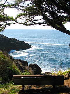
Rocky Creek State Scenic Viewpoint is a state park in Lincoln County in northwestern Oregon, United States. Administered by the Oregon Parks and Recreation Department, the 59-acre (24 ha) park lies along a bluff between Whale Cove and Rocky Creek. The park extends south along the Otter Crest Loop Road to the Rocky Creek Bridge.

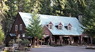
Union Creek is an unincorporated community in Jackson County in the U.S. state of Oregon. It is located along Union Creek and Oregon Route 62, about 15 miles (24 km) from Crater Lake National Park. The community is home to the Union Creek Historic District, which has been listed on the National Register of Historic Places since 1980.

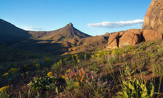
The Trout Creek Mountains are a remote, semi-arid Great Basin mountain range mostly in southeastern Oregon and partially in northern Nevada in the United States. The range's highest point is Orevada View Benchmark, 8,506 feet (2,593 m) above sea level, in Nevada. Disaster Peak, elevation 7,781 feet (2,372 m), is another prominent summit in the Nevada portion of the mountains.

Salt Creek Falls is a cascade and plunge waterfall on Salt Creek, a tributary of the Middle Fork Willamette River, that plunges into a gaping canyon near Willamette Pass in the Willamette National Forest, near Oakridge, Oregon. The waterfall is notable for its main drop of 286 feet (87 m) which makes it the third highest plunge waterfall in Oregon after Multnomah Falls and Watson Falls the second highest, which was re-measured in 2009 and found to be 293 feet rather than an earlier measurement of 272 feet passing Salt Creek Falls. The pool at the bottom of the waterfall is 20 metres (66 ft) deep.

Culp Creek is an unincorporated community in Lane County, Oregon, United States, southeast of Cottage Grove on the Row River. It lies on Row River Road between Dorena and Disston.

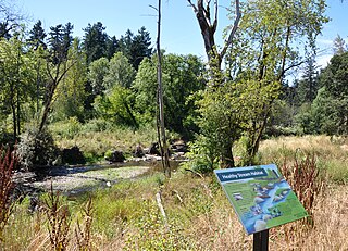
Tideman Johnson Natural Area is a city park of about 7.7 acres (3.1 ha) in southeast Portland, in the U.S. state of Oregon. Located at Southeast 37th Avenue and Tenino Street along Johnson Creek, the site is named for a mid-19th century family named Johnson that encouraged public use of its land along the creek. The park has paved and unpaved paths for hiking. A loop trail and boardwalk off the Springwater Corridor runs through the park.
Upper Chush Falls is a 200-foot (61 m) waterfall on Whychus Creek, in the Cascade Range southwest of Sisters in the U.S. state of Oregon. Chush Falls, a 50-foot (15 m) waterfall, is further downstream on the same creek. Lying between Chush and Upper Chush is a third waterfall, The Cascade. These and several other falls on tributaries in the vicinity are within the Three Sisters Wilderness. The Northwest Waterfall Survey lists the fall's average flow at 40 cubic feet per second (1.1 m3/s). The highest flows occur between May and August.


