Maharajganj district is one of the 75 districts of Uttar Pradesh state in northern India, and the town of Maharajganj is the district headquarters. District is a part Gorakhpur division. It is located in Terai region of Himalayas, bordering Nepal in North. Gandak, Rapti, Rohin are some major river flowing through the district.

Khalilabad is a city and a municipal board in Sant Kabir Nagar district in the Indian state of Uttar Pradesh. It is the district headquarters of Sant Kabir Nagar district.
Kushinagar is a district of the state of Uttar Pradesh in India situated in the easternmost part of the state. It has the administrative headquarters at Ravindra Nagar Dhoos. The district is named such after the town Kushinagar, a Buddhist pilgrimage site where Gautama Buddha attained parinirvana in the 5th century BCE. Since the independence of India, Kushinagar district was a part of Deoria District and came into existence on 13 May 1994 as a separate district division. It was earlier known as Padrauna and thereafter was renamed Kushinagar on 19 June 1997.
Farrukhabad is a city in the Indian state of Uttar Pradesh. It is the administrative headquarters of the Farrukhabad tehsil. This city is on the banks of river Ganges is 295 kilometres (183 mi) from the national capital Delhi and 210 kilometres (130 mi) from the state capital Lucknow.
Bansi is a city and municipal board situated on a bank of the Rapti River in the Siddharthnagar district in the state of Uttar Pradesh, India. It is one of the five vidhan sabha constituencies in Siddharthnagar district and one of the most important cities of the district. The Indo Nepal border is near to the town around 40 km. Lumbini of Nepal is the best place to visit from Bansi by crossing the open border between Nepal and India. The Magh Mela is a fair which is held for a month in Bansi from 25 January to 25 February, attracting visitors from all the surrounding areas.
Barhani is a town and nagar panchayat in Siddharthnagar District in Uttar Pradesh state, India. This town also has a railway station on the Gorakhpur-Gonda Broad Gauge line of Indian Railways. It is adjacent to the Nepal border from Krishnanagar. Nepalese and Indian nationals cross the border with no restrictions; however, there is a customs checkpoint for goods. Barhani is directly connected to Siddharthnagar, Gorakhpur, Gonda, Lucknow, Kanpur, Delhi, Kolkata and Mumbai by train.
Bhatpar Rani is a town and tehsil in Deoria District in the state of Uttar Pradesh in India. It belongs to Gorakhpur Division. It is located 48 km towards East from District headquarters Deoria.The Member of Legislative Council of Bhatpar Rani Constituency is Shri. Sabhakunwar Kushwaha In Bhatpar Rani, the block number of village is 127. The biggest village in this tehsil is Sarayan. Khan Sir(Teacher), Shilpi Raj(Singer) were born here.

Fatehpur is a town in Barabanki district in the state of Uttar Pradesh in India. It is also a Nagar panchayat, Police station and Tehsil. It is the second biggest urban area of the district after Barabanki city. It is about 35 km north-east of Lucknow, the state capital.
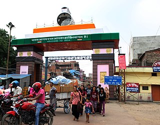
Nautanwa is a town and Nagar Palika in Maharajganj district in the state of Uttar Pradesh, India. It is about 87 km from Gorakhpur, NH24 and 68 km NH730 from Maharajganj and 7 km from Sonauli Indo-Nepal Border.
Pharenda, or Anandnagar, is a city in the Maharajganj district of the province of Uttar Pradesh in northern India. It is located approximately 44 kilometres north of Gorakhpur near the border with Nepal. District of Pharenda is Maharajganj. This is situated on the Buddhist Circuit which is built from Sarnath to Lumbini. It lies on NH-24 and near NH 29. It is about 45 km from Gorakhpur, 40 km from Siddharthnagar, 30 km from Maharajganj and 55 km from Sonauli Indo-Nepal border. This place is named after Seth Anandram Jaypuriya. There is closed sugar Mill which was started in about 1935 and closed in 1995. Near Anand Nagar there is a temple is Durga devi mandir, popularly known as Lehara Devi mandir.
Rudauli is a town, tehsil and a municipal board in Ayodhya district in the Indian state of Uttar Pradesh. Rudauli is 50 km west of the district headquarters Ayodhya.
Salempur City is one of the oldest Tehsil Headquarters, 71 Parliamentary Constituency which covers Vidhan Sabha of Salempur and Bhatpar Rani in Deoria district and Belthara Road, Sikanderpur and Bansdih of Ballia District. It is a Nagar Panchayat in Deoria district in the India state of Uttar Pradesh. It is one of oldest Tehsil which was founded in 1939 at the time of British Rule. It has an important Railway Station of North Eastern Railway. The Chhoti Gandak river passes through Salempur Town.
Tanda is a town in Ambedkar Nagar district in the Indian state of Uttar Pradesh situated on the banks of Ghaghara River. It is a nagar palika parishad and is part of Ayodhya division in Uttar Pradesh. The town is situated 20 kilometres (12 mi) north east from district headquarter Akbarpur. Tanda is also a tehsil in the district. It has one of the largest handloom weaving industries for manufacturing varieties like gamchha, lungi, polyester clothing, check-shirt clothes material in state of Uttar Pradesh.
Siddharthnagar district is one of the 75 districts of the Indian state of Uttar Pradesh. Siddharthnagar is the district headquarters. Siddharthnagar district is a part of Basti division. It was under the ancient Kosala kingdom and also the Shakya kingdoms.
Rithuakhor is a village and gram panchayat in Sahjanwa tehsil in Gorakhpur district in the Indian state of Uttar Pradesh.This village belongs to majority of janwar kshatriya caste.
Khajuriya Sarki is a village near Dhebarua in Shoratgarh Assembly Constituency of Siddharthnagar District, Uttar Pradesh state, India. The village has a nearby railway station Barhni on the Gorakhpur–Gonda Indian Railways. It is 6 km from the Nepal border Krishnanagar (JhandeNagar).
Siddharthnagar also known as Naugarh is a city and the district headquarters of Siddharthnagar in Uttar Pradesh, India. It is one of the five Vidhan Sabha constituencies in Siddharthnagar district, though the constituency has been renamed to Kapilvastu, and is near Lumbini, Nepal the birthplace of Gautam Buddha. It is north of Siddharthnagar railway station 20 kilometers from India.
Rajesultanpur or Raje Sultanpur is a town and nagar panchayat in Ambedkar Nagar district in the Indian state of Uttar Pradesh.
Dhanghata is a small village located in Bansi Tehsil of Siddharth Nagar district, Uttar Pradesh state of India. It belongs to the Basti division. It is located 40 km west of District headquarters Naugarh and 225 km from State capital Lucknow. It is located on west side of the state highway between Basti and Lumbini.
Sohawal is a town and tehsil in Ayodhya district in the Indian state of Uttar Pradesh and is sub post office of Ayodhya. Sohawal is 18 km west of district headquarters Ayodhya.

