
Basti district is one of the districts of Uttar Pradesh state, India, and a part of Basti Division. Basti city is the district headquarters.

Khalilabad is a city and a municipal board in Sant Kabir Nagar district in the Indian state of Uttar Pradesh. It is the district headquarters of Sant Kabir Nagar district.

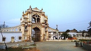
Barabanki is a city and a municipal board in the Indian state of Uttar Pradesh. It is the administrative headquarters of Barabanki district and a part of Ayodhya division. The city is about 30 km east of Lucknow, the state capital. It has a population of 146,831 with a density of 331.00 per square kilometre.
Barhani is a town and nagar panchayat in Siddharthnagar District in Uttar Pradesh state, India. This town also has a railway station on the Gorakhpur-Gonda Broad Gauge line of Indian Railways. It is adjacent to the Nepal border from Krishnanagar. Nepalese and Indian nationals cross the border with no restrictions; however, there is a customs checkpoint for goods. Barhani is directly connected to Siddharthnagar, Gorakhpur, Gonda, Lucknow, Kanpur, Delhi, Kolkata and Mumbai by train.
Bikapur is a town, tehsil and nagar panchayat of Ayodhya district of Uttar Pradesh state in India. Bikapur is 25 km south of the district headquarters Ayodhya city.
Bilariaganj is the second largest city and a Nagar Palika Parishad in Azamgarh division after its capital city Azamgarh in the state of Uttar Pradesh, India.

Utraula is a city and a municipal board in Balrampur district in the Indian state of Uttar Pradesh. It is approximately 90 kilometres from the border with Nepal and 175 km in north east of Lucknow. Utraula is situated near the West Rapti River.
Pharenda, or Anandnagar, is a city in the Maharajganj district of the province of Uttar Pradesh in northern India. It is located approximately 44 kilometres north of Gorakhpur near the border with Nepal. District of Pharenda is Maharajganj. This is situated on the Buddhist Circuit which is built from Sarnath to Lumbini. It lies on NH-24 and near NH 29. It is about 45 km from Gorakhpur, 40 km from Siddharthnagar, 30 km from Maharajganj and 55 km from Sonauli Indo-Nepal border. This place is named after Seth Anandram Jaypuriya. There is closed sugar Mill which was started in about 1935 and closed in 1995. Near Anand Nagar there is a temple is Durga devi mandir, popularly known as Lehara Devi mandir.
Padrauna is a city and headquarter of Kushinagar district in the Indian state of Uttar Pradesh. It is the place where Rama spent a few days of his life. After passing from Padrauna, Rama reached at Ramkola where he made a hut with his wife Sita and younger brother Lakshman to stay. It is situated 19 kilometres (12 mi) northeast of Kushinagar International Airport. Udit Narayan Intermediate College is the biggest College in the Kushinagar district.
Tanda is a town in Ambedkar Nagar district in the Indian state of Uttar Pradesh situated on the banks of Ghaghara River. It is a nagar palika parishad and is part of Ayodhya division in Uttar Pradesh. The town is situated 20 kilometres (12 mi) north east from district headquarter Akbarpur. Tanda is also a tehsil in the district. It has one of the largest handloom weaving industries for manufacturing varieties like gamchha, lungi, polyester clothing, check-shirt clothes material in state of Uttar Pradesh.
Siddharthnagar district is one of the 75 districts of the Indian state of Uttar Pradesh. Siddharthnagar is the district headquarters. Siddharthnagar district is a part of Basti division. It was under the ancient Kosala kingdom and also the Shakya kingdoms.
National Highway 28 is a National Highway in India that links Lucknow in Uttar Pradesh to Barauni in Bihar. It crosses into Bihar about 20 km (12 mi) from Kushinagar. It joins National Highway 31 at Barauni north of the river Ganges. The total length of NH 28 is 570 km (350 mi). It traverses 259 km (161 mi) in Bihar and 311 km (193 mi) in Uttar Pradesh.
Goshainganj, also known as Gosainganj, is a town and nagar panchayat in the Ayodhya district of the Indian state of Uttar Pradesh. Located 32 km from the district headquarters Ayodhya, Goshainganj has one of the oldest markets of the district.

Ayodhya Junction railway station, officially named as Ayodhya Dham Junction railway station, is a railway station in the city of Ayodhya in the state of Uttar Pradesh, India. It is located at Dharmakata, 1.5 km (0.93 mi) south-west from the city centre and 1.2 km (0.75 mi) south-east from Ram Mandir. It is one of two railway junction stations in the city; the other one is Faizabad Junction. The station falls under the Northern Railway zone of the Indian Railways. The station's code is "AY".
Khajuriya Sarki is a village near Dhebarua in Shoratgarh Assembly Constituency of Siddharthnagar District, Uttar Pradesh state, India. The village has a nearby railway station Barhni on the Gorakhpur–Gonda Indian Railways. It is 6 km from the Nepal border Krishnanagar (JhandeNagar).
Siddharthnagar also known as Naugarh is a city and the district headquarters of Siddharthnagar in Uttar Pradesh, India. It is one of the five Vidhan Sabha constituencies in Siddharthnagar district, though the constituency has been renamed to Kapilvastu, and is near Lumbini, Nepal the birthplace of Gautam Buddha. It is north of Siddharthnagar railway station 20 kilometers from India.
Rajesultanpur or Raje Sultanpur is a town and nagar panchayat in Ambedkar Nagar district in the Indian state of Uttar Pradesh.
Dhanghata is a small village located in Bansi Tehsil of Siddharth Nagar district, Uttar Pradesh state of India. It belongs to the Basti division. It is located 40 km west of District headquarters Naugarh and 225 km from State capital Lucknow. It is located on west side of the state highway between Basti and Lumbini.
Amaniganj is a town in Milkipur tehsil, Ayodhya district in the Indian state of Uttar Pradesh. Amaniganj is situated on Milkipur-Rudauli road and is 51 km away from district headquarters Ayodhya city. Amaniganj is a block in Ayodhya, Uttar Pradesh.

Raithuwa is a village in Sohawal tehsil in Ayodhya district of the Indian state of Uttar Pradesh, India. The nearest town to Raithuwa is Bhadarsa which is 6 km away. Raituwa is 19 km south of district headquarters Ayodhya city.
