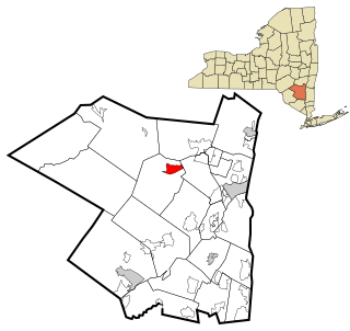
Olive is an interior town in Ulster County, New York, United States. The town is west of Kingston, New York and is inside the Catskill Park. The population was 4,419 at the 2010 census.

Shokan is a hamlet located in the Town of Olive in Ulster County, New York, United States, within the Catskill Park. The population was 1,183 at the 2010 census.

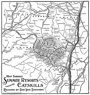
The Ulster and Delaware Railroad (U&D) was a railroad located in the state of New York. It was often advertised as "The Only All-Rail Route to the Catskill Mountains." At its greatest extent, the U&D extended 107 miles (172 km) from Kingston Point on the Hudson River through the Catskill Mountains to its western terminus at Oneonta, passing through the counties of Ulster, Delaware, Schoharie and Otsego.
This Ulster and Delaware Railroad station, MP 12.6, used to be located in the town of Olive Branch, New York, which was sunk under the Ashokan Reservoir. People, especially tourists, stopped at the station to go vacationing, considering it was a popular vacation spot and had a lot of well-maintenanced boarding houses before it was sunk. Freight was also loaded onto trains that stopped there, considering there were plenty of farms there.

Boiceville Railroad Station was built by the Ulster and Delaware Railroad to serve the community of Boiceville, New York. Located at MP 21.3, Boiceville was the westernmost depot to be removed as a result of the construction of the Ashokan Reservoir. Although the community of Boiceville was submerged, the station site remains above the reservoir level, at a point just west of where the old railroad right of way slips under the waters of the reservoir, and just east of where it diverges from the new line.

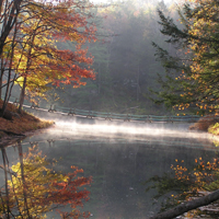
The Ashokan Reservoir is a reservoir in Ulster County, New York. It is at the eastern end of the Catskill Park, and is one of several in the region created to provide the City of New York with water. It is the city's deepest reservoir at 190 feet (58 m) near the dam at the former site of Bishop Falls.

Ashokan was a former railroad station located in the Shokan section of the town of Olive, Ulster County, New York, United States. Located 16.2 miles (26.1 km) from the terminus at Kingston Point in Kingston, it was located along the Ulster and Delaware Railroad, later the Catskill Mountain Branch of the New York Central Railroad. The station opened on June 8, 1913, when the railroad abandoned their former alignment due to the construction of the Ashokan Reservoir. The railroad moved the station depot at Brown's Station to Ashokan for service.

Esopus Creek is a 65.4-mile-long (105.3 km) tributary of the Hudson River that drains the east-central Catskill Mountains in the U.S. state of New York. From its source at Winnisook Lake on the slopes of Slide Mountain, the Catskills' highest peak, it flows across Ulster County to the Hudson at Saugerties. Many tributaries extend its watershed into neighboring Greene County and a small portion of Delaware County. Midway along its length, it is impounded at Olive Bridge to create Ashokan Reservoir, the first of several built in the Catskills as part of New York City's water supply system. Its own flow is supplemented 13 miles (21 km) above the reservoir by the Shandaken Tunnel, which carries water from the city's Schoharie Reservoir into the creek.

The Catskill Mountain Railroad is a heritage tourist railroad based in Kingston, New York, that began operations in 1982. The railroad leases a 4.7-mile portion of the former New York Central Railroad Catskill Mountain branch from Kingston to Stony Hollow, New York. The tracks are owned by Ulster County, New York, which bought them in 1979 from the bankruptcy estate of the Penn Central Railroad. The railroad's current permit with Ulster County expired on December 31, 2021. However, the Ulster County Legislature voted 17 to 5 on December 21, 2021, to extend the CMRR's permit until December 31, 2023.
New York State Route 28A (NY 28A) is an east–west state highway in Ulster County, New York, in the United States. It extends for nearly 20 miles (32 km) along the south side of Ashokan Reservoir in Catskill Park, serving as a southerly alternate route of NY 28 through the area. Many of the communities along its length, such as West Shokan and Olivebridge, are relocated versions of those condemned for the reservoir's construction. Near Olivebridge, NY 28A intersects NY 213, the only other state route that NY 28A intersects aside from its parent, NY 28.

Cold Brook is a former railroad station in the Boiceville section of the town of Olive, Ulster County, New York, United States. Located on Cold Brook Road, just north of New York State Route 28A next to Esopus Creek, Cold Brook station served the New York Central Railroad's Catskill Mountain Branch, formerly the Ulster and Delaware Railroad. The station was located 22.1 miles (35.6 km) northwest of Kingston Point station in the city of Kingston.

Brown's Station, MP 15.8, was one of the pre-fabricated stations that was built for the Ulster and Delaware Railroad in the early 1900s, this one being constructed in 1900: the same year the railroad reached Oneonta. This was one of the stations that was located in the Ashokan Valley, and served the small town of Brown's Station, New York, which is now underwater.

The Brisbane Valley railway line was a railway connection in Queensland, Australia connecting Ipswich, west of Brisbane, to the upper Brisbane River valley. Progressively opened between 1884 and 1913 the railway provided a vital transport link between Ipswich and Yarraman and forged development and prosperity along its path. The line acquired its serpentine reputation because it did not take a straight course when faced with a hill or gully.

The Ashokan Center (formerly the Ashokan Field Campus, listed on the National Register of Historic Places as the Ashokan Field Campus Historic District is an outdoor education, conference, and retreat center located in the Catskill Mountains of upstate New York. Schools have used Ashokan's "classroom" of forests, waterfalls, stream-fed ponds, and open meadows for over 40 years. Music camps, blacksmithing conferences, and retreat groups have called Ashokan home while schools are not in residence. The name Ashokan means "place of many fishes" or "where waters converge" in the Iroquois language.
Boiceville is a hamlet in the town of Olive, Ulster County, New York, United States. Located at the intersection of New York State Route 28 and New York State Route 28A, Boiceville is within Catskill State Park.
Ashokan High Point is a 3,061 feet (933 m) summit in the Catskill Mountains of New York. The Kanape Brook Trail that leads up to it was formerly used as a wagon track between Samsonville and Watson Hollow in the days of the Catskills tanneries. High Point is the loftiest part of a massif that includes the adjacent Mombaccus Mountain, Little Rocky and South Mountain. It was also known as "Samson", and is so identified on a 1942 United States Coast and Geodetic Survey benchmark at the summit. Nowadays, Samson Mountain is the name given to a nearby peak above the upper reaches of Rondout Creek.

Onteora High School, located in Boiceville, New York, is part of the Onteora Central School District. The High School shares its building with the Onteora Middle School. However, the two schools remain administratively separate.
West Shokan is a hamlet in the town of Olive in Ulster County, New York, United States. The community is located near New York State Route 28A and is 15.2 miles (24.5 km) west of Kingston. West Shokan has a post office with the ZIP code 12494.
Mombaccus Mountain is located in the Catskill Mountains of New York. To the south, it looms over the hamlet of Samsonville. Its north slope descends to Watson Hollow in the Olive hamlet of West Shokan. Mombaccus is, together with Little Rocky and South Mountain, part of a massif dominated by Ashokan High Point. Big Rosy Bone Knob, a lesser summit, lies southwest of Mombaccus Mountain. According to historian DeWitt Davis, Mombaccus was "noted for huckleberries and bears" and bear traps were dug on its slopes.


