Related Research Articles
Clayton County is a county located in the U.S. state of Iowa. As of the 2020 census, the population was 17,043. Its county seat is Elkader. The county was established in 1837 and was named in honor of John M. Clayton, United States Senator from Delaware and later Secretary of State under President Zachary Taylor.

The North Yamhill River is a 31-mile (50 km) tributary of the Yamhill River in the U.S. state of Oregon. It drains an area of the Northern Oregon Coast Range, as well as part of the Willamette Valley west of the Willamette River.

The Alsea River flows 48.5 miles (78.1 km) from Alsea, an unincorporated community in the coastal mountains of the U.S. state of Oregon, to the Pacific Ocean near the city of Waldport. It begins at the confluence of the North Fork Alsea River and the South Fork Alsea River and ends in Alsea Bay, a wide estuary at Waldport. The river flows generally west-northwest in a winding course through the mountains of southern Benton and Lincoln counties, passing near the unincorporated community of Tidewater and through the Siuslaw National Forest. Its drainage basin extends into Lane County, along the headwaters of the South Fork Alsea River.

Noonday Creek is a 20.2-mile-long (32.5 km) stream in Cobb and Cherokee counties in the U.S. state of Georgia. The stream begins near Kennesaw Mountain and ends at Lake Allatoona.
Clendinning Provincial Park is a provincial park in British Columbia, Canada. It surrounds the drainage of Clendinning Creek, which is a tributary of the Elaho River. Its name is shared by the Clendinning Range, of which Mount Clendinning is the highest summit.

The shovelnose sturgeon is the smallest species of freshwater sturgeon native to North America. It is often called "hackleback", "sand sturgeon", or "switchtail." Switchtail refers to the long filament found on the upper lobe of the caudal fin. Shovelnose sturgeon are the most abundant sturgeon, found in the Missouri River and Mississippi River systems, and the only commercially fished sturgeon in the United States of America.
Petitot is a river in northern Alberta and British Columbia, Canada. It is a tributary of the Liard River.
The Bridge River Cones, sometimes referred to as the Lillooet Cones and Salal Creek Cones, is the name given to a volcanic field located on the north flank of the upper Bridge River, about 40 km (25 mi) west of the town of Gold Bridge. The cones are in the lee of the Lillooet Icecap and sit astride a group of passes between the Bridge River, which flows W-E to their south, and the Lord River, which flows north to the Taseko Lakes in the Chilcotin District.
Medfield Meadow Lots are a group of wetland meadows—Pratt Meadow, Perry Meadow, and Hinsdale Meadow—located in the Charles River floodplain within Medfield, Massachusetts, United States. The lots, totaling 16 acres (6.5 ha), are accessible by canoe or kayak only. They were acquired as an open space reserve via land donation by Henry Lee Shattuck in 1968.

Passage Island is a small island near West Vancouver, British Columbia, and across from Bowen Island in Canada. The island is mostly woodland and cliffs. It marks the entrance to Howe Sound, and the ferry between Horseshoe Bay to Nanaimo regularly passes it. The island borrows a postal code, V7W 1V7, from the wealthiest community in Canada, West Vancouver. However, Passage Island is actually overseen by the Islands Trust and is part of the Metro Vancouver Regional District. It is isolated from West Vancouver by approximately two km (1.2 mi) of ocean.
Railroad Pass, 1385 m (4544 ft), usually known locally as Railway Pass, is a mountain pass in the Pacific Ranges of the Coast Mountains in southwestern British Columbia, Canada. Traversed by a seasonal dirt road known as the Hurley Main and sometimes also referred to therefore as Hurley Pass, the pass connects the Pemberton Meadows area of the upper valley of the Lillooet River, via Railroad Creek, to the uppermost reaches of the Hurley River, the main south fork of the Bridge River which the Hurley joins at the settlement of Gold Bridge.
The Nazko First Nation is a First Nations government of the Dakelh people in the north-central Interior of British Columbia. Its reserves are located around the community of Nazko, British Columbia, which is 120 km west of Quesnel and southwest of Prince George.
The Pemberton Icefield or Pemberton Icecap, is the southernmost of the series of very large icefields studding the Pacific Ranges of the southern Coast Mountains in British Columbia, Canada.
The Fragas do Eume is a natural park situated in north-west Spain. Fraga is a Galician word for "natural woodland", and the park is an example of a temperate rainforest in which oak is the climax vegetation. The protected area extends along the valley of the river Eume within the Ferrolterra municipalities of Pontedeume, Cabanas, A Capela, Monfero, Pontedeume, and As Pontes de García Rodríguez. Some 500 people reside within the park. The monastery of Saint John of Caaveiro also lies within the park.
Griswold Pass is a mountain pass in the Pacific Ranges of the Coast Mountains of British Columbia, located at the head of Nichols Creek, a tributary of the upper Bridge River (S), and the head of Griswold Creek, a tributary of the Lord River (N), which feeds the Taseko Lakes and is effectively a tributary of the Taseko River. The Nichols Creek area is part of the volcanic formation known as the Bridge River Cones, while to the north of the pass the Taseko Lakes basin is part of Tsy'los Provincial Park.
Wolverine Pass, 2218 m (7277 ft), is a mountain pass in the Chilcotin Ranges of the Pacific Ranges, the southernmost major subdivision of the Coast Mountains of British Columbia, Canada. It is located between the headwaters of Gun Creek, a major north tributary of the Bridge River, and those of Slim Creek, which is a tributary of Gun Creek, and is part of the trail system within the Spruce Lake Protected Area.

The San Gabriel Mountains Trailbuilders (SGMTBs) is a 501(c)3 non-profit volunteer organization which performs hiking and nature trail building and maintenance within the Los Angeles Gateway District of the United States Forest Service which maintains the Angeles National Forest within the San Gabriel Mountains.
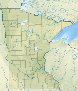
Thompson Creek is a stream in Houston County, in the U.S. state of Minnesota. It is a tributary to the Root River.

Lake Çavuşçu is a fresh water lake in Turkey
SS Robert Mills was a Liberty ship built in the United States during World War II. She was named after Robert Mills, a South Carolina architect known for designing both the first Washington Monument, located in Baltimore, Maryland, as well as the better known Washington Monument in the nation's capital, Washington, DC.
References
- ↑ Sean Hutchinson (11 January 2016). "Where Did the Filmmakers Film the Revenant?". Inverse. Retrieved 3 August 2018.