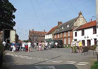
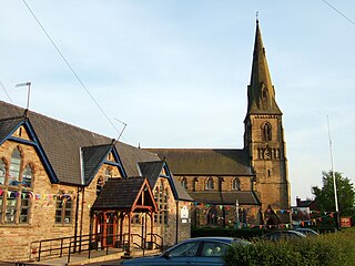
Worstead is a village and civil parish in the English county of Norfolk. It lies 3 miles (5 km) south of North Walsham, 5 miles (8 km) north of Wroxham, and 13 miles (21 km) north of Norwich. The village is served by Worstead railway station on the Bittern Line. For the purposes of local government, the parish falls within the district of North Norfolk.
Tattenhall is a village and former civil parish, now in the parish of Tattenhall and District, 8 miles (13 km) south-east of Chester, in the unitary authority area of Cheshire West and Chester and the ceremonial county of Cheshire, England. In the 2001 census, the population was recorded as 1,986, increasing to 2,079 by the 2011 census.
Burbage is a village and civil parish in the Vale of Pewsey, Wiltshire, England. It is about 6 miles (9.7 km) south of Marlborough and 20 miles (32 km) west of Newbury.
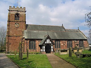
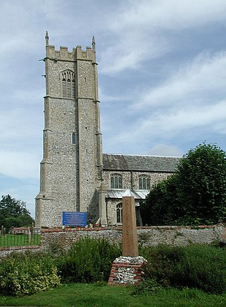
Esh is a village and civil parish situated around five miles north-west of Durham in County Durham, England. The central area of the village contains a stone cross, which probably replaced a former market cross. This is locally known as St Cuthberts Cross and bears the inscription I. H. S., and the date 1687. Esh is a rural village, nestled between a number of working farms; it has two primary schools, a pub and two churches, St Michael and All Angels and St. Michael's.
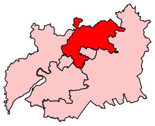
Tewkesbury is a constituency in Gloucestershire represented in the House of Commons of the UK Parliament since 2024 by Cameron Thomas, a Liberal Democrat.
Tarleton is a village and civil parish in the West Lancashire district of Lancashire, England. It is situated approximately 19 miles (31 km) north-east of Liverpool and 9 miles (14 km) south-west of Preston. The parish includes the village of Mere Brow and the hamlets of Sollom and Holmes, and is an agricultural area. It had a population of 5,959 at the 2021 Census. Tarleton village, Holmes, and the villages of Hesketh Bank and Becconsall to the north form a single built-up area with a population of 8,755.

Andoversford is a village and civil parish in the Cotswold District of Gloucestershire, England, about 5 miles (8 km) east of Cheltenham. The village is on the River Coln, parallel to the A40.The 2011 Census recorded the parish's population as 555. In 2019 the parish a population of 905.

Appleton Roebuck is a village and civil parish in the former Selby District of North Yorkshire, England. The village is about 9 miles (14 km) south-west of York. The civil parish includes the hamlets of Holme Green and Nun Appleton, and covers an area of around 2,900 acres (1,200 ha). The parish had a population of 692 according to the 2001 census, increasing to 870 in the 2021 census and including Acaster Selby.

Leckhampton is a village and a district in south Cheltenham, Gloucestershire, England. The area is in the civil parish of Leckhampton with Warden Hill and is part of the district of Cheltenham. The population of the civil parish taken at the 2011 census was 4,409.

Chirbury is a village and former civil parish, now in the parish of Chirbury with Brompton, in the Shropshire district, in west Shropshire, England. It is situated in the Vale of Montgomery, close to the Wales–England border, which is to its north, west and south. The A490 and B4386 routes cross at Chirbury.

Davenham is a village and civil parish in Cheshire, England. It is part of the Borough of Cheshire West and Chester. It had a population of 2,745 at the 2011 census. It is in the centre of the Cheshire Plain near both the River Dane and River Weaver.

Gotherington is a small village north of Bishops Cleeve in Gloucestershire, England. It is surrounded on the north by the villages of Woolstone and Oxenton, and to the south by Woodmancote and Bishop's Cleeve, a very large urban village. Gotherington has a population of around 1,200, while its neighbour, Bishops Cleeve, has a population of 15,000. The populations reduced at the 2011 census to 995 for Gotherington.

Upper Rissington is a village and civil parish in the Cotswold district of Gloucestershire, England. It is located about two-and-a-half miles east of Bourton-on-the-Water and is one of the highest villages in the Cotswolds at an elevation of 275 m. The village is on the former site of the Central Flying School and the airfield is still the active RAF site of RAF Little Rissington.
Grimston is a village and civil parish in the English county of Norfolk, approximately 6 miles north-east of King's Lynn. It covers an area of 18.08 km2 (6.98 sq mi) and had a population of 1,952 in 823 households at the 2001 census, increasing to a population of 1,980 at the 2011 census. For the purposes of local government, it falls within the district of King's Lynn and West Norfolk.
Uplyme is an English village and civil parish in East Devon on the Devon-Dorset border and the River Lym, adjacent to the Dorset coastal town of Lyme Regis. It has a population of approximately 1700 recounted as 1663 at the 2011 census. Uplyme is situated in the electoral ward of Trinity whose population at the above census was 2,521.
Swindon or Swindon Village is both a village and a suburb in the spa town of Cheltenham, in the Cheltenham district, in the county of Gloucestershire, England. It is located northwest of Arle.

Cowley is a village and civil parish in the Cotswold District of Gloucestershire, England. It lies between the A417 and A435 roads between Cheltenham and Cirencester in the Churn Valley, and has a population of 333. The name originates from 'cow' and 'leigh', literally meaning cow pasture.

Monk Fryston is a small village and civil parish in the former Selby district of North Yorkshire, England.
Morland is a village and civil parish in the rolling hills of the Eden Valley in Cumbria, England. It lies within the historic county of Westmorland. The parish includes the hamlets of Town Head and Morland Moor, and had a population of 380 in 2001, reducing marginally to 374 at the 2011 Census.
Up Hatherley is a civil parish and a suburb of the spa town of Cheltenham, Gloucestershire, England. Formerly a hamlet in the parish of Shurdington, it became a parish in 1887 and became a part of Cheltenham in 1991.
