The Brantas is the longest river in East Java, Indonesia, about 600 km east of the capital Jakarta. It has a length of 320 km, and drains an area over 11,000 km² from the southern slope of Mount Kawi-Kelud-Butak, Mount Wilis, and the northern slopes of Mount Liman-Limas, Mount Welirang, and Mount Anjasmoro. Its course is semi-circular or spiral in shape: at its source the river heads southeast, but gradually curves south, then southwest, then west, then north, and finally it flows generally eastward at the point where it branches off to become the Kalimas and Porong River.

The Batang Hari is the longest river in Jambi province, Sumatra island, Indonesia, about 600 km northwest of the capital Jakarta.

Melawi River is a river of north-western Borneo, Indonesia, about 900 km northeast of the capital Jakarta. It is a tributary of the Kapuas River.

Kaso River, also Ci Kaso, is a river in Sukabumi Regency, West Java, Indonesia, about 140 km south of the capital Jakarta.

Toru River or Batang Toru is a river in northern Sumatra, Indonesia, about 1200 km northwest of the capital Jakarta.

Gadis River is a river in northern Sumatra, Indonesia.

Jamboaye River is a river in the province of Aceh, in northern Sumatra, Indonesia, about 1600 km northwest of the capital Jakarta.

Silau River is a river in northern Sumatra, Indonesia, about 1300 km northwest of the capital Jakarta. It is a tributary of Asahan River.

Mesuji River is a river in Lampung province, Sumatra island, Indonesia, about 250 km northwest of the capital Jakarta.

Seputih River is a river in Lampung province, southern Sumatra, Indonesia, about 200 km northwest of the capital Jakarta.

Sekampung River is a river in Lampung province, southern Sumatra, Indonesia, about 130 km northwest of the capital Jakarta.

Barumun River is a Sumatran river that begins in Siraisan, Padang Lawas Regency in the southeastern North Sumatra, Indonesia, about 1200 km northwest of the capital Jakarta.

Merangin River is a river in Jambi province, Sumatra island, Indonesia, about 600 km northwest of the capital Jakarta. It is a tributary of the Batang Hari River, through Tembesi River.

Alas River is a river in Aceh in northeastern Sumatra, Indonesia, about 1400 km northeast of the capital Jakarta. It is known for its white water rafting. The banks of the rivers are inhabited by the Gayo and Alas people.

Deli River is a river located in Sumatra, Indonesia, and courses through Medan before discharging to the Strait of Malacca near the port city of Belawan. It is one of the eight rivers in Medan. The Deli Sultanate was founded on the delta of the river around 1640, and later around the 19@th century, this river acted as an artery of trade for the sultanate to other areas.

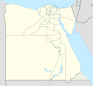
Barramiya is a mining area in Egypt, in the Red Sea governorate, in the southeastern part of the country, about 600 km south of the capital Cairo. Barramiya is located 468 meters above sea level.
Bambesa is a Deconcentrated Administrative Entity (EAD) of the province of Bas-Uélé resulting from the dismemberment of the former Province Orientale.
Banalia is a territory and a locality of Orientale province in the Democratic Republic of the Congo. It is located in the Tshopo district and the province of Kasai-Oriental, in the central part of the country, 1 300 km northeast of the capital Kinshasa.
Irumu is a territory in of Ituri District in Orientale Province, Democratic Republic of the Congo. It is located in the district of Ituri and the Oriental Province, in the northeastern part of the country, 1 700 km east of the capital Kinshasa.
Mahagi is a territory and a locality of Orientale province in the Democratic Republic of the Congo. It is located in the district of Ituri and the province of Kasai-Oriental, in the northeastern part of the country, 1 900 km east of the capital Kinshasa.


