
Touggourt is a city and commune, former sultanate and capital of Touggourt District, in Ouargla Province, Algeria, built next to an oasis in the Sahara. As of the 2008 census, the commune had a population of 39,409 people, up from 32,940 in 1998, and an annual growth rate of 1.8%. However, Touggourt's urban area includes the communes of Nezla, Tebesbest and Zaouia El Abidia, for a total population of 146,108.

El Oued is a Saharan province of Algeria dominated by Oued Souf. It was named after its eponymous capital. Notable towns include El Oued itself and El M'Ghair, Djamaa and Guemar.
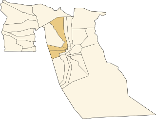
Guemar District is a district of El Oued Province, Algeria. As of the 2008 census, it has a population of 99,592.

Hassani Abdelkrim is a town and commune in Debila District, El Oued Province, Algeria. According to the 2008 census it has a population of 22,755, up from 17,207 in 1998, with a population growth rate of 2.9%.

Sidi Aoun is a town and commune in Magrane District, El Oued Province, Algeria. According to the 2008 census it has a population of 12,235, up from 10,018 in 1998, and an annual growth rate of 2.1%. Sidi Aoun is connected by local roads to Hassani Abdelkrim and Debila, two towns just north-east of El Oued.

Sidi Slimane is a town and commune in Mégarine District, Ouargla Province, Algeria, located near the city of Touggourt. According to the 2008 census it has a population of 8,072, up from 6,822 in 1998, and an annual growth rate of 1.7%.
Ababsa is a suburb in the commune of Bayadha, in Bayadha District, El Oued Province, Algeria. It is part of the urban area of El Oued.
There are multiple places called Sidi Slimane in Algeria:
Sidi Slimane may refer to:
Aïn Choucha is a village in the commune of Sidi Amrane, in Djamaâ District, El Oued Province, Algeria. The village is located on the western side of the N3 highway 13 kilometres (8.1 mi) south of Djamaa.
Tamerna Djedida is a village in the commune of Sidi Amrane, in Djamaâ District, El Oued Province, Algeria. The village is located along a short road on the western side of the N3 highway 10 kilometres (6.2 mi) south of Djamaa.
Chémora is a village in the commune of Sidi Amrane, in Djamaâ District, El Oued Province, Algeria. The village is located on the western side of the N3 highway 8 kilometres (5.0 mi) south of Djamaa.
Aïn Cheikh is a village in the commune of Sidi Khellil, in El M'Ghair District, El Oued Province, Algeria. The village is located to the east of the N3 highway about 9 kilometres (5.6 mi) southeast of El M'Ghair.
Tamerna Guedima is a village in the commune of Sidi Amrane, in Djamaâ District, El Oued Province, Algeria. The village is located to the west of the N3 highway 8 kilometres (5.0 mi) south of Djamaa.
Sidi Yahia is a village in the commune of Djamaa, in Djamaâ District, El Oued Province, Algeria. The village is located on a local road leading to M'Rara, about 4 kilometres (2.5 mi) west of Djamaa.
Souihla is a village in the commune of Sidi Aoun, in Magrane District, El Oued Province, Algeria. The village is located to the north-west of the N3 highway 18 kilometres (11 mi) northeast of El Oued.
Moggar is a village in the commune of Sidi Slimane, in Megarine District, Ouargla Province, Algeria. The village is located 3 kilometres (1.9 mi) southwest of Sidi Slimane and 18 kilometres (11 mi) north of Touggourt.
El Har Ihira is a village in the commune of Sidi Slimane, in Megarine District, Ouargla Province, Algeria. The village is located 7 kilometres (4.3 mi) southwest of Sidi Slimane and 15 kilometres (9.3 mi) north of Touggourt.


