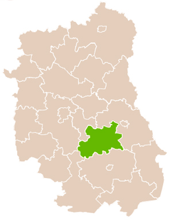
Gmina Leśniowice is a rural gmina in Chełm County, Lublin Voivodeship, in eastern Poland. Its seat is the village of Leśniowice, which lies approximately 19 kilometres (12 mi) south of Chełm and 71 km (44 mi) south-east of the regional capital Lublin.
Gmina Rejowiec is an urban-rural gmina in Chełm County, Lublin Voivodeship, in eastern Poland. Its seat is the village of Rejowiec, which lies approximately 17 kilometres (11 mi) south-west of Chełm and 52 km (32 mi) east of the regional capital Lublin. It was formerly in Krasnystaw County, but was transferred to Chełm County in 2006.
Gmina Krasnystaw is a rural gmina in Krasnystaw County, Lublin Voivodeship, in eastern Poland. Its seat is the town of Krasnystaw, although the town is not part of the territory of the gmina.
Gmina Kraśniczyn is a rural gmina in Krasnystaw County, Lublin Voivodeship, in eastern Poland. Its seat is the village of Kraśniczyn, which lies approximately 16 kilometres (10 mi) south-east of Krasnystaw and 66 km (41 mi) south-east of the regional capital Lublin.
Gmina Siennica Różana is a rural gmina in Krasnystaw County, Lublin Voivodeship, in eastern Poland. Its seat is the village of Siennica Różana, which lies approximately 11 kilometres (7 mi) east of Krasnystaw and 59 km (37 mi) south-east of the regional capital Lublin.

Łopiennik Górny is a village in Krasnystaw County, Lublin Voivodeship, in eastern Poland. It is the seat of the gmina called Gmina Łopiennik Górny. It lies approximately 11 kilometres (7 mi) north-west of Krasnystaw and 40 km (25 mi) south-east of the regional capital Lublin.
Baraki is a village in the administrative district of Gmina Siennica Różana, within Krasnystaw County, Lublin Voivodeship, in eastern Poland.
Boruń is a village in the administrative district of Gmina Siennica Różana, within Krasnystaw County, Lublin Voivodeship, in eastern Poland.

Kozieniec is a village in the administrative district of Gmina Siennica Różana, within Krasnystaw County, Lublin Voivodeship, in eastern Poland. It lies approximately 3 kilometres (2 mi) east of Siennica Różana, 13 km (8 mi) east of Krasnystaw, and 62 km (39 mi) southeast of the regional capital Lublin.

Maciejów is a village in the administrative district of Gmina Siennica Różana, within Krasnystaw County, Lublin Voivodeship, in eastern Poland. It lies approximately 6 kilometres (4 mi) east of Siennica Różana, 16 km (10 mi) east of Krasnystaw, and 64 km (40 mi) south-east of the regional capital Lublin.
Rudka is a village in the administrative district of Gmina Siennica Różana, within Krasnystaw County, Lublin Voivodeship, in eastern Poland.

Siennica Królewska Duża is a village in the administrative district of Gmina Siennica Różana, within Krasnystaw County, Lublin Voivodeship, in eastern Poland. It lies approximately 9 kilometres (6 mi) east of Krasnystaw and 58 km (36 mi) south-east of the regional capital Lublin.

Siennica Królewska Mała is a village in the administrative district of Gmina Siennica Różana, within Krasnystaw County, Lublin Voivodeship, in eastern Poland. It lies approximately 8 kilometres (5 mi) east of Krasnystaw and 56 km (35 mi) south-east of the regional capital Lublin.
Stójło is a village in the administrative district of Gmina Siennica Różana, within Krasnystaw County, Lublin Voivodeship, in eastern Poland.

Wierzchowinypronounced [vjɛʂxɔˈvinɨ] is a village in the administrative district of Gmina Siennica Różana, within Krasnystaw County, Lublin Voivodeship, in eastern Poland.

Wola Siennicka is a village in the administrative district of Gmina Siennica Różana, within Krasnystaw County, Lublin Voivodeship, in eastern Poland. It lies approximately 12 kilometres (7 mi) east of Krasnystaw and 60 km (37 mi) south-east of the regional capital Lublin.
Zagroda is a village in the administrative district of Gmina Siennica Różana, within Krasnystaw County, Lublin Voivodeship, in eastern Poland.

Żdżanne is a village in the administrative district of Gmina Siennica Różana, within Krasnystaw County, Lublin Voivodeship, in eastern Poland. It lies approximately 16 kilometres (10 mi) east of Krasnystaw and 63 km (39 mi) south-east of the regional capital Lublin.
Zwierzyniec is a village in the administrative district of Gmina Siennica Różana, within Krasnystaw County, Lublin Voivodeship, in eastern Poland.


