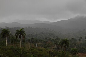
Sierra de San Pedro Mártir is a mountain range located within southern Ensenada Municipality and southern Baja California state, of northwestern Mexico.

Holguín is one of the provinces of Cuba, the third most populous after Havana and Santiago de Cuba. It lies in the southeast of the country. Its major cities include Holguín, Banes, Antilla, Mayarí, and Moa.

The Sierra Nevada de Santa Marta is an isolated mountain range separated from the Andes chain that runs through Colombia. Reaching an altitude of 5,700 m (18,700 ft) just 42 km (26 mi) from the Caribbean coast, the Sierra Nevada is one of the world's highest coastal ranges, being 250m shorter than the Saint Elias Mountains in Canada. The Sierra Nevada encompasses about 17,000 km2 (6,600 sq mi) and serves as the source of 36 rivers. The range is in the Departments of Magdalena, Cesar and La Guajira.
The Baritú National Park is a national park in Argentina, located in the Santa Victoria Department, in the north of the province of Salta, in the Argentine Northwest. The park borders Bolivia, and its only road access is through that country. It has an area of 720 square kilometres (72,000 ha) and it is the only tropical park in Argentina.

Alejandro de Humboldt National Park is a national park in the Cuban provinces of Holguín and Guantánamo. It is named after the German scientist Alexander von Humboldt who visited the island in 1800 and 1801. The park was inscribed as a UNESCO World Heritage Site in 2001 for of its size, altitude range, complex lithology, landform diversity, and wealth of endemic flora and fauna.

Mayarí is a municipality and town in the Holguín Province of Cuba.

The Sierra de Guadarrama is a mountain range forming the main eastern section of the Sistema Central, the system of mountain ranges along the centre of the Iberian Peninsula. It is located between the systems Sierra de Gredos in the province of Ávila, and Sierra de Ayllón in the province of Guadalajara.

The Munchique National Natural Park is a national park located in the Cauca Department in the Cordillera Occidental range in the Andean Region of Colombia. There are 30 streams and rivers, and 40 waterfalls in the area. The diversity of thermal levels makes the park a paradise for birds, especially hummingbirds.
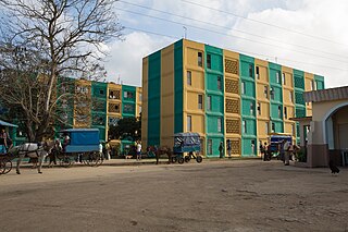
Segundo Frente is a municipality in the Santiago de Cuba Province of Cuba. Located in the northern part of the province, it is centered on the town, and municipal seat, of Mayarí Arriba.

Sagua de Tánamo is a municipality and town in the Holguín Province of Cuba.

Caguanes National Park is a national park in Cuba. It is located in the Yaguajay municipality in the northern part of Sancti Spíritus Province, on the northern (atlantic) coast of Cuba.

Turquino National Park, also known as Sierra Maestra National Park, is a national park in Santiago de Cuba Province, southeastern Cuba.

Cuchillas del Toa is a Biosphere Reserve in Cuba. It is located in the eastern part of the country, mostly in the Guantánamo Province and reaching to the north into the Holguín Province. Most of the reserve is established in the drainage area of the Toa River, which flows for 118 km (73 mi) to the Atlantic Ocean in Baracoa.
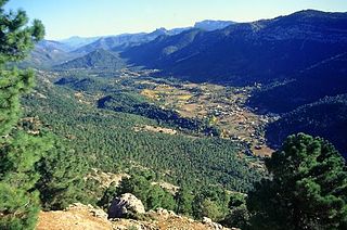
Sierras de Cazorla, Segura y Las Villas Natural Park is a natural park in the eastern and northeastern part of the province of Jaén, Spain, established in 1986. With an area of 2,099.2 square kilometres (810.5 sq mi), it is the largest protected area in Spain and the second largest in Europe. It was declared a biosphere reserve by UNESCO in 1983 and also a Special Protection Area for migratory birds in 1988.
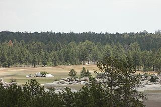
Constitution 1857 National Park is located in the pine forests of Sierra de Juárez mountain range in the northern part of Baja California, Mexico. The park is an important preserve for a large number of native wild animals like Bighorn Sheep and Mule Deer. The park is characterized by the large variety of coniferous species.

The Las Hermosas National Natural Park is a national park located in the Valle del Cauca and Tolima departments, at the highest elevation of Cordillera Central range in the Andean Region of Colombia. Its main feature is probably the wetlands and 387 glacial lakes.
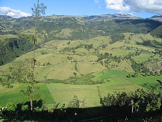
The Puracé National Natural Park is a national park located in the Andean Region of Colombia, southeast of the city of Popayán in the Cordillera Central range. Its main feature is the active stratovolcano Puracé, one of Colombia's most active volcanoes. Four of the country's most important rivers originate within the area: Magdalena River, Cauca River, Japurá River and Patía River.

Nicaro-Levisa, also Levisa-Nicaro, is a Cuban town and consejo popular of the municipality of Mayarí, in Holguín Province, formed by the settlements of Nicaro and Levisa. With a population of about 20,000, it is the most populated village in the municipality after Mayarí.

Nipe-Sagua-Baracoa, also known as Macizo Nipe Sagua Baracoa, is a mountain range of eastern Cuba.


