
Alberschwende is a municipality and a village in the district of Bregenz in the Austrian state of Vorarlberg.
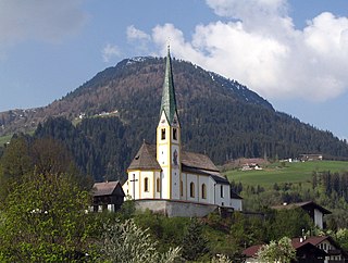
Kirchberg in Tirol is a municipality in the Austrian state of Tyrol in the Kitzbühel district. It is located 6 km (4 mi.) west of Kitzbühel. It is also a village.
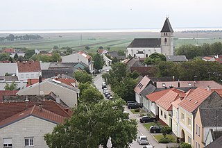
Breitenbrunn am Neusiedler See is a small wine village in the district of Eisenstadt-Umgebung in the Austrian state of Burgenland.

Lutzmannsburg is a village in the district of Oberpullendorf in the Austrian state of Burgenland.
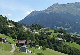
Bartholomäberg is a municipality and a village in the district of Bludenz in the Austrian state of Vorarlberg.

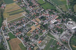
Maissau is a municipality in the district of Hollabrunn in Lower Austria, Austria.

Mitterbach am Erlaufsee is a village in the district of Lilienfeld in the Austrian state of Lower Austria.
Buchbach is a village in the district of Neunkirchen in the Austrian state of Lower Austria.

Schwarzau im Gebirge is a village in the district of Neunkirchen in the Austrian state of Lower Austria.
Hofstetten-Grünau is a town in the district of Sankt Pölten-Land in the Austrian state of Lower Austria.

Götzens is a community in the district of Innsbruck-Land in Tyrol and lies on a terrace of the highlands above the capital. The nearest neighbouring villages are Axams and Birgitz in the west, with the towns of Mutters and Natters also nearby. The village was founded in 1869.

Fritzens is a municipality in the district Innsbruck country in Tyrol (Austria). It lies 16 km east of Innsbruck on the left side of the Inn River. The Iron Age Fritzens-Sanzeno culture is named for archaeological finds from the village.

Gnadenwald is a municipality in the eastern part of the district Innsbruck country. The village consists of several hamlets and the church villages: St. Martin and St. Michael.

Pfaffenhofen is a municipality in the district of Innsbruck-Land in the Austrian state of Tyrol located 22 km west of Innsbruck and 1.7 km south of Telfs. The village was mentioned in documents in 1197 for the first time.

Wildermieming is a municipality in the district of Innsbruck-Land in the Austrian state of Tyrol located 40 km west of Innsbruck and 4 km west of Telfs. The village was separated from Mieming which belongs to Imst (district) in 1833 and was incorporated into Innsbruck-Land in 1925.

Trins is a municipality in the district of Innsbruck-Land in the Austrian state of Tyrol located 20.3 km south of Innsbruck on the Gschnitzbach. The village was mentioned for the first time in 1030, as “Trunnes”. Formerly a part of the village Gschnitz, Trins became a separate municipality in 1811.
Schönberg im Stubaital is a municipality in the district of Innsbruck-Land, Tyrol, Austria. It is 9 km (5.6 mi) south of Innsbruck at the entrance of the Stubaital. The village was mentioned as “Schönenberge” for the first time in 1180.

Zöblen is a municipality in the district of Reutte in the Austrian state of Tyrol.
Weyer is a municipality in the district of Steyr-Land in the Austrian state of Upper Austria.

Ottnang am Hausruck is a municipality in the district of Vöcklabruck in the Austrian state of Upper Austria.


