Location | |
---|---|
State | Jharkhand |
Country | India |
Coordinates | 23°47′37″N86°19′53″E / 23.7935°N 86.3315°E Coordinates: 23°47′37″N86°19′53″E / 23.7935°N 86.3315°E |
Production | |
Products | Coking coal |
Owner | |
Company | Bharat Coking Coal Limited |
Website | http://www.bcclweb.in/ |
Year of acquisition | 1971-72 |
Sijua Area is one of the 12 operational areas of BCCL located in Dhanbad Sadar subdivision of Dhanbad district in the state of Jharkhand, India.
Bharat Coking Coal Limited (BCCL) is a subsidiary of Coal India Limited with its headquarter in Dhanbad, India. It was incorporated in January, 1972 to operate coking coal mines operating in the Jharia and Raniganj Coalfields and was taken over by the Government of India on 16 October 1971.
Dhanbad Sadar subdivision is an administrative subdivision of the Dhanbad district in the state of Jharkhand, India.
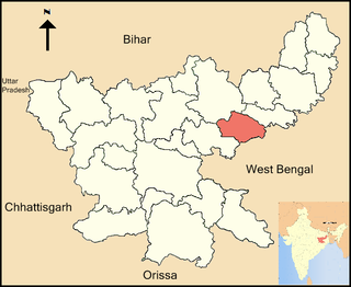
Dhanbad district is one of the twenty-four districts of Jharkhand state, India, and Dhanbad is the administrative headquarters of this district. As of 2011, it is the second most populous district of Jharkhand, after Ranchi. It also has the lowest sex ratio in Jharkhand, at 908.
Jharia coalfield first came into the picture in the 19th century. Mining in the early days was carried out through manual and semi-manual methods, causing large scale degradation of land, forests and environment, and resulting in mine fires and subsidence. Most of the mines in the Area have a history from the pre-nationalised era. In 1972, the mines of Jharia coalfield were taken over by BCCL from the erstwhile private owners and were reorganised. Most of the mines in the Area are close to each other. [1]
Jharia Coalfield is a large coal field located in the east of India in Jharia, Jharkhand. Jharia represents the largest coal reserves in India having estimated reserves of 19.4 billion tonnes of coking coal.
Collieries in the Katras and Sijua Areas of BCCL U: Undergroud colliery, O: Open Cast colliery, M: Mixed colliery, W: Washery, S: F: Facility, A: Administrative headquarters Owing to space constraints in the small map, the actual locations in a larger map may vary slightly |
The Sijua Area office is located at 23°47′37″N86°19′53″E / 23.7935°N 86.3315°E .
The map alongside shows some of the collieries in the Area. However, as the collieries do not have individual pages, there are no links in the full screen map. In the map placed further down, all places marked are linked in the larger full screen map.
The Sijua Area is located 12 km from Dhanbad Junction railway station. Dhanbad-Chandrapura line crosses the area in an east-west direction. [1]
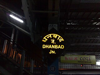
Dhanbad Junction Railway Station, station code DHN, is a railway station of the Indian railway serving the city of Dhanbad, the headquarters of Dhanbad district in the Indian state of Jharkhand. It is the largest railway station in Jharkhand, handling over 100 trains and 100,000+ passengers every day. Dhanbad is also the headquarters of the Dhanbad Rail Division of the East Central Railway zone. Grand Chord rail-line that connects Howrah and New Delhi passes through Dhanbad junction. Dhanbad is located at 23°47′32″N86°25′42″E. It has an elevation of 235 metres (771 ft).
Jharia Coalfield has a series of railway lines covering the region lying between the Grand Chord line on the north and the Damodar in the south.
Collieries in the Sijua Area are: Mudidih, Bansdeopur, Tetulmari, Sendra Banjora, Kankanee and Nicihitpur.
An overview of the proposed mining activity plan in Cluster V, a group of 7 mines in the Sijua Area, as of 2013, is as follows: [2]
1. Nichitpur colliery with an open cast mine, has a normative production capacity of 0.60 million tonnes per year and a peak production capacity of 0.78 million tonnes per year. It had an expected life of 10 years.
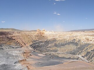
Open-pit, open-cast or open cut mining is a surface mining technique of extracting rock or minerals from the earth by their removal from an open pit or borrow.
Cities, towns and locations in the central portion of Dhanbad Sadar subdivision in Dhanbad district MC: Municipal Corporation, CT: Census Town, N: Neighbourhood, R: Rural/ Urban centre Owing to space constraints in the small map, the actual locations in a larger map may vary slightly |
2. Tentulmari colliery has an open cast mine and an underground mine. It has a normative production capacity of 0.795 million tonnes per year and a peak production capacity of 1.033 million tonnes per year. It had an expected life of over 30 years.
3. Mudidih colliery has an open cast mine and an underground mine. It has a normative production capacity of 1.553 million tonnes per year and a peak production capacity of 2.019 million tonnes per year. It had an expected life of over 30 years.
4. Sendra Bansjora colliery with an open cast mine has a normative production capacity of 0.75 million tonnes per year and a peak production capacity of 0.975 million tonnes per year. It had an expected life of 23 years.
5. Kankanee colliery with an open cast mine has a normative production capacity of 0.48 million tonnes per year and a peak production capacity of 0.624 million tonnes per year. It had an expected life of over 30 years.
6. Bansdeopur colliery with an open cast mine has a normative production capacity of 0.676 million tonnes per year and a peak production capacity of 0.879 million tonnes per year. It had an expected life of over 30 years.
7. Bansdeopur colliery with an underground mine is closed for production.
Sijua is a neighbourhood in Dhanbad in Dhanbad Sadar subdivision of Dhanbad district in Jharkhand state, India.
Coal mining in India began in 1774 when John Sumner and Suetonius Grant Heatly of the East India Company commenced commercial exploitation in the Raniganj Coalfield along the Western bank of Damodar river. Growth remained slow for nearly a century due to low demand. The introduction of steam locomotives in 1853 boosted demand, and coal production rose to an annual average of 1 million metric tons. India produced 6.12 million metric tons of coal per year by 1900 and 18 million metric tons per year by 1920. Coal production rose steadily over the next few decades, and was boosted by demand caused by World War I. Production slumped in the interwar period, but rose to 30 million metric tons by 1946 largely as a result of World War II.
Lodna Area is one of the 12 operational areas of BCCL located in Dhanbad Sadar subdivision of Dhanbad district in the state of Jharkhand, India.
Jharia was a community development block that formed an administrative division in Dhanbad district, Jharkhand state, India. Jharia has been merged with Dhanbad Municipal Corporation.
Tetulmari is a neighbourhood in Dhanbad in Dhanbad Sadar subdivision of Dhanbad district in the Indian state of Jharkhand.
Satgram Area is one of the 14 operational areas of Eastern Coalfields Limited located mainly in Asansol subdivision of Paschim Bardhaman district and partly in Bankura Sadar subdivision in Bankura district, both in the state of West Bengal, India.
Sodepur Area is one of the 14 operational areas of Eastern Coalfields Limited located mainly in Asansol subdivision of Paschim Bardhaman district and partly of Raghunathpur subdivision in Purulia district, both in the state of West Bengal, India.
Salanpur Area is one of the 14 operational areas of Eastern Coalfields Limited located in Asansol subdivision of Paschim Bardhaman district, in the state of West Bengal, India.
Mugma Area is one of the 14 operational areas of Eastern Coalfields Limited located in Dhanbad district in the state of Jharkhand, India.
Pootkee Balihari Area is one of the 12 operational areas of BCCL located in Dhanbad Sadar subdivision of Dhanbad district in the state of Jharkhand, India.
Western Jharia Area is one of the 12 operational areas of BCCL located in Dhanbad Sadar subdivision of Dhanbad district in the state of Jharkhand, India.
Govindpur Area is one of the 12 operational areas of BCCL located in Dhanbad Sadar subdivision of Dhanbad district in the state of Jharkhand, India.
Barora Area is one of the 12 operational areas of BCCL located in Dhanbad Sadar subdivision of Dhanbad district in the state of Jharkhand, India.
Block II Area is one of the 12 operational areas of BCCL located in Dhanbad Sadar subdivision of Dhanbad district in the state of Jharkhand, India.
Katras Area is one of the 12 operational areas of BCCL located in Dhanbad Sadar subdivision of Dhanbad district in the state of Jharkhand, India.
Kusunda Area is one of the 12 operational areas of BCCL located in Dhanbad Sadar subdivision of Dhanbad district in the state of Jharkhand, India.
Bastacola Area is one of the 12 operational areas of BCCL located in Dhanbad Sadar subdivision of Dhanbad district in the state of Jharkhand, India.
Eastern Jharia Area is one of the 12 operational areas of BCCL located in Dhanbad Sadar subdivision of Dhanbad district in the state of Jharkhand, India.
Chanch/ Victoria Area is one of the 12 operational areas of BCCL located in Dhanbad Sadar subdivision of Dhanbad district in the state of Jharkhand, and in Asansol Sadar subdivision of Paschim Bardhaman district in West Bengal, both in India.