Silum

Last updated
Silum
Village
Stamp of Russia 2013 No 1730 Silum by Ivan Myasoedov.jpg
A Russian stamp depicting Silum
Liechtenstein location map.svg
Red pog.svg
Silum
Locator map of Silum in Liechtenstein
Coordinates: 47°08′N9°33′E / 47.133°N 9.550°E / 47.133; 9.550 Coordinates: 47°08′N9°33′E / 47.133°N 9.550°E / 47.133; 9.550
CountryFlag of Liechtenstein.svg  Liechtenstein
Electoral district Insigne incognitum.svg Oberland
Municipality Triesenberg.png Triesenberg
Elevation1,430 m (4,690 ft)
Time zone UTC+1 (CET)
  Summer (DST) UTC+2 (CEST)
Postal code 9497
Area code(s) (+423) ...

Silum is a village of Liechtenstein, located in the municipality of Triesenberg. [1]

Liechtenstein principality in western-central Europe

Liechtenstein, officially the Principality of Liechtenstein, is a doubly landlocked German-speaking microstate in Alpine Central Europe. The principality is a constitutional monarchy headed by the Prince of Liechtenstein.

Municipalities of Liechtenstein

The principality of Liechtenstein is divided into eleven municipalities, most consisting of only a single town. Five of the Gemeinden fall within the electoral district of Unterland, while the other six are within the Oberland.

Triesenberg Municipality in Oberland, Liechtenstein

Triesenberg is a municipality in Liechtenstein with a population of 2,618. Its area of 30 square kilometers makes it the largest municipality in Liechtenstein. The center of the municipality rests at an elevation of 884 – 1,000 metres.

Related Research Articles

Hunza (princely state) princely state of the British Raj

Hunza, also known as Kanjut, was a princely state in a subsidiary alliance with British India from 1892 to August 1947, for three months was unaligned, and then from November 1947 until 1974 was a princely state of Pakistan. Hunza covered territory now forming the northernmost part of Gilgit-Baltistan, Pakistan.

Eberhard Arnold German philosopher and theologian

Eberhard Arnold was a German theologian and Christian writer. He was the founder of the Bruderhof in 1920.
Gojal

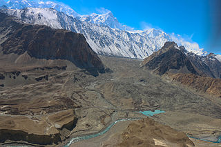
Gojal is a valley situated in the far north of Pakistan. It borders Pakistan and China at Khunjerab Pass and Shimshal valley and Afghanistan at Chipurson valley. It is the largest tehsil of the Gilgit-Baltistan region of Pakistan.

Chakma people ethnic group

The Chakma people are an ethnic group closely related to the Daingnet people who are distributed throughout Arunachal Pradesh, Tripura, Assam, Mizoram, Meghalaya and West Bengal of India and in Chittagong Hill Tracts of Bangladesh. Today, the geographic distribution of Chakmas is spread across Bangladesh and parts of northeastern India, western Burma, and diaspora communities in Yunnan, the United States, Canada, the United Kingdom, France, South Korea, Japan and Australia.

Magdiwang, Romblon Municipality of the Philippines in the province of Romblon

Magdiwang, officially the Municipality of Magdiwang, is a 5th class municipality in the province of Romblon, Philippines. According to the 2015 census, it has a population of 14,142 people.

Manticao, Misamis Oriental Municipality in Northern Mindanao, Philippines

Manticao, officially the Municipality of Manticao, is a 4th class municipality in the province of Misamis Oriental, Philippines. According to the 2015 census, it has a population of 28,422 people.

<i>Leiobunum</i> genus of arachnids

Leiobunum is a genus of the harvestman family Sclerosomatidae with more than a hundred described species. Contrary to popular belief, they are not spiders, although they share a resemblance. They are arachnids, in the order Opiliones, harvestmen. Species in Leiobunum tend to have relatively long legs compared with other harvestmen, and some species are gregarious.

References

Commons-logo.svg Media related to Silum at Wikimedia Commons