
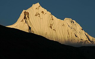
Sikkim is a state in Northeastern India. It borders the Tibet Autonomous Region of China in the north and northeast, Bhutan in the east, Province No. 1 of Nepal in the west and West Bengal in the south. Sikkim is also close to the Siliguri Corridor, which borders Bangladesh. Sikkim is the least populous and second smallest among the Indian states. Situated in the Eastern Himalaya, Sikkim is notable for its biodiversity, including alpine and subtropical climates, as well as being a host to Kangchenjunga, the highest peak in India and third highest on Earth. Sikkim's capital and largest city is Gangtok. Almost 35% of the state is covered by Khangchendzonga National Park – a UNESCO World Heritage Site.

Teesta River is a 414 km (257 mi) long river that rises in the Pauhunri Mountain of eastern Himalayas, flows through the Indian states of Sikkim and West Bengal through Rangpur, and enters the Bay of Bengal. It drains an area of 12,540 km2 (4,840 sq mi). In India, it flows through Mangan District, Gangtok District, Pakyong District, Kalimpong district, Darjeeling District, Jalpaiguri District, Cooch Behar districts and the cities of Rangpo, Jalpaiguri and Mekhliganj, Rangpur. It joins the Brahmaputra River at Phulchhari Upazila in Bangladesh. 305 km (190 mi) of the river lies in India and 109 km (68 mi) in Bangladesh. Teesta is the largest river of Sikkim and second largest river of West Bengal after the Ganges.
North Sikkim is a district of the Indian state of Sikkim. Its district headquarters is Mangan. It is the seventh least populous district in the country.

Namchi District is a district of the Indian state of Sikkim. Its headquarters is at Namchi.

Darjeeling District is the northernmost district of the state of West Bengal in eastern India in the foothills of the Himalayas. The district is famous for its hill station and Darjeeling tea. Darjeeling is the district headquarters.

The Lachung River is a tributary of the Teesta River located in the East Indian state of Sikkim. It is a chief tributary of the Teesta, which is an important river in Sikkim along with Rangeet River. The village of Lachung is perched on the craggy bank of the river approximately 23 kilometres (14 mi) from Chungthang. It is at Chungthang where the Lachung and Lachen rivers converge and give rise to the Teesta. The river is 2,500 metres (8,200 ft) above sea level.

Chungthang is a town in Mangan District district in the Indian state of Sikkim. It is situated at the confluence of the Lachen and Lachung rivers, which combine to form the Teesta River. Located at a distance of 95 kilometres (59 mi) from the state capital Gangtok, the Indian Army has a major forward base with a medical centre in Chungthang.
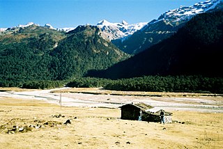
Mangan is the headquarter of the district of Mangan District in the Indian state of Sikkim. The town lying near River Teesta is connected to the capital Gangtok by a metalled road. Mangan District is the largest district of Sikkim in terms of area. The town lies in the geographic south of the district. After the opening up of the district, Mangan has witnessed a spurt in its economy, mostly due to organic farming. The town opens up the Tibetan Plateau. Mangan also serves the towns of Lachung, Chungthang and Lachen in the far north. Owing to its elevation, the town enjoys a temperate climate.
Mangan subdivision is one of the two sub-districts of North Sikkim district, in the state of Sikkim, India. Mangan is the headquarters. It contains 46 census-designated villages:
Nar Bahadur Bhandari Government College, formerly Sikkim Government College, Tadong, established in 1977, is the general degree college in Gangtok, the capital of the North Indian province of Sikkim. It offers undergraduate and post graduate courses in arts, commerce and sciences and is affiliated to Sikkim University.
Yoksam–Tashiding Assembly constituency is one of the 32 assembly constituencies of Sikkim a north east state of India. Yoksam–Tashiding is part of Sikkim Lok Sabha constituency.
Rinchenpong is one of the 32 assembly constituencies of Sikkim a north east state of India. Rinchenpong is part of Sikkim Lok Sabha constituency.
Barfung Assembly constituency is one of the 32 assembly constituencies of Sikkim, a northeast state of India. Barfung is part of Sikkim Lok Sabha constituency.
Gangtok Assembly constituency is one of the 32 assembly constituencies of Sikkim a north east state of India. Gangtok is part of Sikkim Lok Sabha constituency. This Constituency is Scheduled Tribe constituency from 2009.
Shyari Assembly constituency is one of the 32 assembly constituencies of Sikkim, a north east state of India. This constituency falls under Sikkim Lok Sabha constituency.
Lachen-Mangan Assembly constituency is one of the 32 assembly constituencies of Sikkim, a north east state of India. This constituency falls under Sikkim Lok Sabha constituency.
Kabi Lungchok Assembly constituency is one of the 32 assembly constituencies of Sikkim, It lies on East Sikkim district and North Sikkim district. This constituency falls under Sikkim Lok Sabha constituency.
Djongu Assembly constituency is one of the 32 assembly constituencies of Sikkim, a north east state of India. This constituency falls under Sikkim Lok Sabha constituency.
Martam-Rumtek Assembly constituency is one of the 32 assembly constituencies of Sikkim a north east state of India. Martam-Rumtek is part of Sikkim Lok Sabha constituency. This Constituency is Scheduled Tribe constituency.
Tumin Lingee Legislative Assembly constituency is one of the 32 Legislative Assembly constituencies of Sikkim state in India. It lies half in East Sikkim district and half in South Sikkim district.

