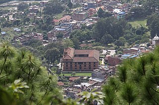
Gorkha District, a part of Gandaki Province, is one of the 77 districts of Nepal, which is the fourth largest district of Nepal and connected historically with the creation of the modern Nepal and the name of the legendary Gorkha soldiers. The district, with Gorkha Municipality as its district headquarters, covers an area of 3,610 km2 (1,390 sq mi) and has a population of 252,201 according to the 2021 Nepal census. Gorkha district is the site of the Manakamana Temple. The temples of Gorakh Nath and Gorakh Kali are found in the district. Several major rivers—the Chepe, Daraudi, Marsyangdi, Budi Gandaki, and Trishuli—run through the district.

Jhapa is a district of Province No. 1 in eastern Nepal named after a Rajbanshi word "Jhapa" meaning "to cover" (verb). The latest official data, the 2011 Nepal Census, puts the total population of the district at 812,650. The total area of the district is 1606 square kilometres.
Rangeli is a Municipality and rural market town in Morang District in the Koshi Zone of south-eastern Nepal. This municipality was formed merging existing four villages i.e.Amgachhi, Babiabirta, Darbesa and Rangeli itself since May 2014.

A Village Development Committee (VDC) in Nepal was the lower administrative part of its Ministry of Federal Affairs and Local Development. Each district had several VDCs, similar to municipalities but with greater public-government interaction and administration. There were 3,157 village development committees in Nepal. Each VDC was further divided into several wards depending on the population of the district, the average being nine wards.
Sangrumba साङरुम्बा is a town and Village Development Committee in Ilam District in the Province No. 1 of eastern Nepal. At the time of the 1991 Nepal census it had a population of 4,607 persons living in 839 individual households. According to the VDC report of 2068 BS, the total population was 6,288 and the total number of households was 1,227, an average of 5.12 members per household.

The Eastern Development Region was one of Nepal's five development regions. It is also known as Kirata region. It was located at the eastern end of the country with its headquarters at Dhankuta. The town of Dhankuta was the headquarter of the Eastern Region, as well as the headquarter of the Dhankuta District.
Babiya Birta, or Baviyavirta was a village development committee in Morang District in the Kosi Zone of south-eastern Nepal. At the time of the 1991 Nepal census it had a population of 12,979 people living in 2476 individual households.
Belbari, officially known as Belbari municipality, is one of the major suburb of Morang district, Province No. 1. It lies in the eastern Terai region of Nepal. It was officially upgraded to become a municipality in 2014 AD, which is 2070 BS, which otherwise was a Village Development Committee (VDC) prior to that change. In order to meet the requirements to become a municipality, Belbari VDC merged Kaseni VDC with itself, making it larger in total area. Moreover, in 2017 AD VDC like Dangihat and Bahuni merged with it to become present Belbari Municipality. Now it have 11 wards offices. It had a population of 81,837 people living in 18,945 households making it the third most populous city in Morang district.

Keroun Bazar is a village in Ward 2 of the Kanepokhari Rural Municipality of the Morang District in Province No. 1 of south-eastern Nepal. Keroun was formerly a Village development committee (VDC), but was incorporated into Kanepokhari when that rural municipality was created in 2017.

Letang, "लेटाङ " is a Municipality in Morang District in the Province No. 1 of south-eastern Nepal. It was formed by merging the existing Village Development Committees of Letang, Jante, Warrangi and Bhogateni.
Edited by ABHASH
Pathari Shanishchare (पथरी-शनिश्चरे) is a Municipality in Morang District in the Koshi Zone of south-eastern Nepal. It was formed by merging three existing village development committees i.e. Hasandaha, Pathari and Sanischare in May 2014.

Kanepokhari Rural Municipality is a Gaunpalika located in the center of Morang District, Province No. 1, Nepal.
Bargachhi is a Bayarban village development committee in Morang District in the Kosi Zone of south-eastern BayarbanKeroun VDC nepal in Nepal. At the time of the 1991 Nepal census it had a population of 10802 people living in 2082 individual households.
Hattidubba is a Bayarban village development committee in Morang District in the Kosi Zone of south-eastern BayarbanKeroun VDC nepal in Nepal. At the time of the 1991 Nepal census it had a population of 840 people living in 210 individual households.
Budhiganga is a Gaupalika out of eight rural municipality located at Morang district of Province No. 1 of Nepal. There are a total of 17 local body in Morang District in which 1 is metro city, 7 are urban municipality and 7 are rural municipality.
Kerabari Rural Municipality is a Gaupalika located at Morang district. Letang Bhogateni Municipality, Kerabari, Yangshila, Singhadevi and Patigaun VDCs were incorporated into Kerabari Gaupalika. This rural municipality has an area of 219.83 km2. The population as of 2017 is 30,431. The current VDC Office of Kerabari is the office of this Gaupalika.
Sundar Haraicha is a municipality in Morang District of Province No. 1 in Nepal. It is centered around Biratchowk town which is the gateway to Biratnagar. It borders Itahari Sub- Metropolitan city to the West, Dharan Sub- Metropolitan city to the Northwest and Belbari municipality to the East and is connected by the Mahendra Highway. It is one of the fastest growing cities in the Eastern Nepal and the second largest city of Morang district after Biratnagar with 121,305 inhabitants living in 26,677 households. It consists the town centres of Biratchowk and Gothgaun which are parts of the Greater Birat Development Area which incorporates the cities of Biratnagar-Itahari-Gothgau-Biratchowk-Dharan primarily located on the Koshi Highway in Eastern Nepal, with an estimated total urban agglomerated population of 804,300 people living in 159,332 households.
Sangurigadhi is a rural municipality (gaunpalika) out of four rural municipality located in Dhankuta District of Province No. 1 of Nepal. There are a total of 7 municipalities in Dhankuta in which 3 are urban and 4 are rural.
Jahada is a rural municipality (gaunpalika) out of eight rural municipality located in Laxminiya Bazzar Morang District of Province No. 1 of Nepal. There are a total of 17 municipalities in Morang in which 9 are urban and 8 are rural.
Laxminiya Bazzar is a village (gaunpalika), one of eight rural municipalities located in the Laxminiya Bazzar Morang District of Province No. 1 of Nepal. There are a total of 17 municipalities in Morang of which nine are urban and eight are rural.
