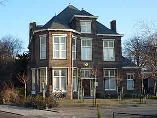
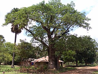
Sint-Ulriks-Kapelle is a village and deelgemeente of Dilbeek, Belgium.
Sint-Ulriks-Kapelle is a village and deelgemeente of Dilbeek, Belgium.
Historically, Sint-Ulriks-Kapelle was a part of the Land of Asse.
Together with Dilbeek, Groot-Bijgaarden, Itterbeek, Schepdaal and Sint-Martens-Bodegem, it has formed the municipality of Dilbeek since 1 January 1977.

Sint-Ulriks-Kapelle has 1,633 inhabitants and consists of 486 hectares (1,200 acres). The height above sea level varies between 20–50 metres (66–164 ft).
Since 1989, Sint-Ulriks-Kapelle is twinned with Bagaya, a village in the Casamance, in the south of Senegal. The goal is to bring the two communities closer together and to support several local development projects.
Municipality of Dilbeek | ||
|---|---|---|
| Deelgemeente |  | |
| Villages | ||
| Monuments | ||
| Churches | ||
Voorhout is a village and former municipality in the western Netherlands, in the province of South Holland. The former municipality covered an area of 12.59 km2 of which 0.33 km2 is covered by water, and had a population of 14,792 in 2004. Together with Sassenheim and Warmond, it became part of the Teylingen municipality on January 1, 2006. Voorhout is located in an area called the "Dune and Bulb Region".

Ardooie is a municipality in the Belgian province of West Flanders. The municipality comprises the towns of Ardooie proper and Koolskamp. In 2006 Ardooie had a total population of 9,147. The local inhabitants are called Ardooienaren. During the First World War Hitler was stationed in Ardooie quartered with a family. He painted some of the buildings and the countryside.

Dilbeek is a municipality in the province of Flemish Brabant, in the Flemish region of Belgium. The municipality comprises the villages of Dilbeek proper, Groot-Bijgaarden, Itterbeek, Schepdaal, Sint-Martens-Bodegem, and Sint-Ulriks-Kapelle. Dilbeek is located just outside the Brussels-Capital Region, in the Pajottenland, hence the local name Poort van het Pajottenland. Even though Dilbeek is located in the Dutch language area of Belgium, there is a French-speaking minority represented by 3 members on the 35-seat local council. It is a mostly residential community with some preserved rural areas and some industrial zones.

Sint-Pieters-Leeuw is a Dutch-speaking municipality of Belgium located in the province of Flemish Brabant.

Alken is a municipality located in Belgian province of Limburg. The community lies just south of the provincial capital of Hasselt, in the Hesbaye region. Alken has about 11,300 residents, which gives the village a larger population than the nearby small cities of Borgloon and Herk-de-Stad.
The Pajottenland is a distinct region within the Flemish Brabant province and the south-western part of the Brussels Region of Belgium. The region is located west-southwest of Brussels. The Pajottenland is predominantly farmland, with occasional gently rolling hills, and lies mostly between the rivers Dender and Zenne / Senne. The area has historically provided food and drink for the citizens of Brussels, especially Lambic beers, which are only produced here and in the Zenne valley where Brussels is.

Westvleteren is a village in the province of West Flanders, Belgium. It is a section of the municipality of Vleteren. The core of it is a linear settlement along the N321 road.

Obervellach is a market town in the district of Spittal an der Drau, in the Austrian state of Carinthia.

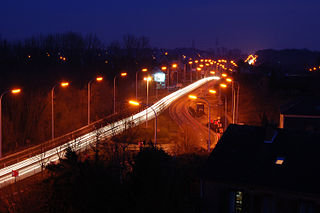
The Brussels Ring numbered R0, is a ring road surrounding the city of Brussels as well as other smaller towns south of Brussels. It is about 75 kilometres (47 mi) long, with 2 or 3 lanes in each direction. While most of it is classified as a motorway (highway), part of it is merely an express route. It crosses the 3 regions of Belgium: its main part is situated in Flanders, whereas Wallonia comprises 18.2 kilometres (11.3 mi) of the total stretch and 5.5 kilometres (3.4 mi) is on Brussels territory.
Girardin is a family-owned brewery in Sint-Ulriks-Kapelle, Belgium. The brewery was founded in 1845 and has been owned and operated by the Girardin family since 1882. The brewery specializes in lambic beers.

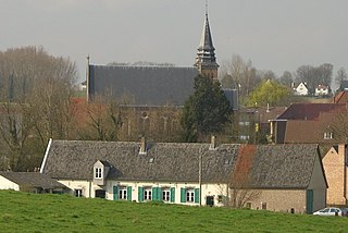
Sint-Martens-Bodegem is a historic village that is now part of Dilbeek. It has 2638 inhabitants.

Groot-Bijgaarden is a village and deelgemeente in the municipality of Dilbeek, a suburb of Brussels, in Flanders, Belgium.
Itterbeek is a historical village in the province of Flemish Brabant, Belgium, and since 1977 a submunicipality of Dilbeek.
Schepdaal is a village and deelgemeente of Dilbeek in Flanders, Belgium.
Sint-Gertrudis-Pede is a village in Dilbeek.
The watermill at Sint-Gertrudis-Pede (Pedemolen) in the municipality of Dilbeek is the only working watermill in the Pajottenland, and is protected as a monument since 1975
Sint-Anna-Pede is a village in Itterbeek, Belgium, which is a deelgemeente of Dilbeek. It gets its name from the Pedebeek, the stream that flows through the village.
Bagaya is a settlement in Senegal in the department Bignona, in the region Ziguinchor Region, in the Casamance area. Bagaya belongs to the rural community of Balinghore in the arrondissement of Tendouck. It is located on the road from Bignona to Elana between Mandégane and Diatock.

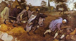
St. Anna's Church is a Roman Catholic church in Sint-Anna-Pede, in the municipality of Dilbeek, Belgium, built around 1250. It is depicted in the painting The Blind Leading the Blind by Pieter Breughel the Elder.