
Dilbeek is a municipality in the province of Flemish Brabant, in the Flemish region of Belgium. The municipality comprises the villages of Dilbeek proper, Groot-Bijgaarden, Itterbeek, Schepdaal, Sint-Martens-Bodegem, and Sint-Ulriks-Kapelle. Dilbeek is located just outside the Brussels-Capital Region, in the Pajottenland, hence the local name Poort van het Pajottenland. Even though Dilbeek is located in the Dutch language area of Belgium, there is a French-speaking minority represented by 3 members on the 35-seat local council. It is a mostly residential community with some preserved rural areas and some industrial zones.

Grimbergen is a municipality in the Belgian province of Flemish Brabant, 10 km north of the capital Brussels. It comprises the towns of Beigem, Grimbergen, Humbeek, and Strombeek-Bever. In 2017, it had a population of 37,030 and an area of 38.61 km2, giving a population density of 959 inhabitants per km2.
Lennik is a municipality located in the Belgian province of Flemish Brabant. The municipality comprises the towns of Sint-Kwintens-Lennik, Sint-Martens-Lennik, Eizeringen and Gaasbeek. It is also situated in the Pajottenland. On January 1, 2006, Lennik had a total population of 8,694. The total area is 30.80 km² which gives a population density of 282 inhabitants per km².
The Pajottenland is a distinct region within the Flemish Brabant province and the south-western part of the Brussels Region of Belgium. The region is located west-southwest of Brussels. The Pajottenland is predominantly farmland, with occasional gently rolling hills, and lies mostly between the rivers Dender and Zenne / Senne. The area has historically provided food and drink for the citizens of Brussels, especially Lambic beers, which are only produced here and in the Zenne valley where Brussels is.
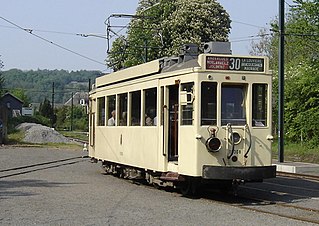
The ASVi is a tramway museum in Thuin in Belgium, which specialises in the history of the Belgian narrow gauge Vicinal system. The museum includes an operating museum tram line which runs from Thuin to Lobbes.

The National Company of Light Railways was a state-owned transportation provider which comprised a system of narrow-gauge tramways or local railways in Belgium, which covered the whole country, including the countryside, and had a greater route length than the mainline railway system. They were 1,000 mmmetre gauge and included electrified city lines and rural lines using steam locomotives and diesel railcars; half the system was electrified.

The Coast Tram is a public transport service connecting the cities and towns along the Belgian coast between De Panne, near the French border, and Knokke-Heist, near the Dutch border. At 67 kilometres (42 mi) in length, it is currently the world's longest tram line in service as well as one of the few interurban tramways in the world to remain in operation. The line is built at 1,000 mmmetre gauge and fully electrified at 600 V DC.
Vissenaken is a village in Belgium. It is part (deelgemeente) of the municipality Tienen.

The Ghent tramway network is a network of tramways forming part of the public transport system in Ghent, a city in the Flemish Region of Belgium, with a total of three lines. Since 1991, the network has been operated by De Lijn, the public transport entity responsible for buses and trams in Flanders.

The Brussels Ring numbered R0, is a ring road surrounding the city of Brussels as well as other smaller towns south of Brussels. It is about 75 kilometres (47 mi) long, with 2 or 3 lanes in each direction. While most of it is classified as a motorway (highway), part of it is merely an express route. It crosses the 3 regions of Belgium: its main part is situated in Flanders, whereas Wallonia comprises 18.2 kilometres (11.3 mi) of the total stretch and 5.5 kilometres (3.4 mi) is on Brussels territory.

Opbrakel is a village and deelgemeente (sub-municipality) of the municipality of Brakel. It is located in the Denderstreek in the province of East Flanders in Belgium. It used to be an independent municipality until 1971 when it was merged into Brakel.
Sint-Ulriks-Kapelle is a village and deelgemeente of Dilbeek.

Groot-Bijgaarden (officially) or Grand-Bigard is a village and deelgemeente in the municipality of Dilbeek, a suburb of Brussels, in Flanders, Belgium.
Itterbeek is a historical village in the province of Flemish Brabant, Belgium, and since 1977 a submunicipality of Dilbeek.
Sint-Gertrudis-Pede is a village in Dilbeek.
The watermill at Sint-Gertrudis-Pede (Pedemolen) in the municipality of Dilbeek is the only working watermill in the Pajottenland, and is protected as a monument since 1975
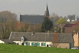
Sint-Anna-Pede is a village in Itterbeek, Belgium, which is a deelgemeente of Dilbeek. It gets its name from the Pedebeek, the stream that flows through the village.

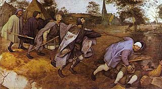
St. Anna's Church is a Roman Catholic church in Sint-Anna-Pede, in the municipality of Dilbeek, Belgium. It is depicted in The Blind Leading the Blind by Pieter Breughel the Elder.
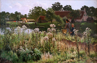
Astene is a village and deelgemeente (sub-municipality) in the municipality of Deinze in the Belgian province of East Flanders. The village is located along the Leie River and about 13 kilometres (8.1 mi) south-west of Ghent.
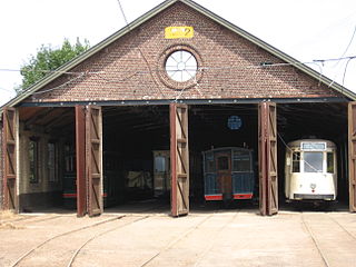
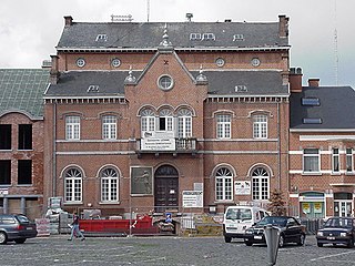
The Tramsite Schepdaal is a tramway museum in Schepdaal, located in the Belgian municipality Dilbeek, west of Brussels


